
8/19-8/30: Rangeley, ME -> Monson, ME
One of the most common regrets that people cite about their thru-hikes is that they went too fast towards the end of the trail. Countless people have expressed that in hindsight, they feel like they rushed through New Hampshire and Maine and wish they had taken more time to savor the thru-hiking experience as it came to a close. As I continued through Maine, I was determined not to make the same mistake. Many hikers that I knew on the trail, especially folks who were starting to finish up their hikes in mid-August, urged me to take it slow and soak it all in. I wanted to do everything I could to make the most of my thru-hike in its waning days.
One of the things I did to make the most of it was stop listening to audiobooks or music while I hiked. After Sophie left trail, I had probably spent more hiking time than not with earbuds in my ears, keeping myself entertained with music or audiobooks. This was often a welcome distraction and kept me going, and didn’t feel like it detracted from my hike. However, as I got to the Whites, I wanted to make sure I was fully engaged with the trail as I hiked, for several reasons. I didn’t want to distract myself in what I knew would be the hardest sections of trail, and I wanted to be fully present and fully appreciate the AT as I neared the end of my thru-hike, especially since NH and ME were the states and sections that I had been looking forward to most! I resolved not to listen to anything while I hiked between there (right before Mt. Moosilauke) and the end of the trail, or at least to try that out and see how well it went.
It went very well! I ended up making it all the way to Katahdin (spoiler alert!) without any music or audiobooks, and I loved it that way. I was pleased with how much easier it felt to hike alone with my own thoughts than it had felt toward the beginning of the trail. I felt so connected with the trail as I neared the end, both due to this choice and many others I made to make the most of the rest of my hike.
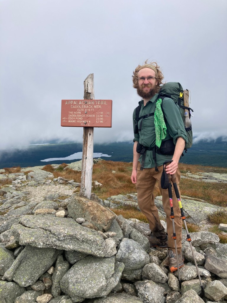
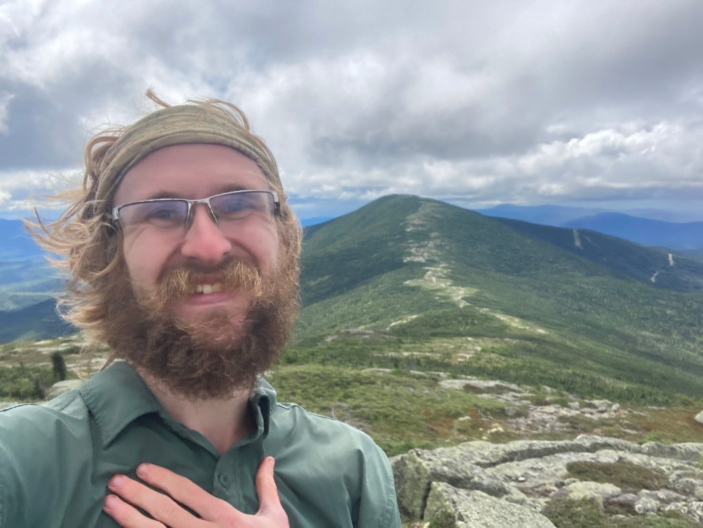
As I left Rangeley, I knew there were a lot of wonderful things to come right off the bat! We were heading into Maine’s High Peaks region, and there were a lot of big, beautiful mountains (and New England 4Kers to boot) coming up. First up was Saddleback, also a site of another ski resort.
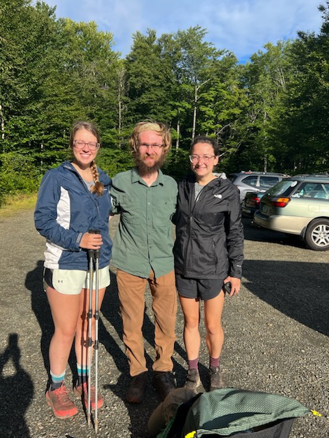
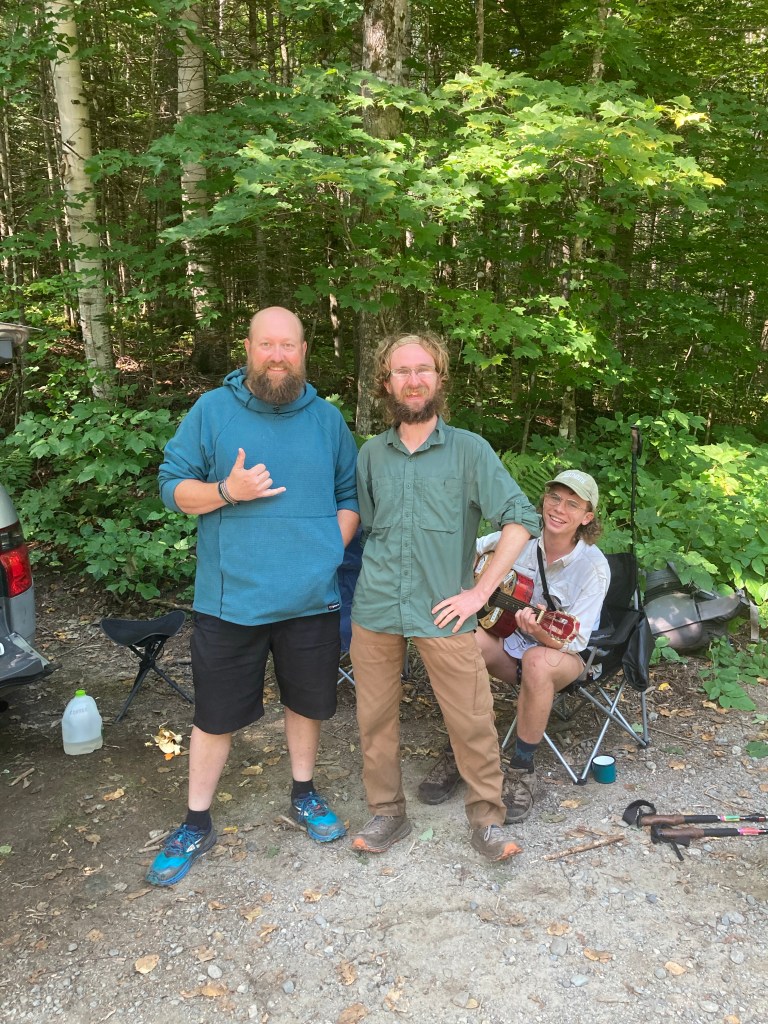
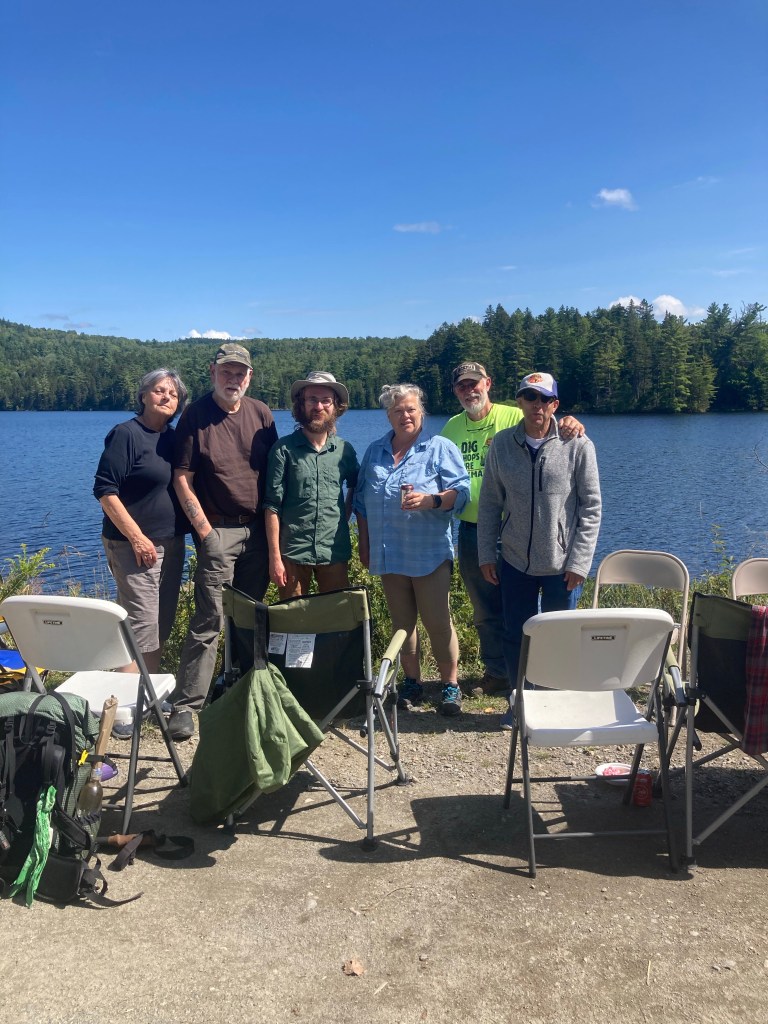
Jo kindly offered to drive me, Meadow, and Victory back to the trail in the morning. She even went above and beyond and made all three of us gigantic, delicious breakfast sandwiches! Somehow, I still felt full from feasting the previous day, so I waited until I had worked up an appetite by hiking a couple miles to eat mine. I was so appreciative of Jo’s hospitality and trail magic in Rangeley. I knew she’d be my last “meetup” off trail. I loved being able to see so many people I know – and those I newly met – along the way throughout my thru-hike, and meeting Jo was the perfect conclusion to this important aspect of my hike.
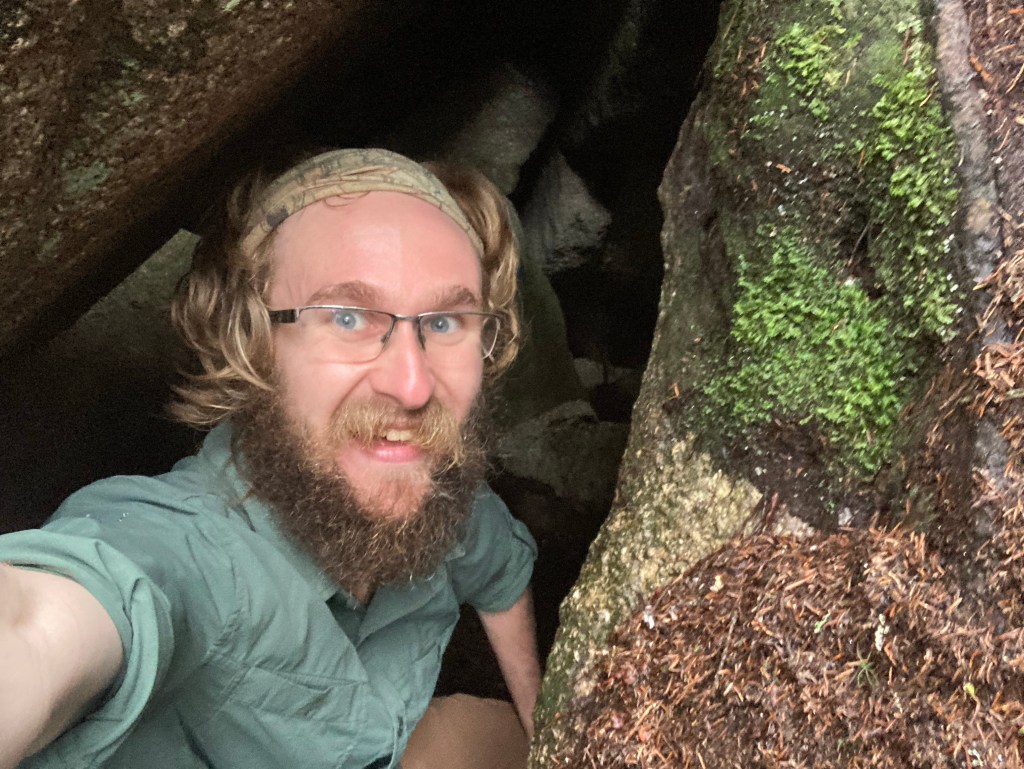
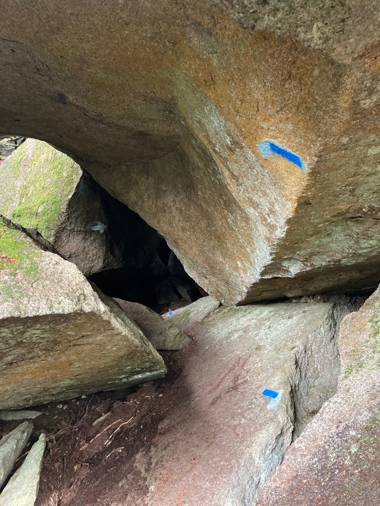
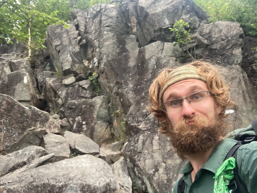
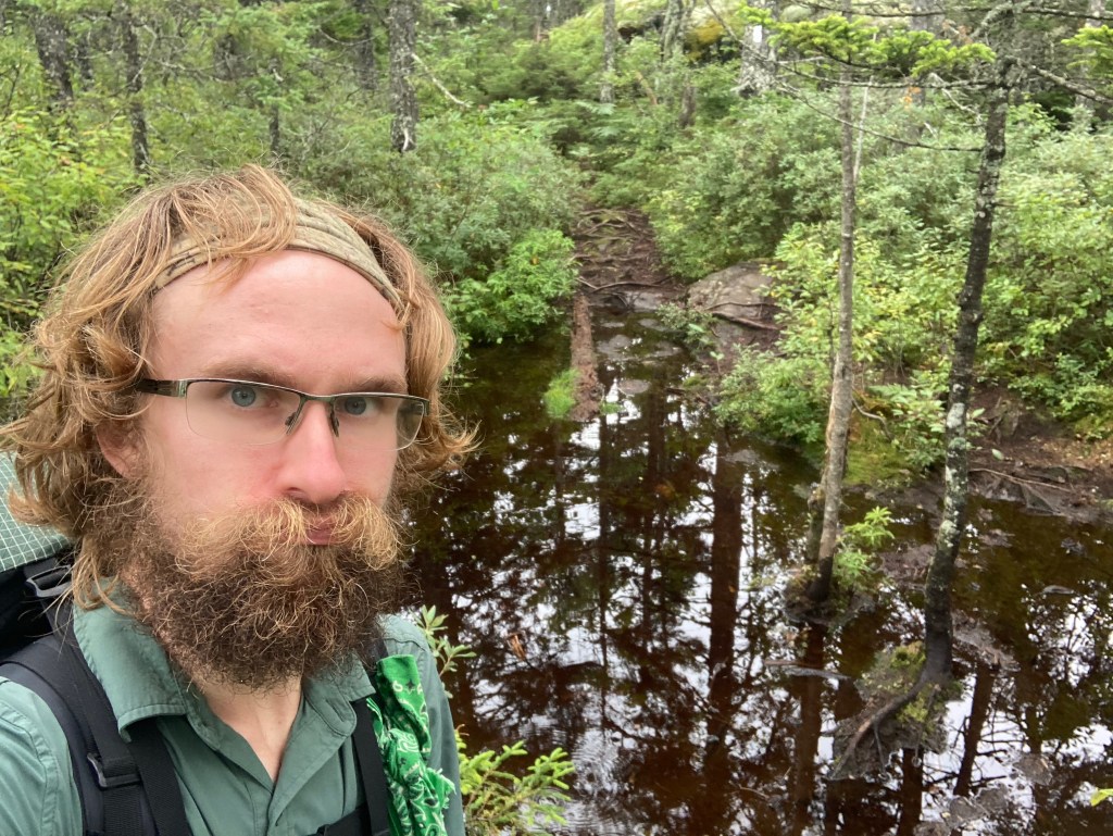
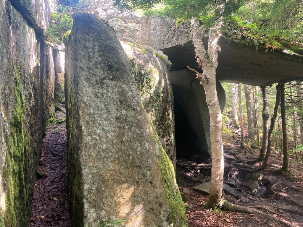
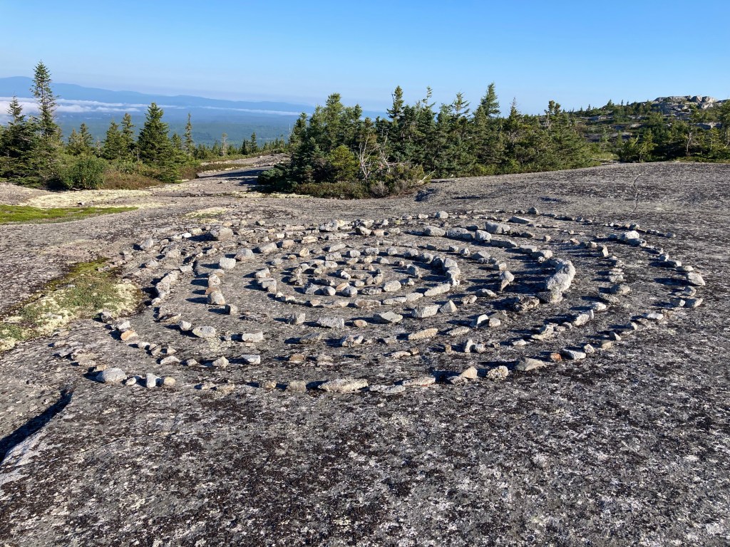
Not long into the day, I took a brief side trail to explore the Caves. This was a unique feature close to the AT: a blue-blazed trail snaking over, under, and around large boulders to climb a hundred feet or so. The trail didn’t really lead anywhere, and there weren’t any views to reward you; this one was all about the journey, not the destination. Nevertheless, I loved it!! I had a lot of fun climbing and squeezing myself through some more tight spots. It reminded me of the best parts of Mahoosuc Notch, except vertical, and infinitely improved since I didn’t have to carry my pack! Between the unique experience and the high bang for my buck, considering how close the Caves were to the AT, it was one of my favorite side trails ever (coming from a certifiable side trail expert).
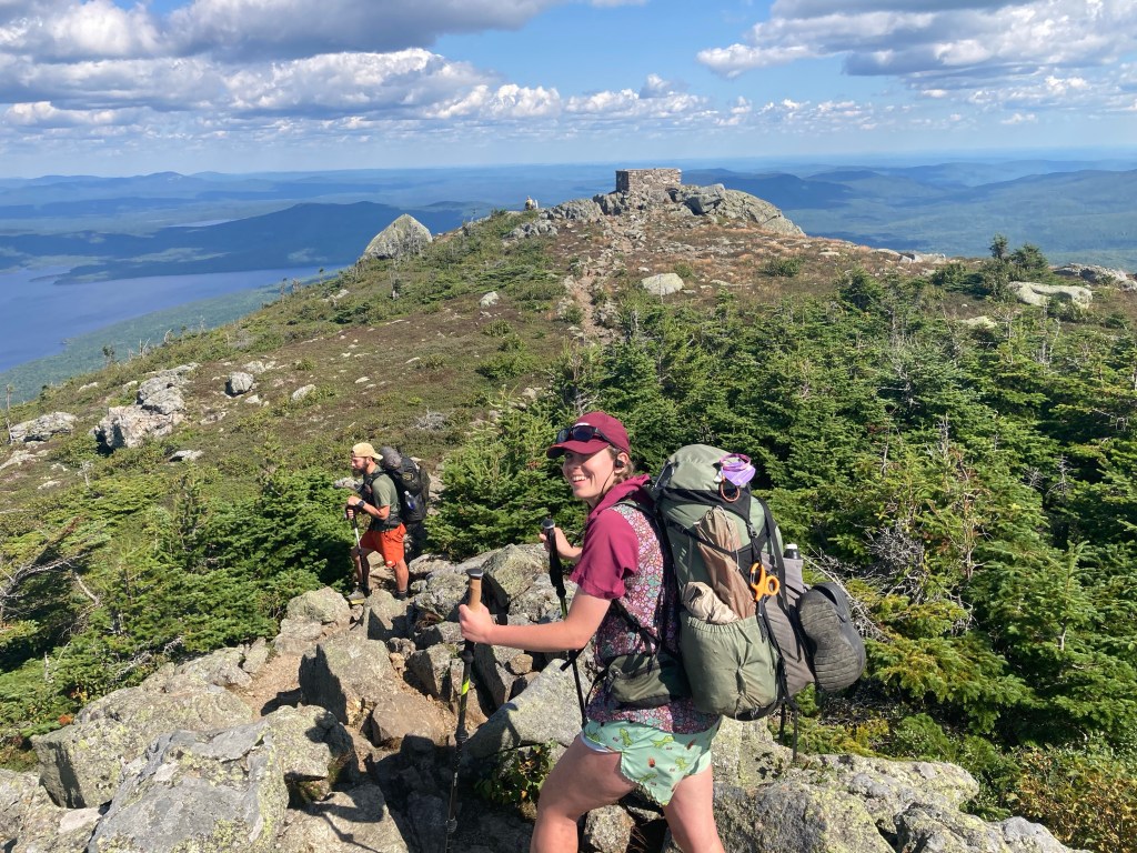
I ran into Geo as we approached the climb of Saddleback Mountain. I had met him a few days earlier, and we hiked most of the rest of the day together. Geo has a very interesting thru-hiking story: he is hiking the AT in week-long sections throughout all of 2023, while still working every other week or so. It’s so cool to meet people who do the AT in all sorts of ways – there’s really no single or “right” way to do it!
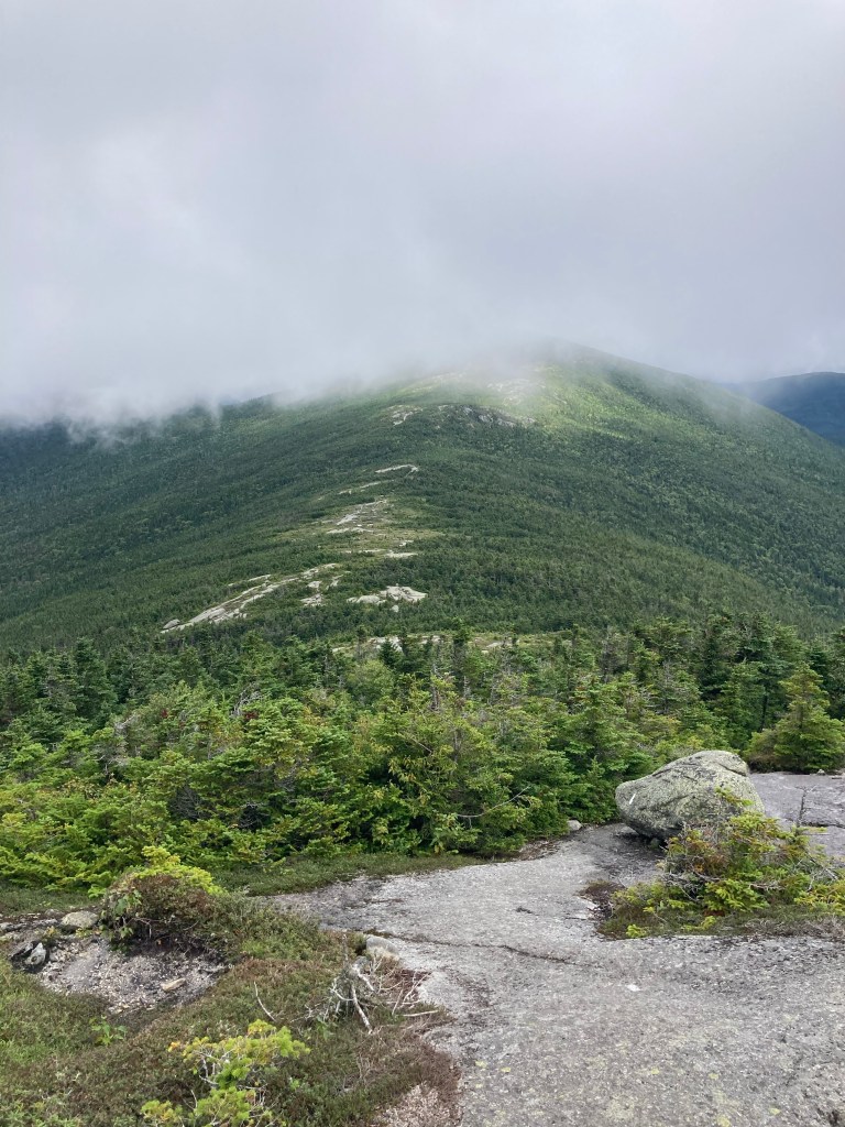
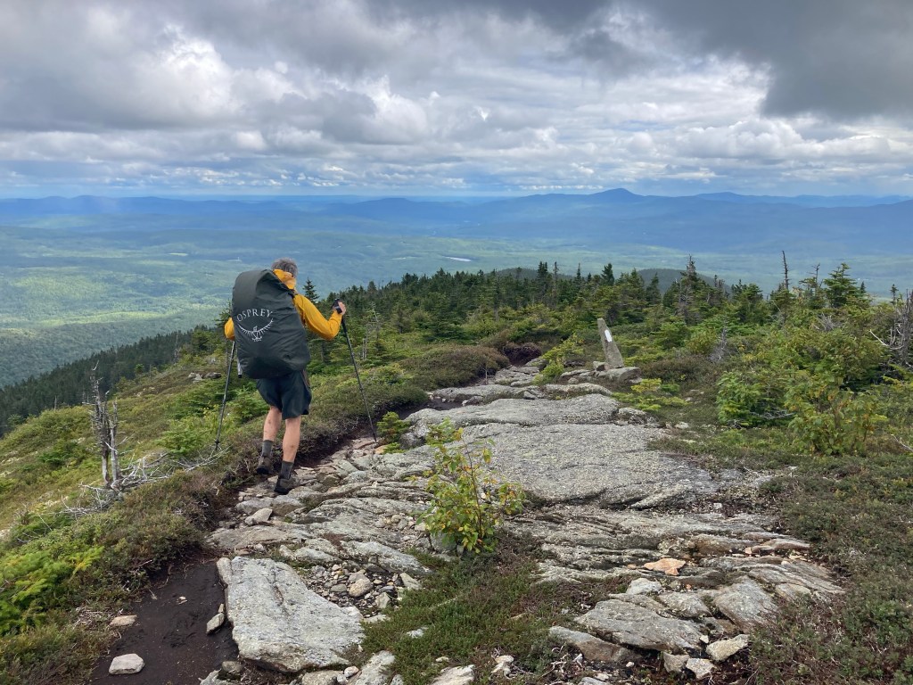
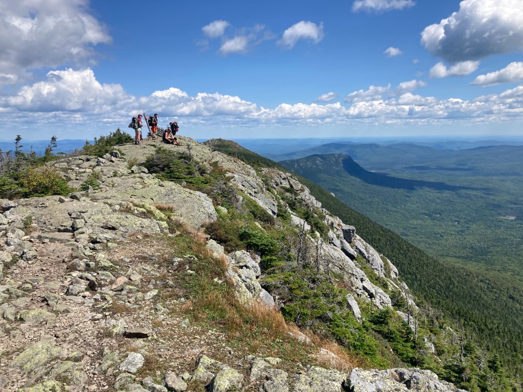
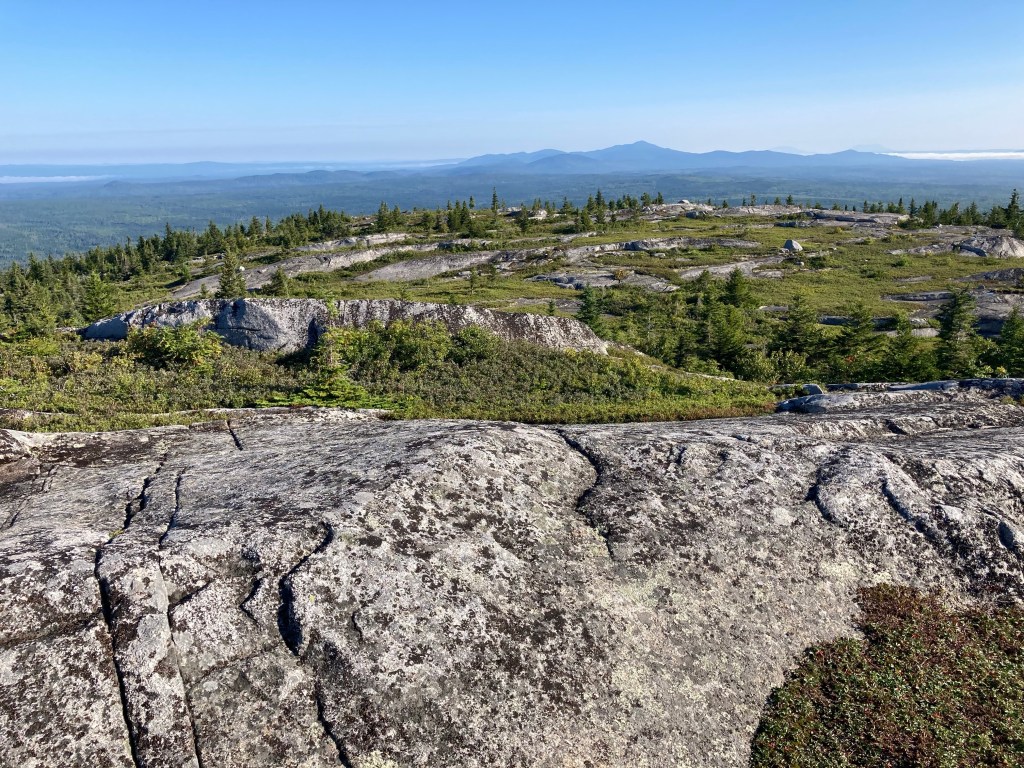
The climb up Saddleback featured classic Maine terrain of smooth rock with low-lying alpine vegetation all around us. It was not too difficult as we ascended to the summit in the fog. We did manage to catch some views through and under the cloud ceiling, though.
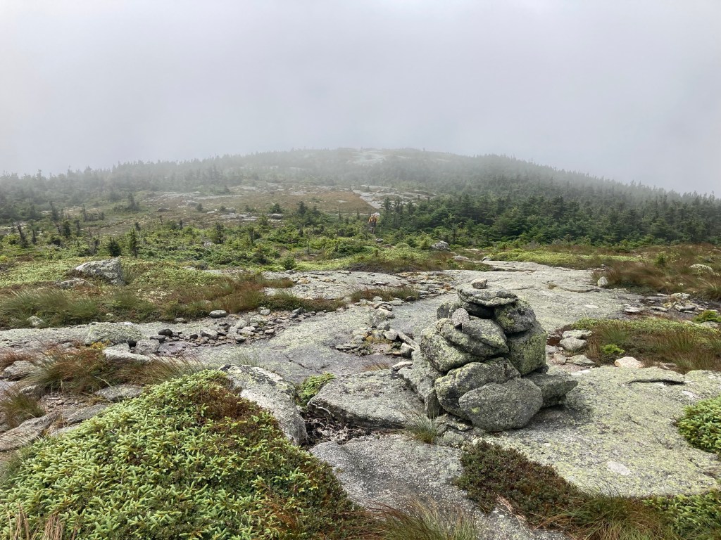
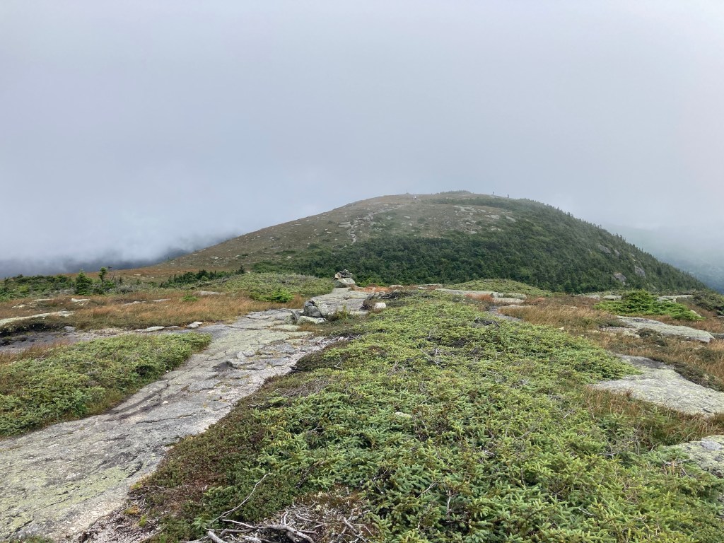
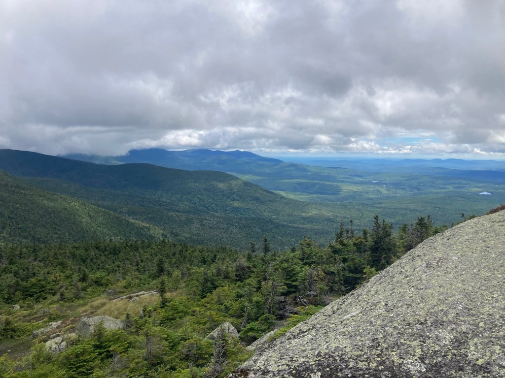
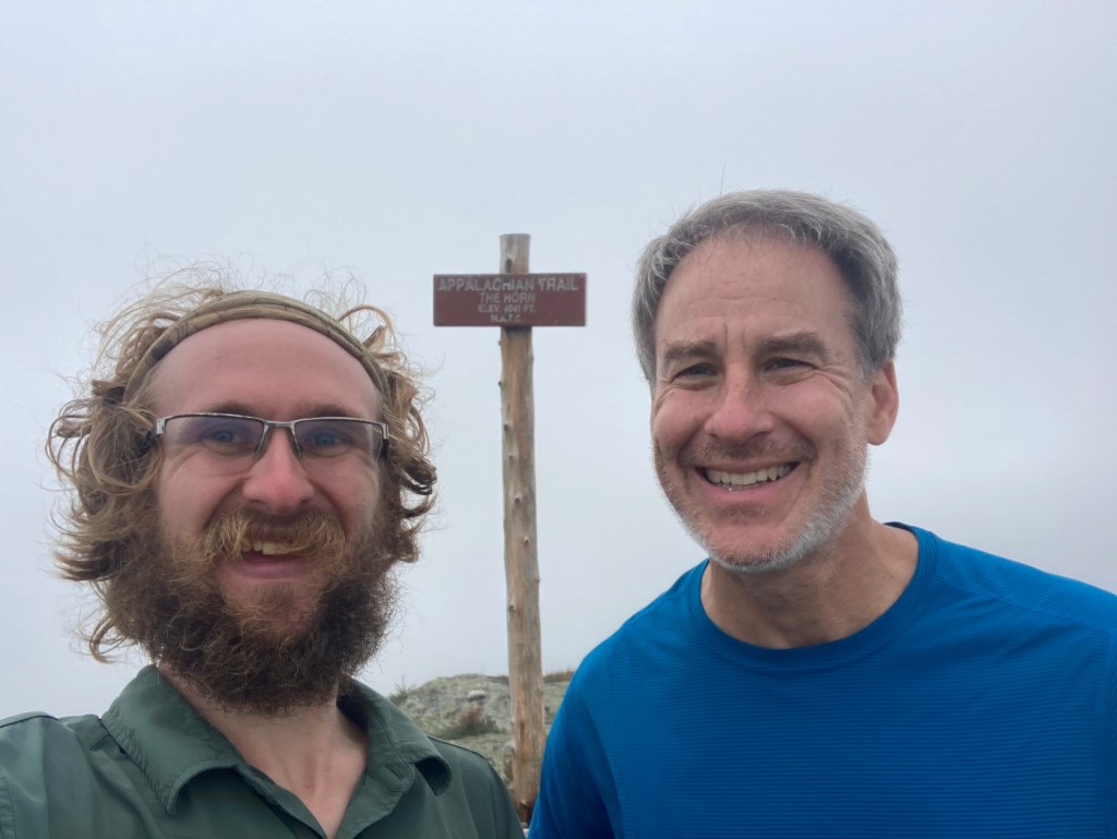
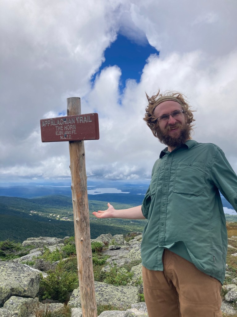
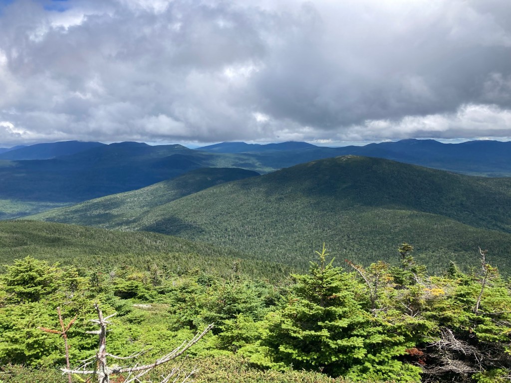
The ridgewalk from there over to the Horn, Saddleback’s other 4000-foot peak, was a lot tougher, but cool. Geo and I stopped for lunch on the summit of the Horn. (It took me way too long to realize why Saddleback and the Horn are called that! I think the naming is pretty apt based on the shape of the mountain.) We were completely socked in up there – until all of a sudden, we weren’t! It was incredible how quickly it happened. Among the clouds, I looked down to eat a bite of my plum (thanks for the special treat, Jo!), and when I looked up, the clouds had split and I could see for miles in all directions. It was magical! To one side, the Rangeley Lakes dotted the horizon. Ahead of us, more of the High Peaks of Maine filled our field of view. Now we could see some of the infrastructure for the Saddleback ski resort, too.
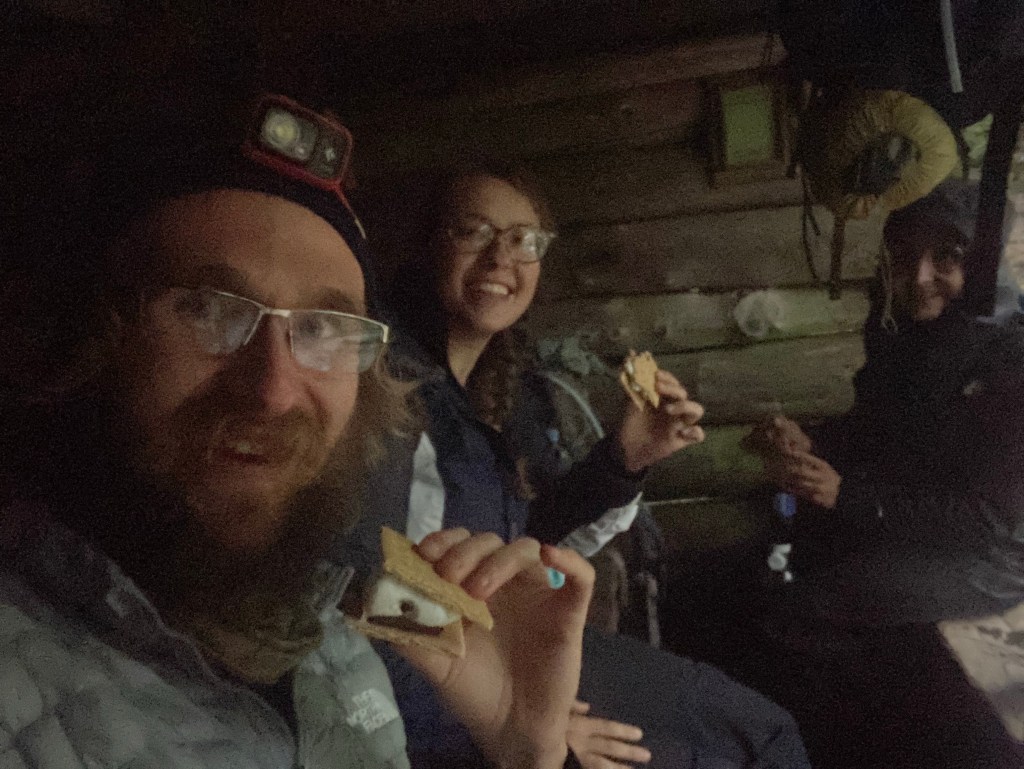
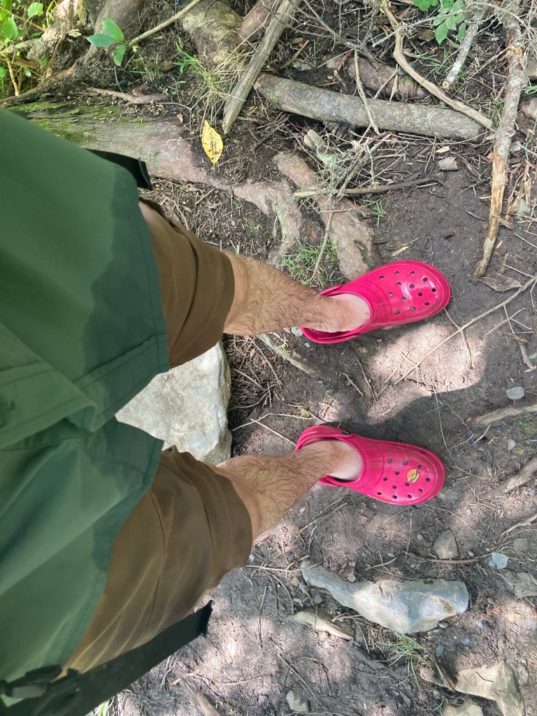
After a tough descent down the mountain and over the amusingly-named Saddleback Junior, I stopped at Poplar Ridge Lean-to, which was my original target for the night. Since it was pretty early, I debated pushing ahead to a campsite a few miles up, where Geo was heading. Meadow and Victory were already set up at the shelter, though, and I was tempted to stay there with them. I was glad I dilly-dallied in deciding, though, because not long after I got there, the skies opened up and a downpour began. That made my decision easy! I gladly set up in the shelter and had a pleasant night there while the rain pounded the roof all night. Victory, Meadow, and I made s’mores on trail, satisfying a trail bucket list item for me, and I enjoyed reading the extensive trivia about the surrounding area and the MATC in the logbook. The trail maintainer in that region has collected and answered questions from hikers at Poplar Ridge Lean-to through the shelter log, and it’s an awesome continuing tradition. Among other things, I learned why the shelters in Maine are uniquely called “Lean-tos” and not “Shelters.” (No particular reason…they are all basically lean-tos, and Maine’s often predated the rest? So it was just a preference thing by the MATC. That’s sorta all I got)
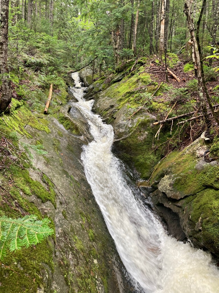
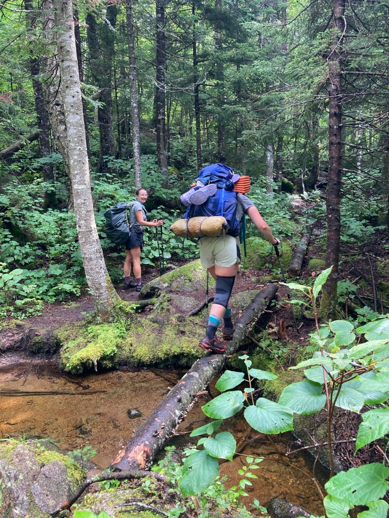
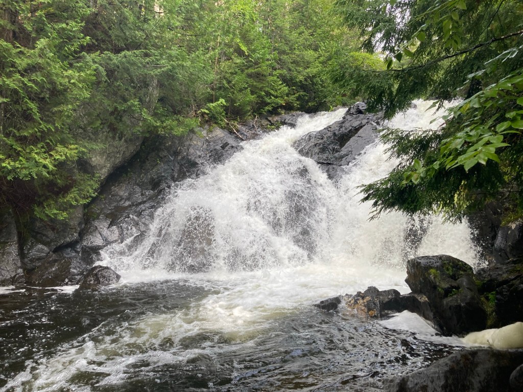
It was a cold night. We could all notice that as we got further north and nearer to September, the days were getting shorter and the weather was turning cold again. I wasn’t looking forward to this trend continuing over the last few hundred miles. I hiked much of the morning with Meadow and Victory, fording Oberton Stream and seeing several big waterfalls. My enthusiasm for side trails had become sort of a meme between the three of us, since I am almost always gung-ho to take them, and Victory and Meadow rarely do. They said they sometimes found themselves thinking, “what would Shaggy say if we did this side trail?” (And I was always proud of them when they did!) This feeling went both ways though – I sometimes felt sort of compelled to live up to my reputation. When I got to a small side trail to some more waterfalls, I thought, “what would Meadow and Victory say if I DIDN’T take this?” and resigned myself to going the few extra tenths of a mile. And whadya know, I was glad I did! Totally worth an easy jaunt to see a few more cool cascades.
That morning, I also grappled with the timing of the rest of my hike. The time had come for me to plan out a finishing date so that Macy could come pick me up. Unfortunately, this was looking harder than I expected. The problem was, I was on pace to summit Katahdin during Labor Day weekend. Thru-hikers are highly encouraged not to summit then. Labor Day weekend is the biggest weekend in Baxter State Park, since it is the time of yearly spiritual pilgrimage to Katahdin for the Penobscot people. So both out of respect for the Penobscot Nation and for logistical regions, I wanted to avoid finishing my hike then. I had also just learned in Rangeley that Macy wouldn’t be able to come up to get me the two days after Labor Day. As I saw it, this left me with three options:
- Hike faster, doing bigger, but doable, days, and not taking any days off, and summit Friday 9/1.
- Slow way down and not summit until Thursday 9/7, when Macy would be able to pick me up.
- Slow down a little and summit Tuesday 9/5, and find my own way home, sans Macy.
None of these options were ideal, and I was loathe to make a choice. Putting them this way, though, I came to the conclusion that Option 2 was easily the best. Option 1 was basically a non-starter for me. I had no desire to speed up that significantly, and particularly not taking any zeros or neros for the rest of the time would probably have made me miserable. I knew that Macy wouldn’t like Option 3 either. Having thought this through, I still felt pretty sad to be picking the slowest option. It would mean leaving Meadow and Victory behind (er, ahead), and seeing so many of my friends already ahead of me in the shelter logs was starting to weigh on me. I tried to remind myself that I had friends behind me too. At that moment, though, for the first time, I felt ready to be done.
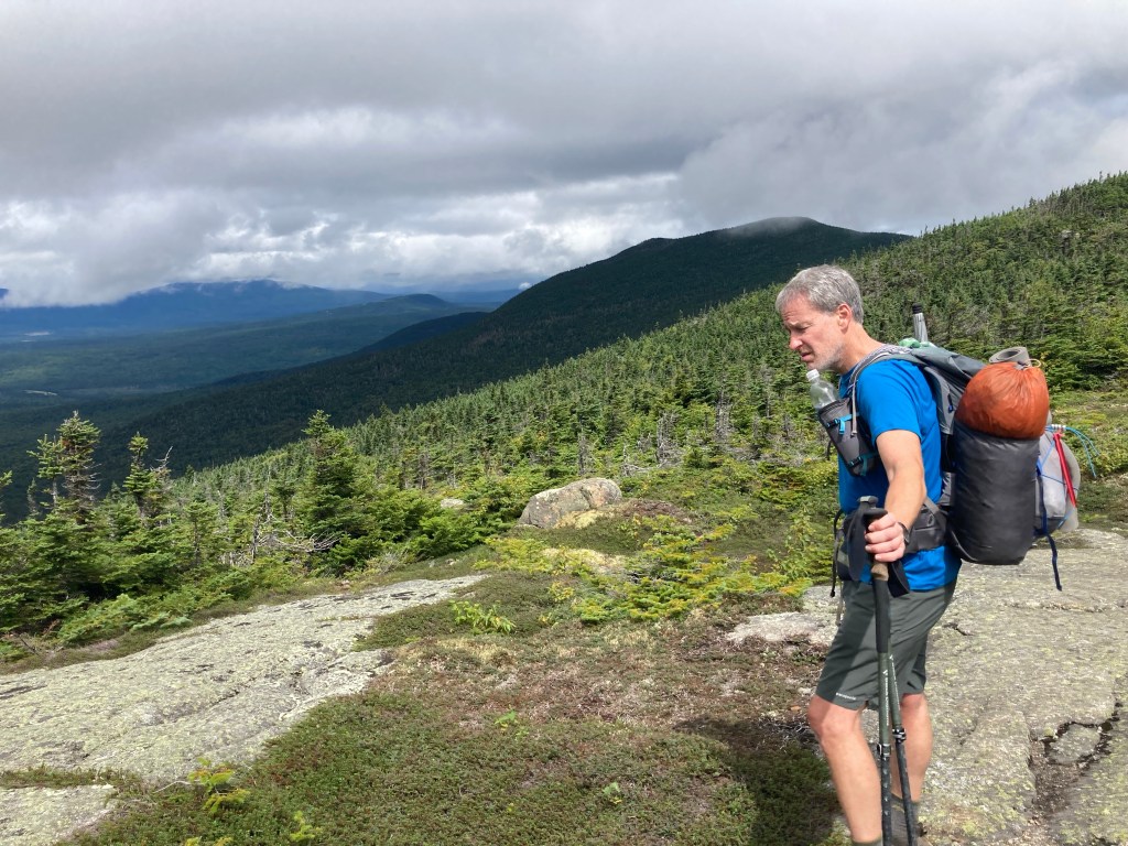
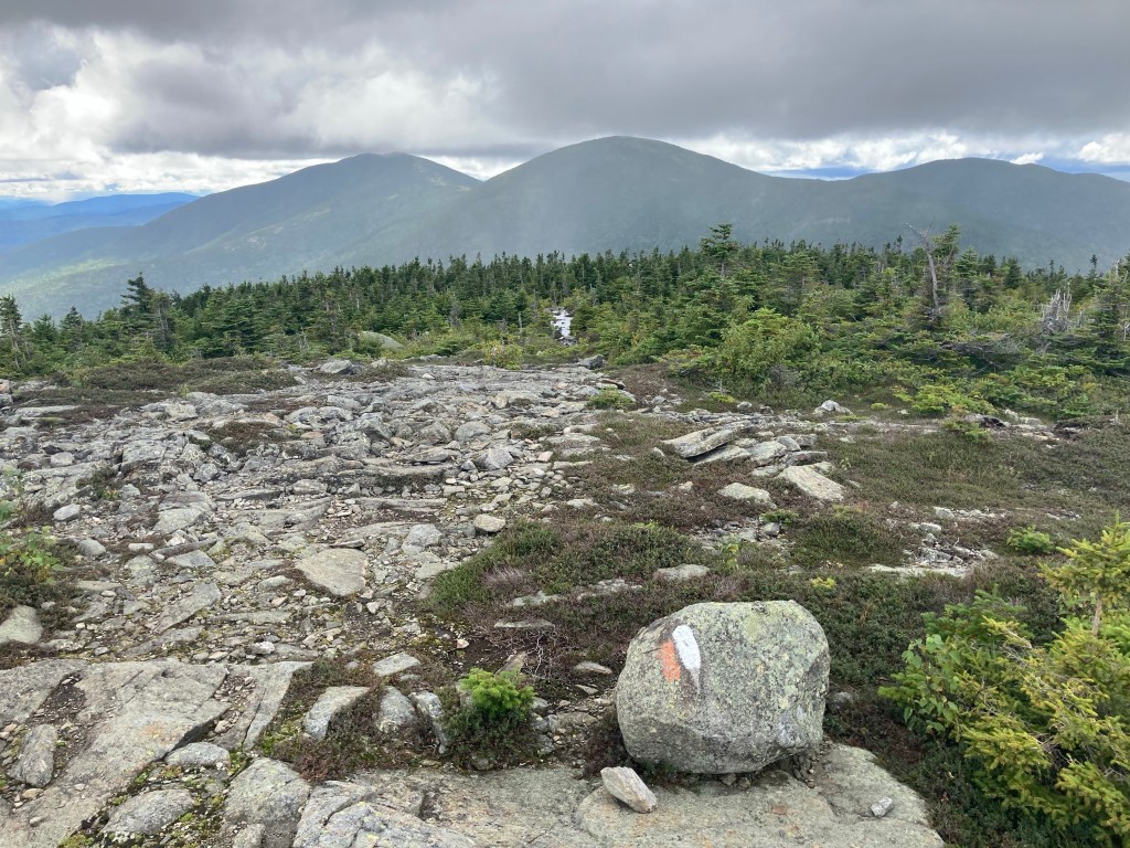
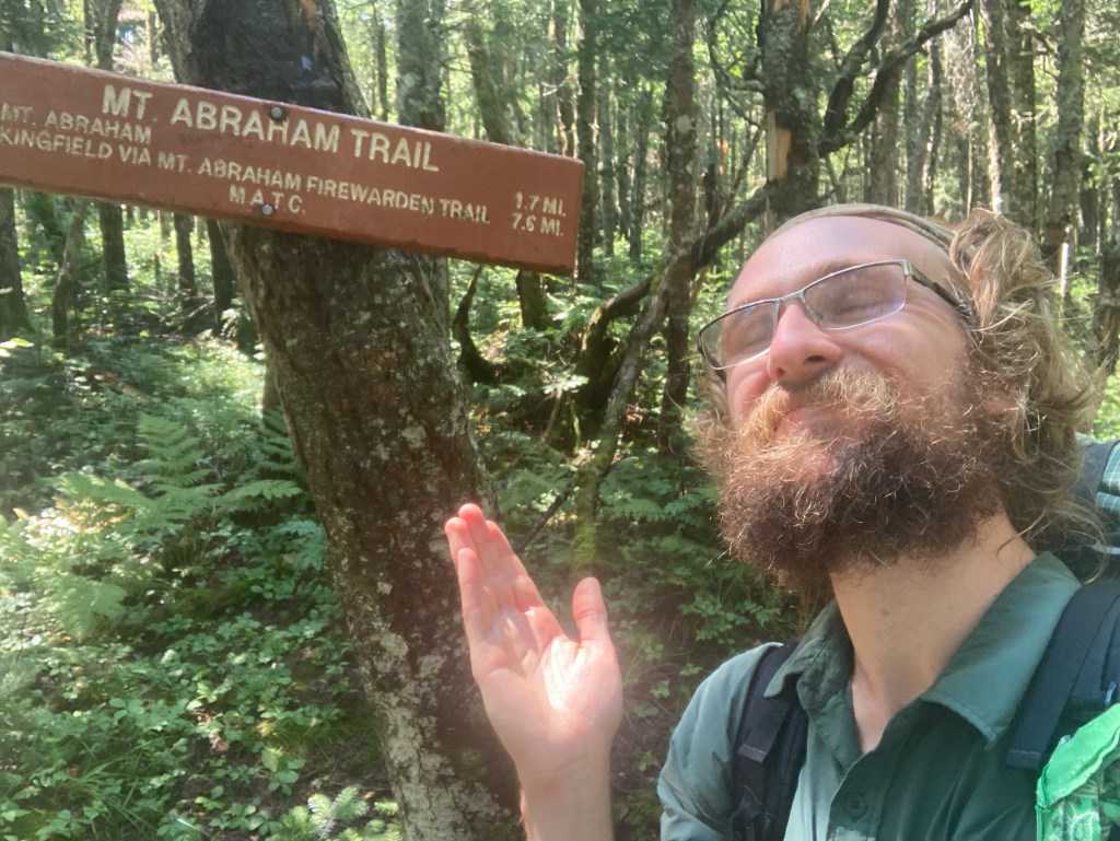
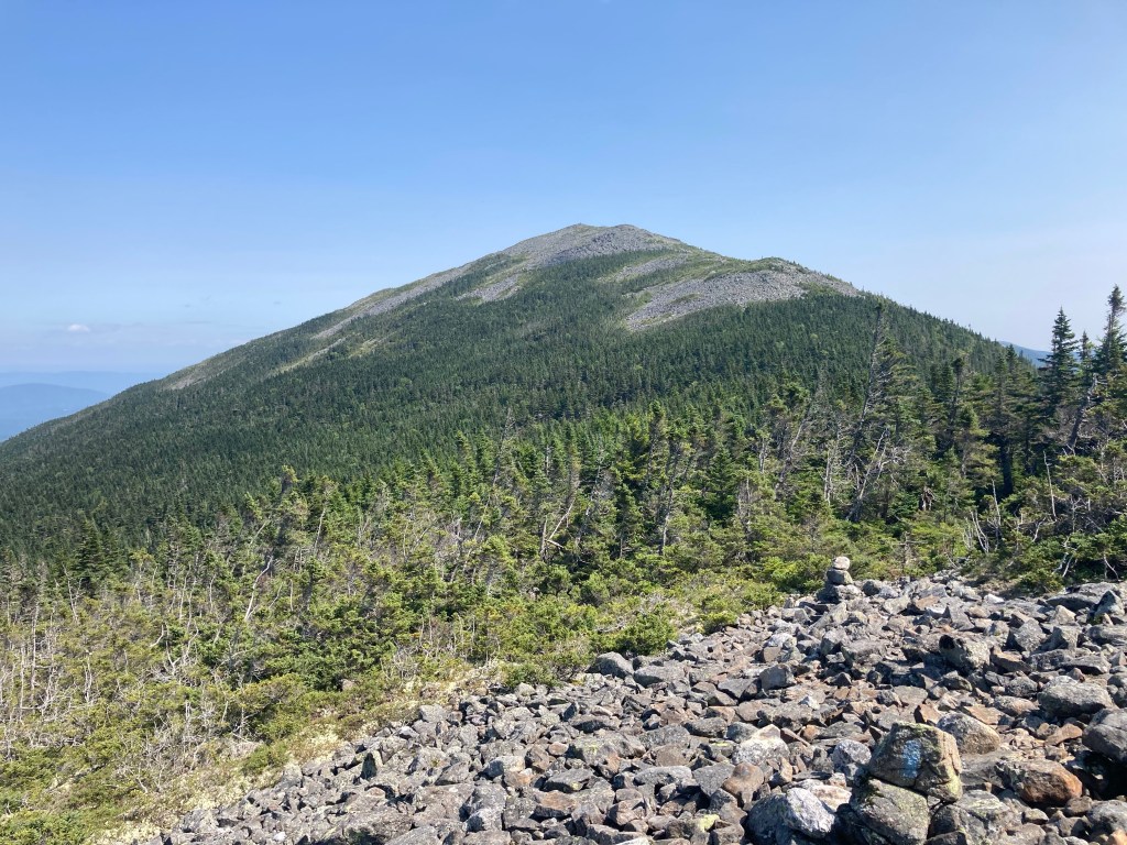
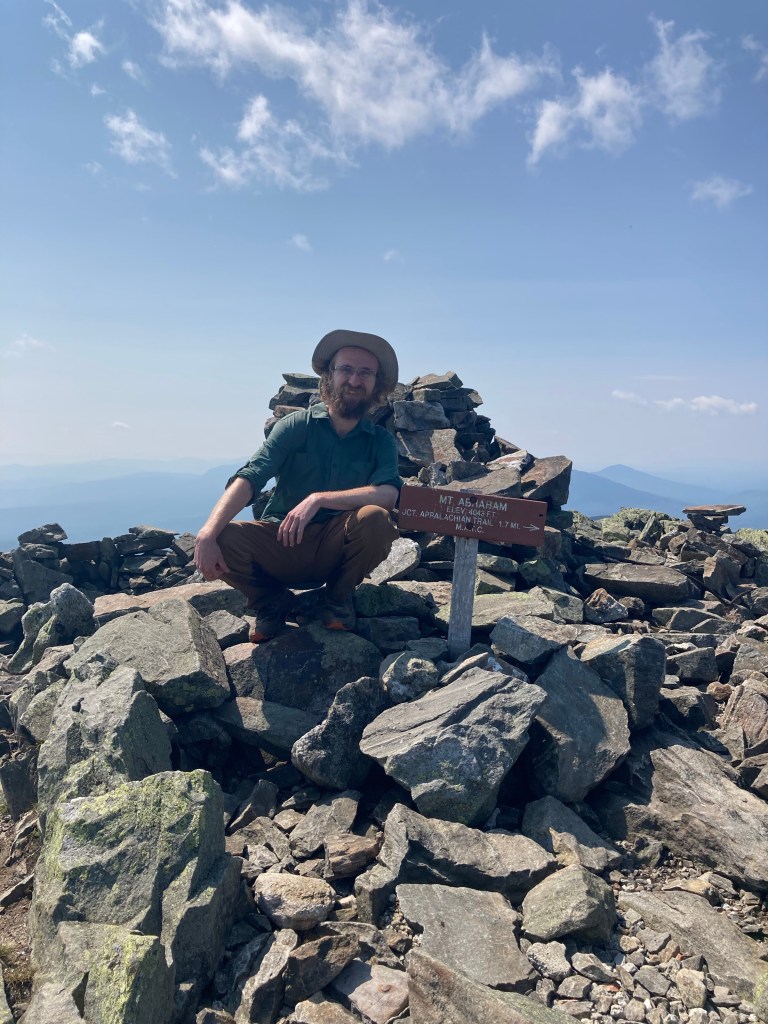
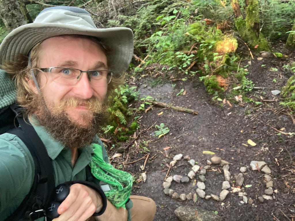
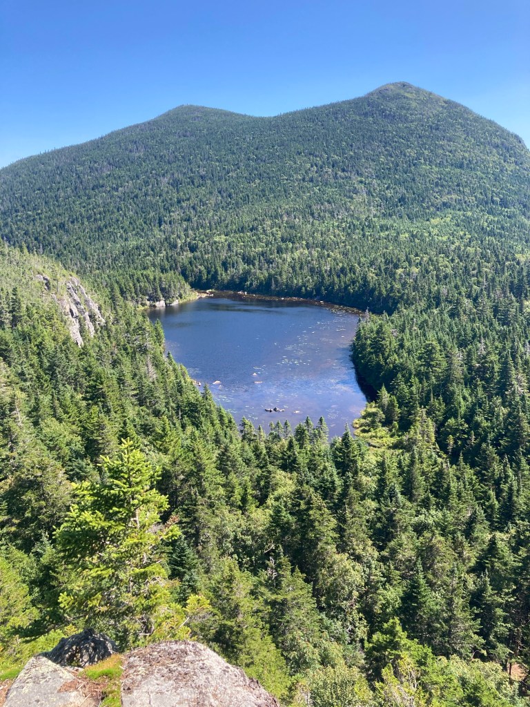
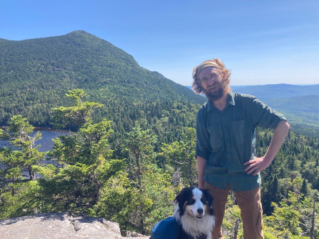
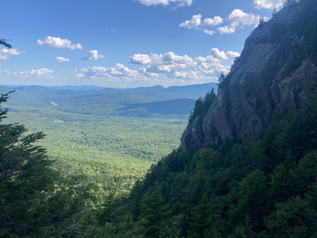
Victory, Meadow, and I ascended the sweaty climb of Lone Mountain, which was the beginning of another ridge of 4,000 footers. Before getting to Maine on the AT, I had never given much thought to climbing the “New England 67,” the list of all 67 mountains above 4,000 feet in New England. However, looking ahead, it turned out that the AT hit, or came reasonably close to, 12 out of the 14 4kers in Maine! It felt very worth it to me to hit as many of these as I could, since I would be so close. In the present, that meant going out of my way to summit Mt. Abraham.
Mt. Abraham is a whopping 1.7 miles off the AT – it would be by far my longest side trail ever. It’s also quite exposed, featuring the second-largest alpine zone in ME after Mt. Katahdin. For this reason, I hadn’t decided whether or not I would bag it until the day of. It wouldn’t have felt worth it if the weather wasn’t good. However, I had planned my day around the opportunity to do it (I kinda had to, since it would mean an extra 3.4 miles on the day!), and as it turned out, the weather was looking beautiful. So to Mt. Abraham I went!
This meant saying my goodbyes to Victory and Meadow. I didn’t even try to convince them to do the huge side trail with me 😉 I explained to them my thinking about the timing of the rest of the trail. I was very sorry to leave them. I truly didn’t know if we’d see each other again, but either way, I was so thankful for the times we had shared together on the AT.
The long side trail to Mt. Abraham was totally worth it. The last half mile or so to the summit was a large, difficult boulder field, but it was spectacular! It reminded me a lot of the Presidentials. I really earned my side trail enthusiast AND peakbagger badges with that one!
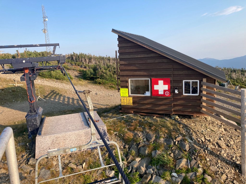
Later on, I took a much shorter side trail to summit Spaulding Mt., then climbed to the peak of Sugarloaf Mt. to finish my day. There is a ski patrol hut at the top that is left unlocked for hikers to sleep in! It was a cool, unique place to spend the night. One other hiker showed up later to share the space, a new face named Chili Dog. He happened to be a serious ultimate frisbee player, so we chatted about that.

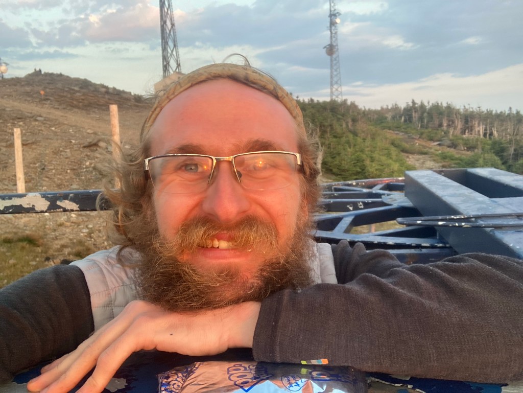
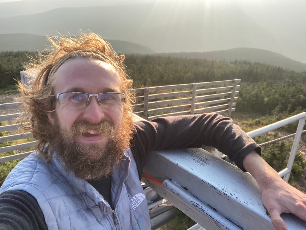
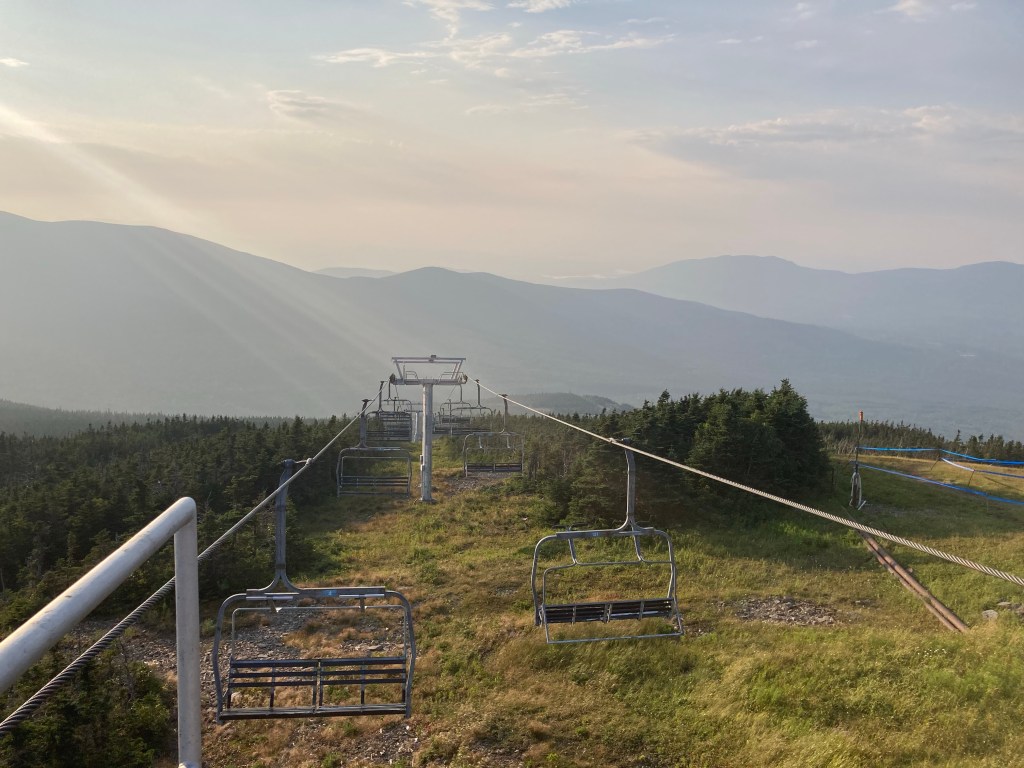
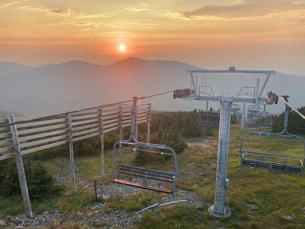
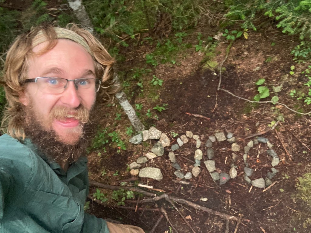
I watched the sun set over the Crockers from the top of a chairlift tower. I had just about 200 miles to go as of that night. I thought about everything to come in those 200 miles, and how small that number felt. I remember how much of the trail the first 200 miles felt like, from Springer to the highest point at Clingman’s Dome. Now, it was only going to be a few short weeks until my thru-hike was over.
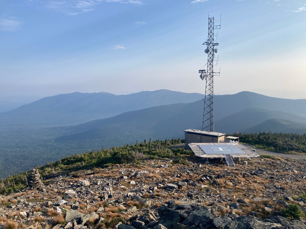
Luckily, I had excellent cell service there (because of the massive cell tower on top of Sugarloaf…), so I called Macy to discuss my three options for the rest of the trail. Naturally, she preferred the first, fast option, but understood why it wouldn’t work out well. Together, we decided on Option 2. I had my summit date. (I hadn’t wanted to set a timeline for myself at all, but this gave me more than enough time to be flexible between now and then and make sure I could stick to it.)
Somehow, I felt even sadder to officially confirm this plan. It felt like a long time until I would see Macy at the end. I was ready to be done. At the same time, I knew I would really miss this, miss the trail and its lifestyle. Lying there atop Sugarloaf Mountain in a ski patrol hut, making this decision, was one of the hardest moments of the AT for me.
Then, I saw that my friends Legs and Hooter had summitted Katahdin and finished their thru-hikes that day!! I was so thrilled for them and filled with an exuberant joy, both to see my friends succeed but also for what the rest of the trail would offer me. I knew that with taking it slow, I could really make the most of it. Hooter and Legs had already been great inspirations for me – it was them that had clued me in to the opportunity to stay in this hut on Sugarloaf, for one! I was excited to really soak in the rest of the AT. After a mentally tough, mixed-bag day, I went to bed happy 🙂
There was one intriguing item on my trail bucket list that came with a question mark: a day of silence? Sophie and I had thrown around the idea way back in the day, and I wasn’t committed to the idea. But with the bucket list on my mind with 200 miles to go, the next day, I figured, what the heck, let’s give it a shot. It felt like a good time for it, now that I was separated from Meadow & Victory and unsure who I knew, if anyone, that I would run into that day. It felt weird, and harder than I expected! I didn’t realize how much I narrate my own thoughts out loud, heh. I did an okay job not speaking aloud throughout the morning anyway, aided by the fact that I only briefly passed by a couple of hikers who were deep in their own conversation.
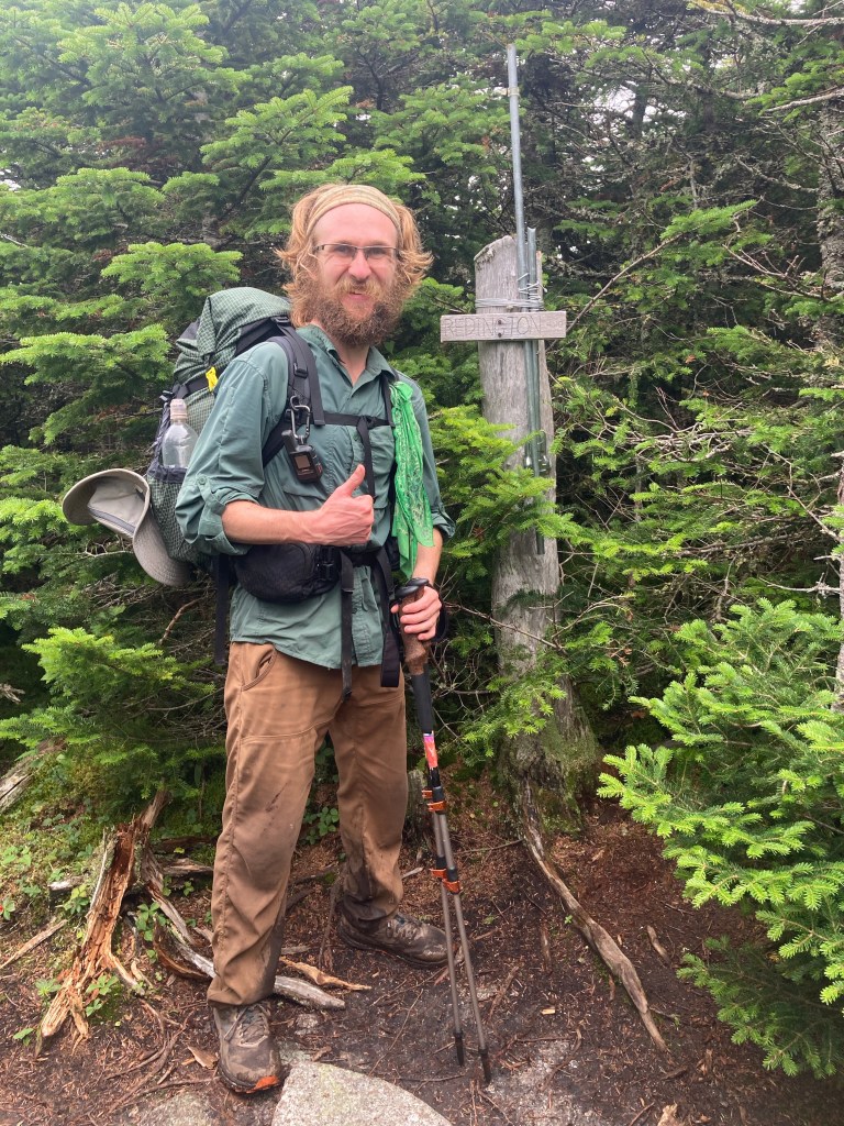
The descent of Sugarloaf was steep and tough, and the following climb of South Crocker Mountain was less so. I reached the summit in the fog on a short side trail. (Later, Meadow and Victory proudly told me they had walked the extra 50 feet to the peak of South Crocker too! Woohoo!) Then I had a decision to make concerning a certain other side trail. Mt. Redington, another ME 4000-footer, was about a mile away from South Crocker and the AT. It was the last 4ker that wasn’t directly on the AT, but feasible to do (besides the other two peaks in Baxter State Park, which I knew I wouldn’t be doing during my thru-hike). I was tempted to bag it, since I didn’t know when I’d have a chance to come back to this area and it would be more convenient to climb it now (I know, I know, peakbagger problems). There was just one problem: there was no maintained trail to the summit.
I had read that there was a “herd path” to Mt. Redington, since so many people have hiked to it anyway. Still, I had told myself not to even consider taking it. I had never done a bushwhack trail before, and I was loathe to do it alone, especially for the first time. It would be very bad to have gotten lost in the woods. However, when I got to South Crocker, I was still thinking about it…
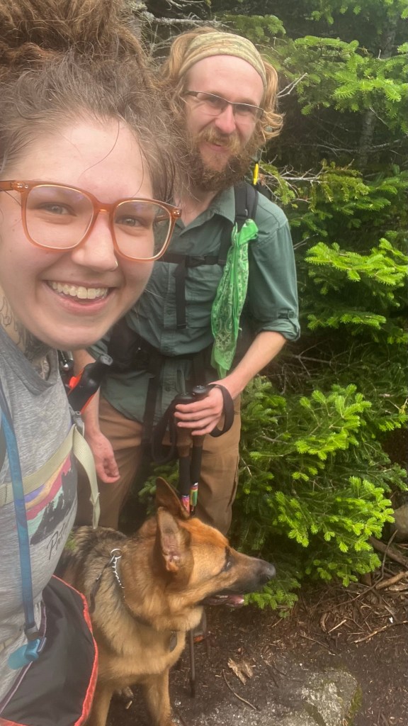
I was still standing there on the summit when a woman and her dog appeared, asking me about the herd path to Mt. Redington. Immediately, I forgot all about my day of silence and enthusiastically answered her. Since I wouldn’t be alone, I felt a lot better about navigating our way to Mt. Redington, and we decided to head there together. My new friend was another peakbagger named Bri, who was in the area to hike many of the 4kers in the High Peaks region. Her dog was named Kinsman!
As it turned out, the “herd path” was incredibly easy to follow. Not only had so many people trod the path that it was very clear where the trail was, but it was often marked with ribbons on trees along the way. There was only one time on the return trip that we had a question about where to go, but quickly figured it out. After 1.2 miles (another quite long side trip – it would have been my longest side trail had it not been for Mt. Abraham the day before) we reached the summit of Mt. Redington. It was by far my most peak-baggiest peak yet! It was a wooded summit with no views, but that goes without saying. It was really fun to be able to have that unique experience with Bri, and I enjoyed getting to know her and Kinsman along the way.
After that side trip, I journeyed on by myself to North Crocker mountain. At the top, I took a very long break talking with some SOBOs that I met, a young guy named Stow and an older woman named Foxy. Foxy was a flip-flopper and was now heading south from Katahdin. When she finishes her thru-hike, she will become the oldest Black woman to thru-hike the AT. Hearing her story was really inspirational. I loved having the chance to hang out with the two of them without feeling rushed in any way. It made for a great day. Already, I was loving my take-it-slow, stop-and-smell-the-roses approach for the rest of the trail!
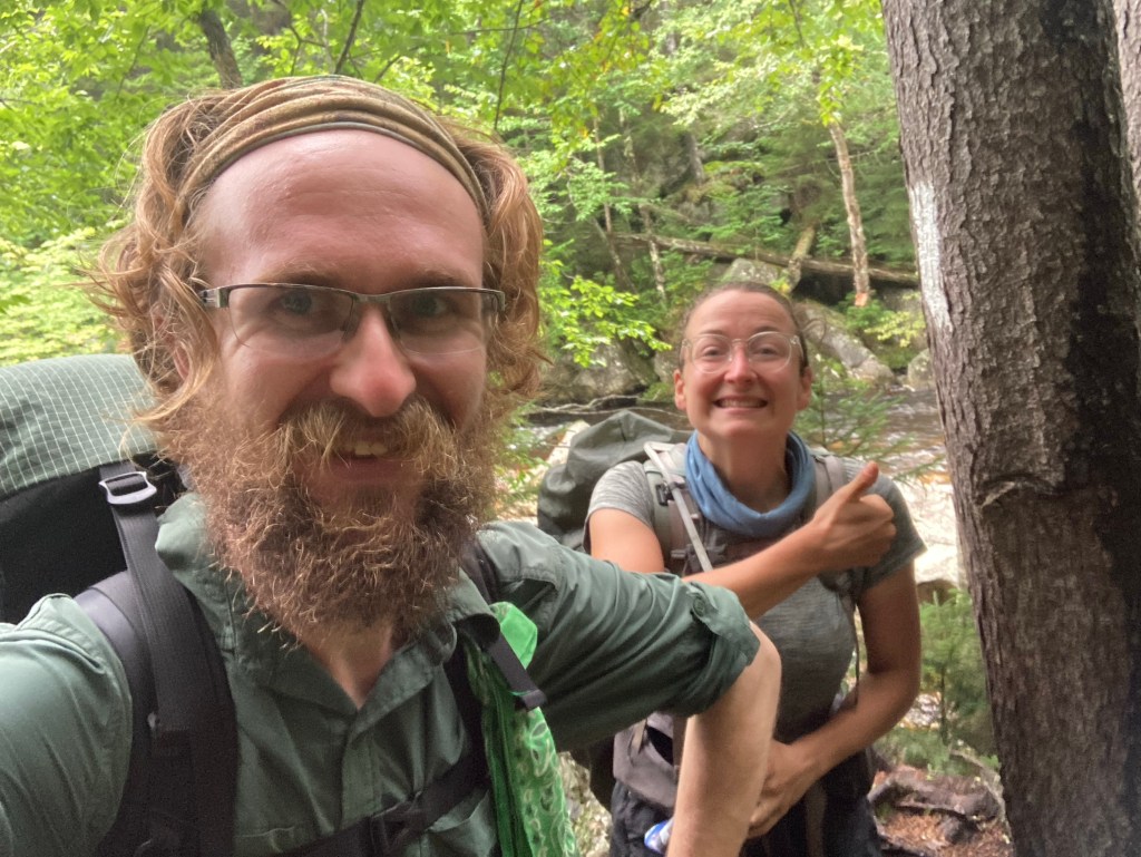
I stayed that night on the shoulder of North Crocker, a few miles away from the road into Stratton, ME, where I had reserved a bunk at the Maine Roadhouse hostel. When I got to the road in the morning, I called the hostel and one of the owners, Jenn, picked me up right away. The timing worked out perfectly so that she was dropping off Meadow and Victory back to the trail at the time! I was glad to see them again. They gave the hostel a glowing review before we said our goodbyes again, not knowing if we would see each other again.
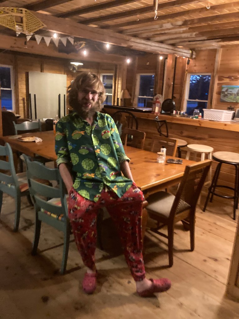
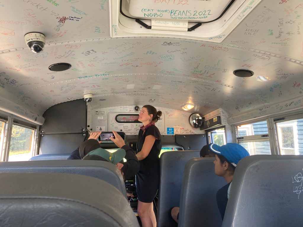
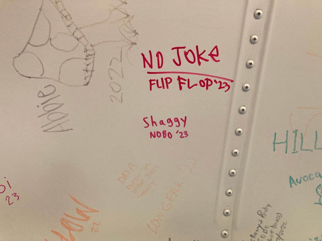
I love getting to hostels early. I didn’t have any competition for showers and laundry, and I was able to get my chores done quickly and spend a lovely remainder of my nero day at the hostel. In this case, I even lucked into breakfast leftovers, a delicious take on eggs Benedict with pot roast. The ever-changing breakfast offered at the Maine Roadhouse was just one part of what made it one of my favorite hostels on the AT! It had immaculate rustic vibes, looking like a huge wooden cabin. It was soo Maine. The Jenns (both with two N’s!) that run the place were both super friendly and helpful. Plus, they had an impressive assortment of loaner clothes. I got a lot of compliments on my Ninja Turtles shirt, but I was more excited about the Mickey Mouse pants. There was also a decommissioned school bus that they used as a shuttle that hikers could sign.
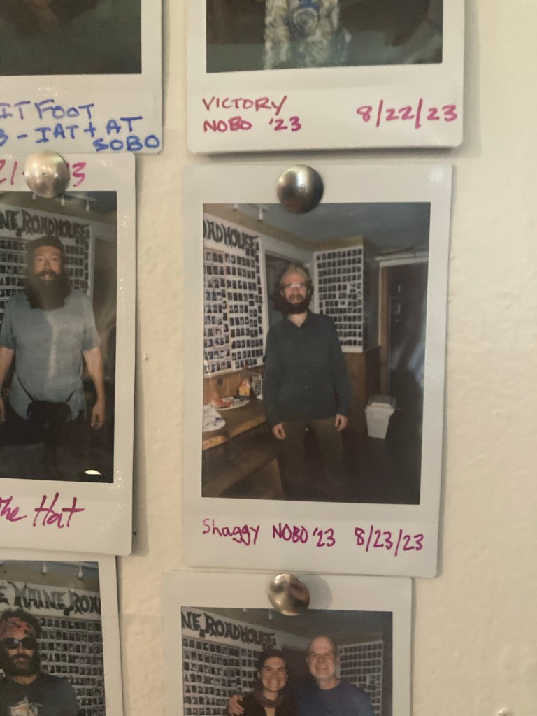
You know that scene in The Incredibles where Mr. Incredible looks around his office in awe at all his old newspaper clippings and awards, reliving his glory days? That is what signing that bus felt like to me. I was forcibly reminded of signing the bus at Around the Bend back in Georgia; that felt so cool at the time, but looking back, it was pretty insignificant. In the grand scheme of things, I had not come very far to be there, and so many people who signed that bus must not have gotten very far on the trail beyond that. Here though, at the Maine Roadhouse, (most) signatories had come 2,000 miles to be there, a monumental feat. I looked around in awe at all the signatures, seeing so many wonderful friends that I had met along the way, and feeling an overwhelming pride in them and myself, and our shared accomplishment. Then I added my name.
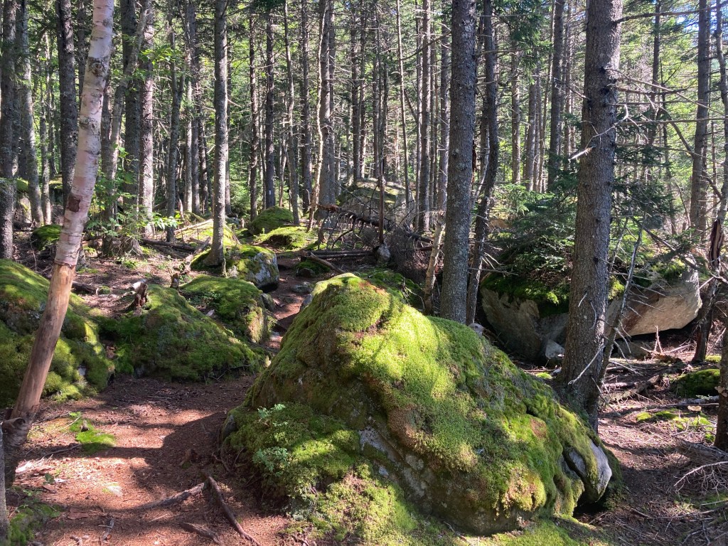
The next morning, after another delicious breakfast, I shuttled back to the trailhead (with a big crowd) to head up to the Bigelows. It was a beautiful day, and I was excited to tackle the last big peaks in a while – the final 4,000-footers until Mama K herself! The climb was utterly gorgeous, with the sunlight shining on moss and pines. The Maine woods are so pretty.
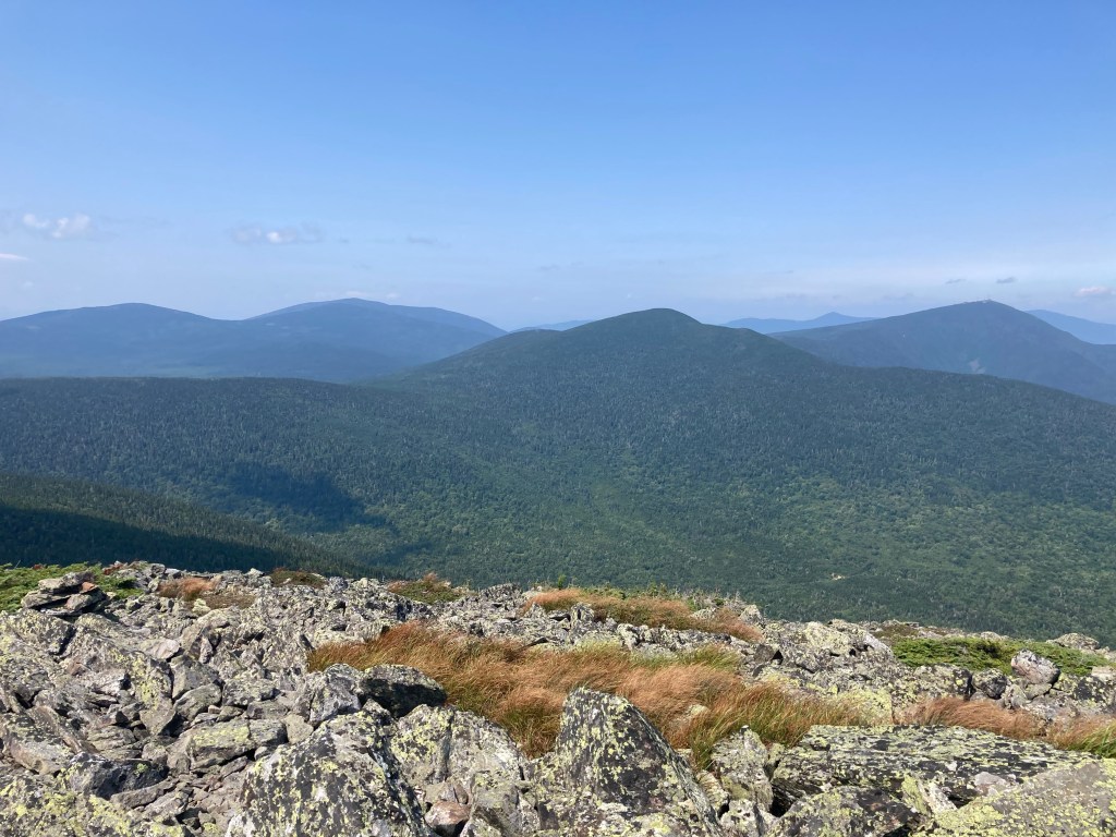
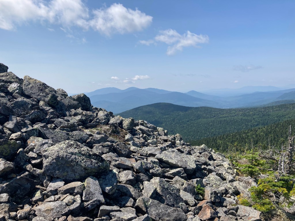
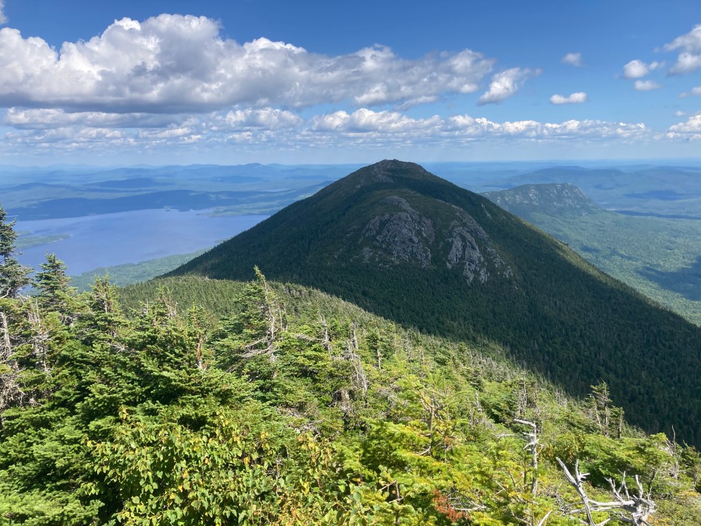
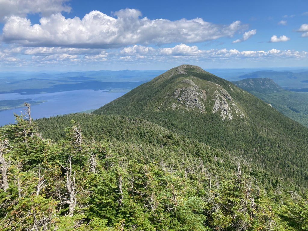
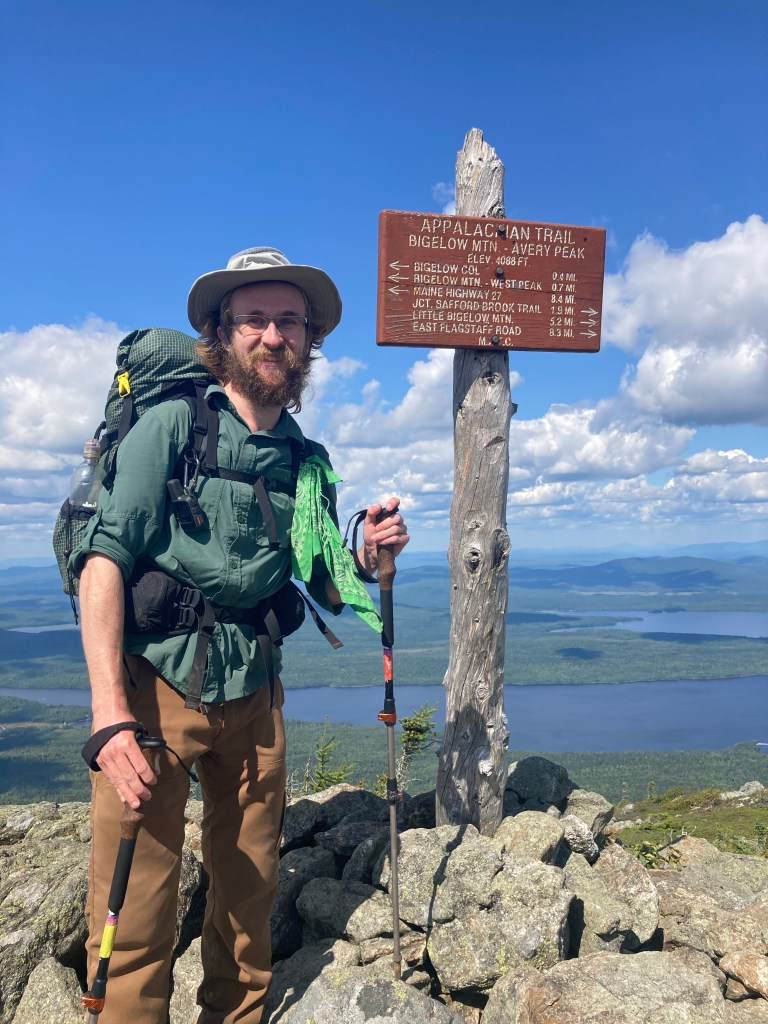
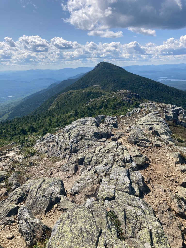
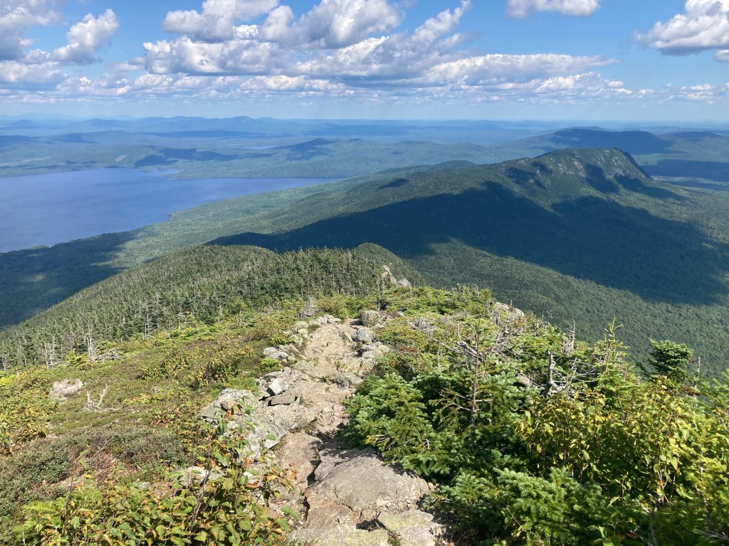
The Bigelow Preserve contains 5 different peaks: North and South Horn, the twin 4,000-foot peak of Bigelow Mountain, and finally Little Bigelow Mountain. I went over all of them that day, and it was absolutely stunning. First were the Horns. I had an amazing view of the peaks overlooking Horns Pond, then came the climb. I slackpacked the side trail to North Horn, and I was rewarded with splendid views in all directions.
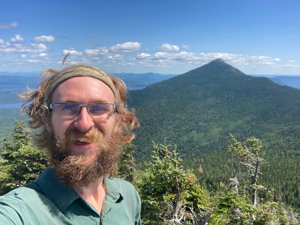
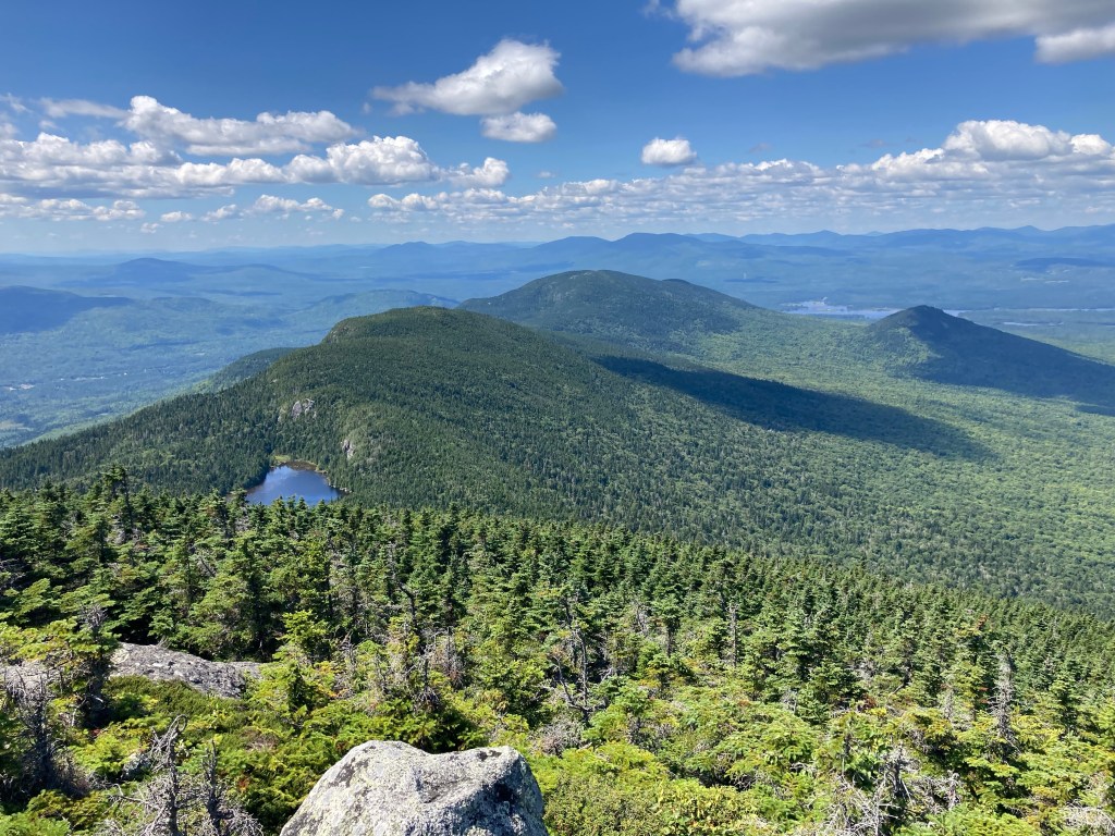
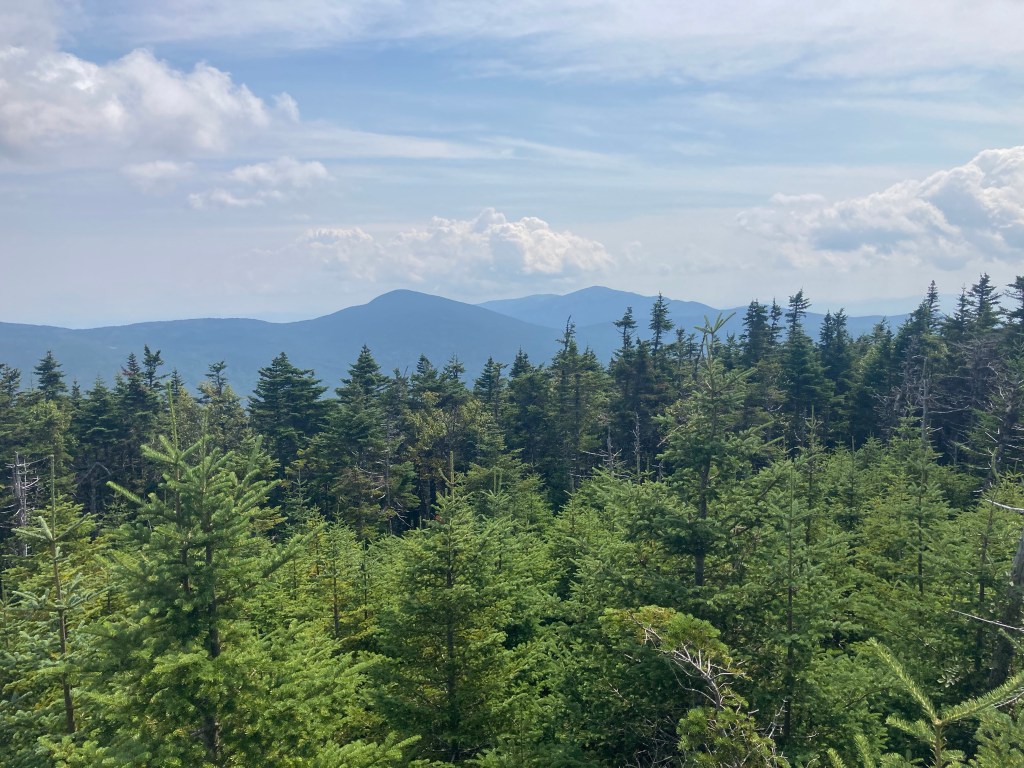
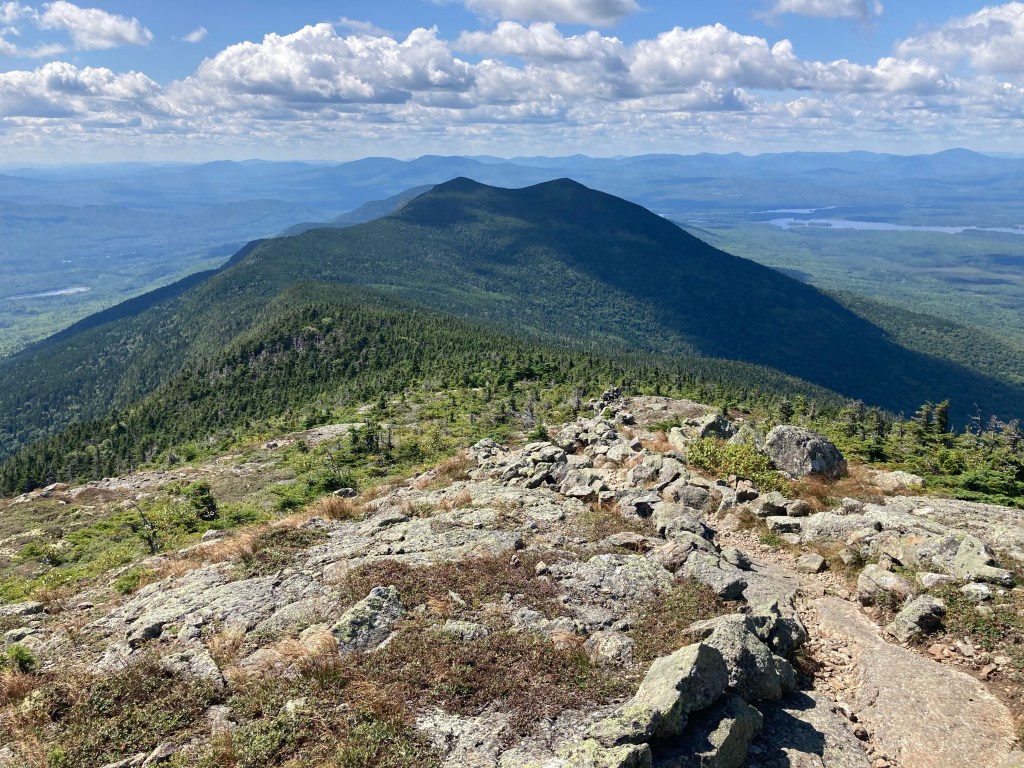
It only got better as I passed South Horn and scaled Bigelow’s West and Avery Peaks. I could see the High Peaks that I had done over the last few days, including the Crockers and Sugarloaf. Flagstaff Lake sprawled to the north. Far in the distance, I could see all the way back to Mt. Washington. And in the other direction, I could just make out Mt. Katahdin through the haze! That’s right, the end was in sight for the first time. Honestly, since I could truly barely see it, I didn’t get too excited, and it felt like a technicality more than anything else.
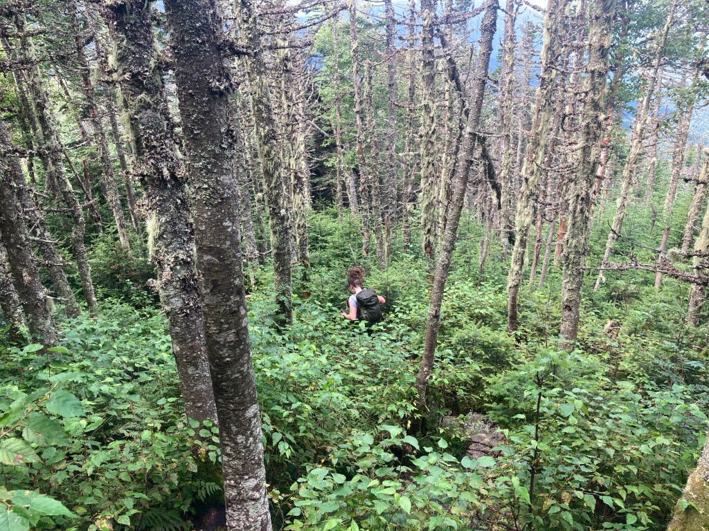
The rest of the day was a long afternoon going down and over Little Bigelow Mountain. It was a deceptively tough day, with tricky terrain and climbs throughout. I think it felt deceptive because I was so distracted by the beauty all around me. The mountains had so much character, and I loved it all very much. The Bigelows are now some of my favorite mountains ever! It was one of the best single-day sections of the trail.
Along the way, I enjoyed meeting and hanging out with some new friends. I hiked with Soapy, who I had met at Maine Roadhouse. I met Pigpen, and ran into Ronin, who I hadn’t seen since way back in central PA! I also met Hazel’s Parents (no other trail names!) and their very sweet dog – wait for it – Hazel. At the shelter that night, I had a good time with a tramily of funny, friendly characters that styled themselves the “Nude Dudes” (they were not naked at the time, though). It was fun to be around so many hikers on such a beautiful day.
The next day started off with a bang when I came across the first trail magic in what felt like a very long time. Step was a current SOBO thru-hiker who was taking a pause from his hike to be a traveling trail angel extraordinaire. I ended up spending quite a while at what turned out to be a very meaningful trail magic and a fond trail memory. I enjoyed getting to know Step and the Nude Dudes: Cheesefoot, Limp Pickles, Rocket Sauce, Beefcake, and Wizard Spoon. Cheesefoot was carrying a guitar on the trail, and was actually highly prone to use it! I later heard him playing and singing several tunes in his tent. Now, he and Step, who had a “guitalele” of his own, performed for us and jammed while we sang along and appreciated the music. I learned some new songs that really resonated with me, especially at that point on the trail when we were nearing the end of our journeys. It was really fun to have a great bonding experience at this trail magic that spontaneously had making music together as a focus. I left there feeling renewed gratitude for the trail community and excitement for the rest of my hike.
I spent the rest of the day hiking around the Nude Dudes, as we traversed a mercifully flat and easy section of the trail. Many folks had said that the trail got a lot easier in Northern Maine after the Bigelows, and if this was what we were in for, I was very satisfied. It was not without its roots, rocks, and mud, but it was better than I’d had in months.

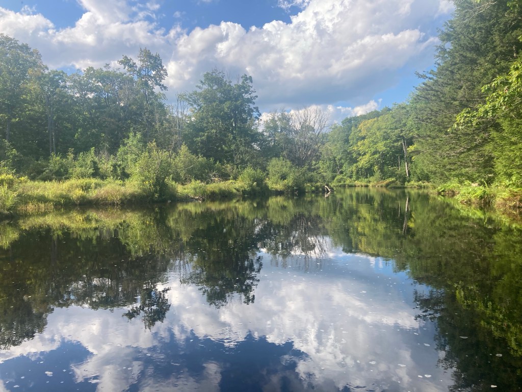
After my amazing week going through the Whites, it would have been nearly impossible to beat out New Hampshire for my favorite state on the trail, but Maine was trying its dang best! We passed so many scenic ponds. I even became an honorary Nude Dude myself when I skinny-dipped with a bunch of them in beautiful East Carry Pond. It was a refreshing swim, and kind of masculinity-liberating to do that with a bunch of dudes I had just met. I love the trail xD
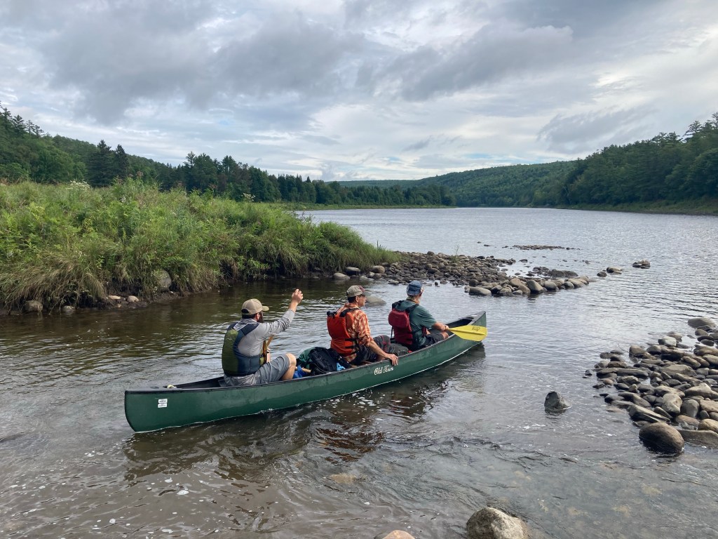
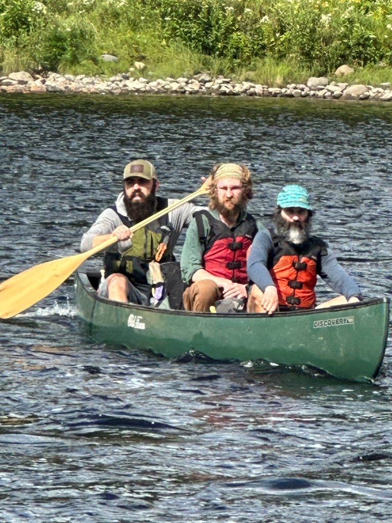
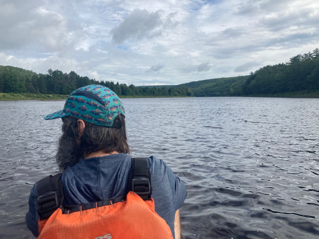
I stopped for the night at the idyllic Pierce Pond Lean-to – me and everyone else within a 50-mile radius, it seemed. The reason why this shelter was so popular was that it was right before the Kennebec River. The Kennebec is the largest and deepest unbridged river crossing on the AT, and it is incredibly dangerous to ford it due to unpredictable changes in water level. As such, the official route of the AT is a canoe ferry across the river, staffed by volunteers! The ferry only runs at certain times of day, so there was a big crowd at the shelter of people waiting to cross the river the next morning. I wasn’t worried about the rush, though, because I had other plans.
There was one more major item on my trail bucket list, and this one I was truly determined to do: a trail zero day. No miles hiked, spending all day in the woods. With rain in the forecast and a conveniently located shelter spot, I seized the opportunity to take my only on-trail zero. To be honest, I didn’t know how it was going to go. Would I be bored out of my mind? Would I feel super lonely staying put, more so than hiking by myself all day?
As it turned out, it wasn’t nearly as bad as I feared. I spent a lot of time relaxing in my tent, working on my blog and listening to the rain. I also spent time at the nearby Pierce Pond Camp, down a short side trail from the shelter. The presence of this rustic sporting camp was another reason I had chosen this spot for my trail zero. The owner, Tim Harrison, also offers a huge pancake breakfast for a limited number of hikers every day. I enjoyed meeting him and Ronnie at the camp, and I got to play some piano. When I returned for “patriotic pancakes” in the morning, Tim asked me to play some more. That compliment meant even more later, when I learned that Tim was an accomplished pianist himself.
To my surprise, it was only me and Goldfish, who I had met at the Maine Roadhouse, at the shelter that night, compared to the huge crowd of the previous night. However, when we both went back to Harrison’s camp for breakfast, we were joined by old faces and new: Grizz, Peace Pipe, Terry, and Holy Shit (another incredible trail name).
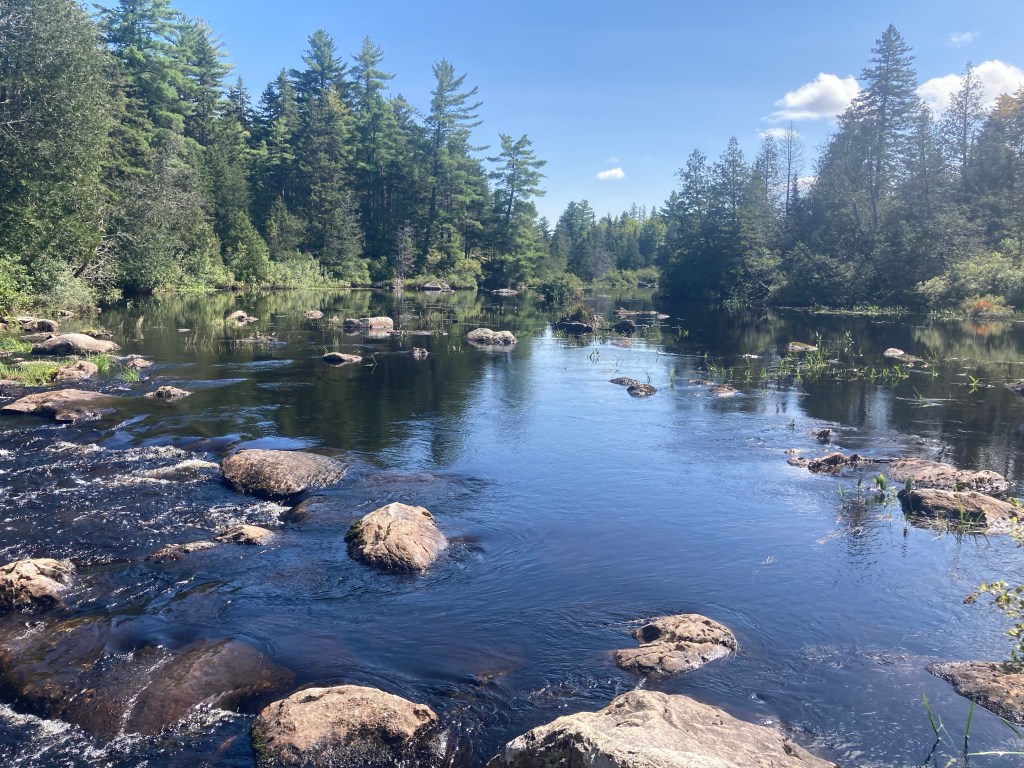
After a short hike passing several cool waterfalls, we reached the sprawling Kennebec River. Justin, the friendly ferry operator, paddled us across two by two. It was fun! It felt pretty surreal to cross that river. First of all, I felt lucky that I was able to take the ferry at all; it had been shut down for prolonged periods twice this summer due to dangerous water levels with all the rain, and hikers had to take a long high water detour. I would have been bummed to miss the ferry; it was something that I had been looking forward to since before my hike even began. Like the zoo or the train station, the Kennebec River ferry was something that people talked about: “wait ’til you take the ferry!” This felt like the last of those unique milestones. It was another reminder of just how close the end of the trail and the end of this odyssey was.
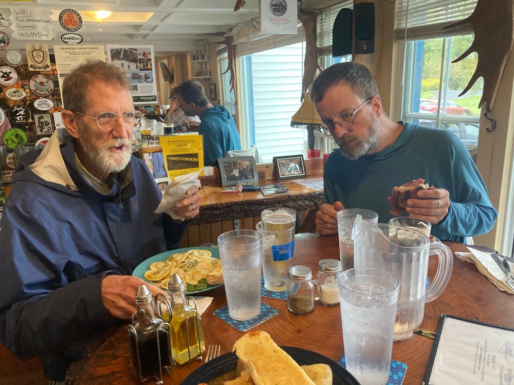
On the east side of the Kennebec, I stopped by the Sterling Inn in tiny Caratunk, ME. Not only do they have a surprisingly good resupply, but they let hikers shower and do laundry even if they aren’t staying the night. I resupplied to take me the rest of the way to Monson, got cleaned up, and hung out there for a few hours with several friends. I had leftover pancakes (Tim gave us TWELVE each, plus eggs and sausage, and somehow I was the only one not to finish them for breakfast – no shame!) and a pint of Ben & Jerry’s for lunch, reveling in being able to eat a ton of unhealthy stuff on the hiker diet for a little while longer. I enjoyed talking to the owner, Eric, too. I feel like I get along well with old small-town Mainers 🙂
After waiting out a brief thunderstorm, I headed back to the trail – only to get caught in another passing storm half an hour later. Oh well. It wouldn’t be the AT without one more downpour!
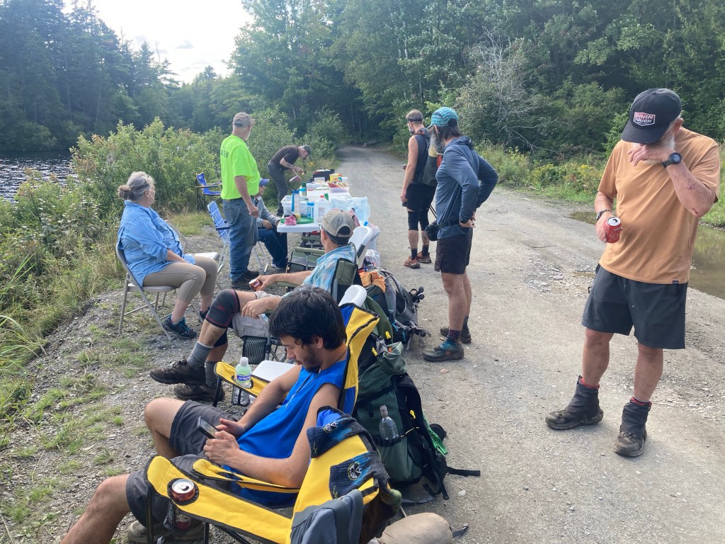
I felt a little bit out of it the next morning, amidst another beautiful, classic ME section. At midday, I was treated to the best trail magic spread I’d had in hundreds of miles! I took another long, relaxing stop there, eating plenty of delicious food and chatting with the group of trail angels from a “nearby” town. It was the pick-me-up I needed!
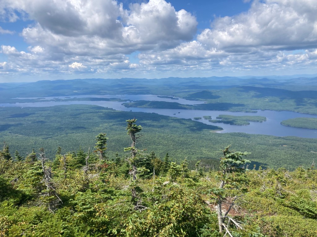
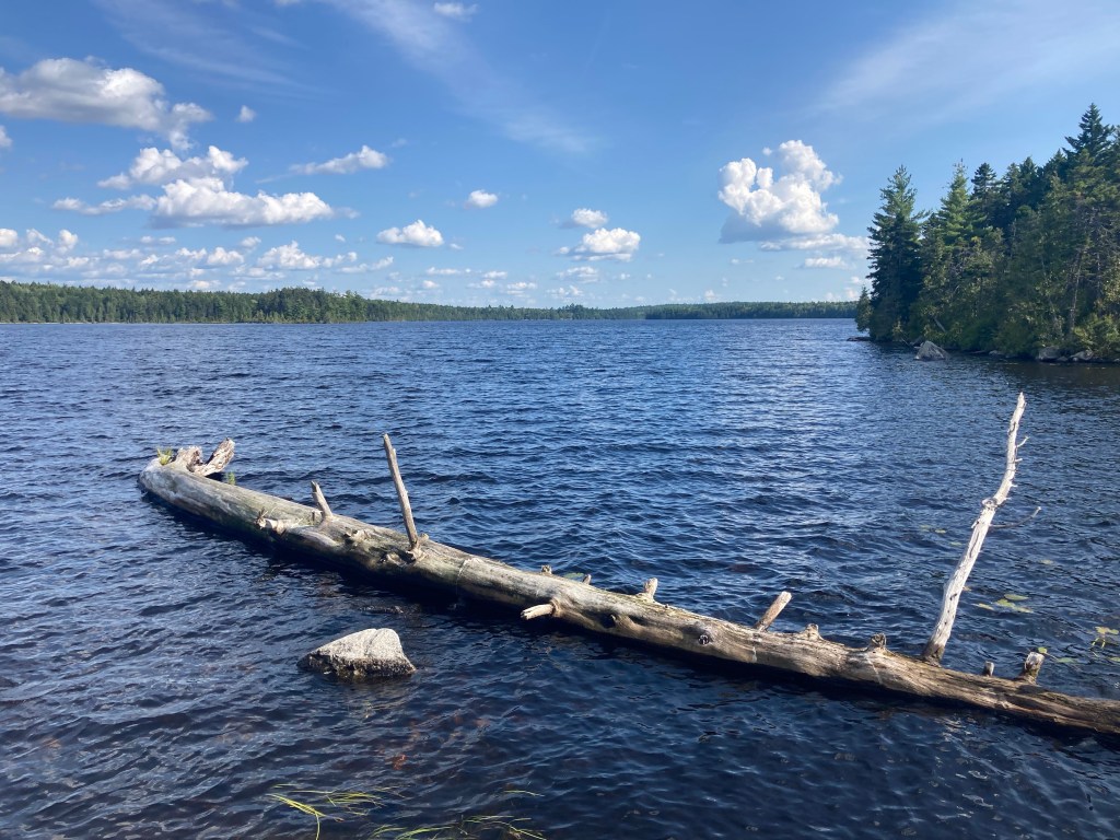
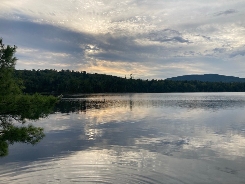
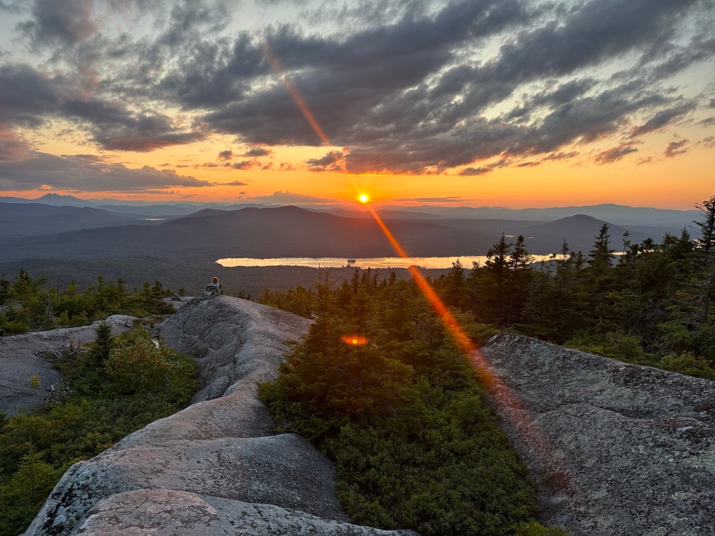
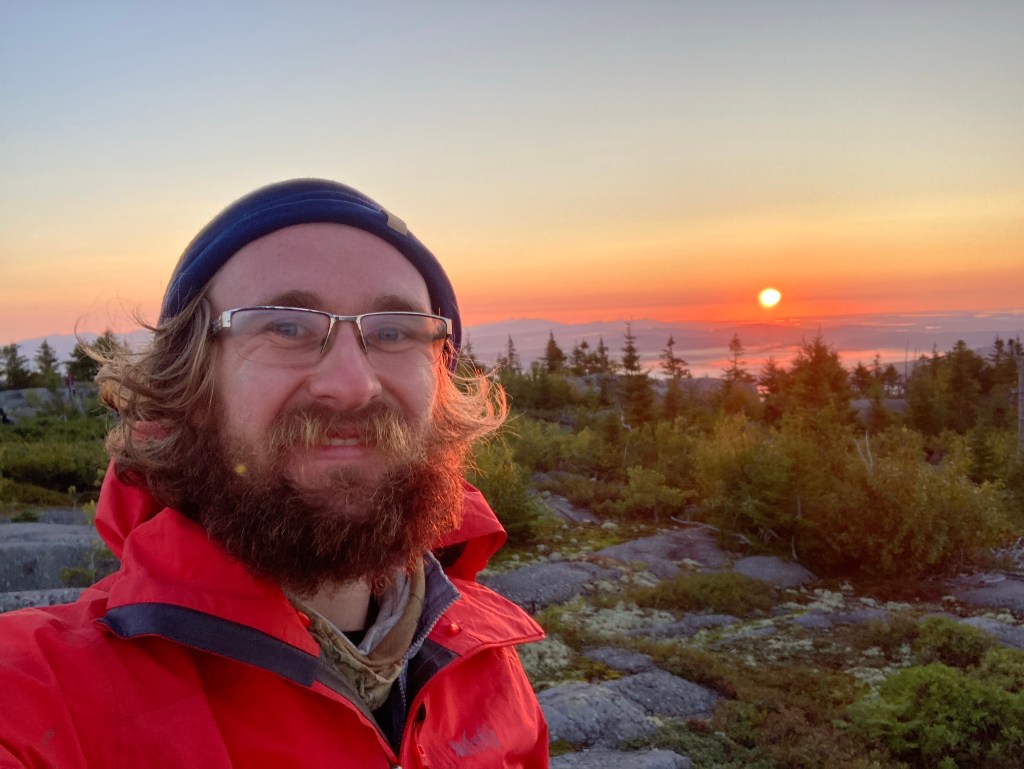
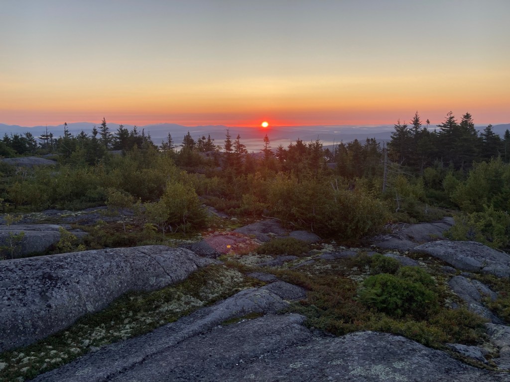
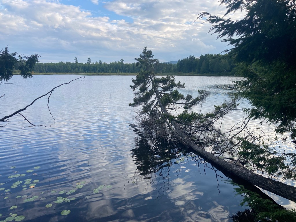
It was a gorgeous afternoon, with clear skies in the forecast for that night, and I had an inkling to cowboy camp again. Yes, my first experience cowboy camping hadn’t exactly gone great, but I had heard that Moxie Bald Mountain was a great spot for it, and I was willing to test my luck again. Moxie Bald was a relatively small but much-beloved mountain, and when I ended my day there, I could immediately see why. It had an awesome, rocky, exposed summit with wonderful views in all directions, including the upcoming mountains of the Hundred Mile Wilderness and the High Peaks behind us. In particular, the distinctive peaks of the Bigelows in the distance made an awesome backdrop for a great sunset into the mountains.

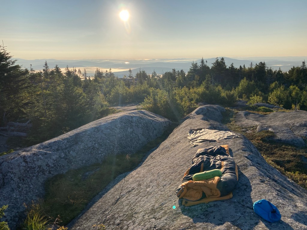
I found a perfect spot for cowboy camping at the summit, a small grassy area nestled in between large rock sheets to shelter me from the wind. I was glad I had gotten there when I did, because three more people came up later with the same idea, and we all found spots to share the summit. Moxie Bald was one of my favorite spots I had ever stayed and one of my favorite spots on the AT. “I love it here & I love my life,” I wrote that night.
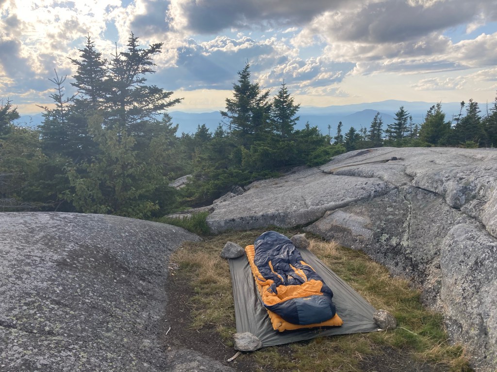

Cowboy camping went a lot better this time! There was still condensation on my gear, but it wasn’t quite as much, and I didn’t encounter any other difficulties (I didn’t get rained on this time!). I was so glad that I didn’t let my previous experience deter me and gave it another shot. In the middle of the night, I awoke under the best stars I had seen on the trail, by far. It was spectacular! I saw the Milky Way (which is a given: my main metric for “good stargazing” is “can I see the Milky Way?”), several meteors, the ISS, and even the Andromeda Galaxy with the naked eye!
In the morning, we watched a great sunrise over seas of fog. Learning from last time, and because the sun was actually out, I hung out for a while in the morning to dry my gear out before hiking on. The whole night was one of my favorite trail memories.
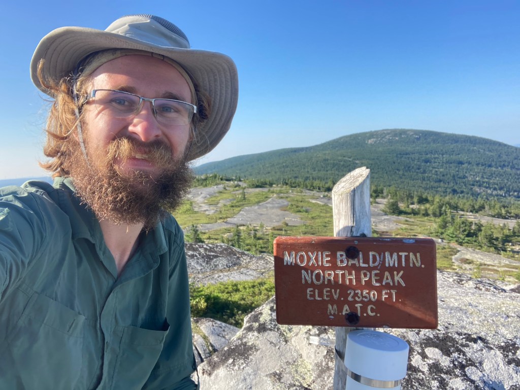
Soon, I took another lengthy and rarely-traveled side trail to Moxie Bald’s gorgeous North Peak. At this point on the AT, wild blueberries had become an endangered species, but in this less trafficked area, bluebs abounded and made for a great snack.
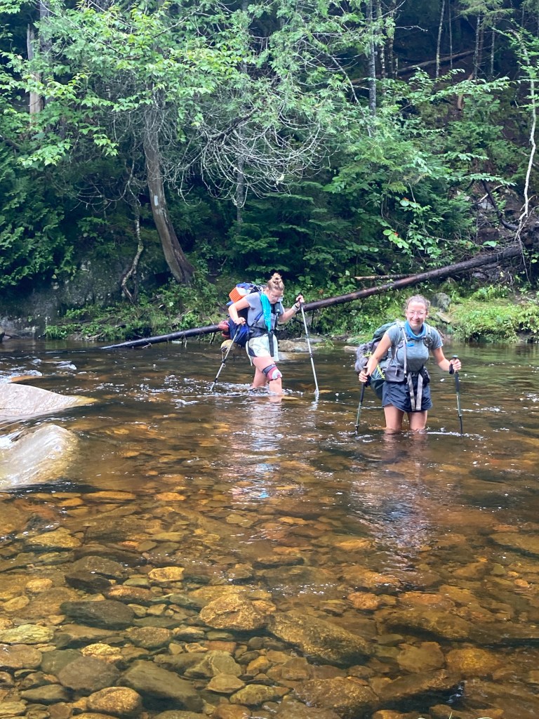
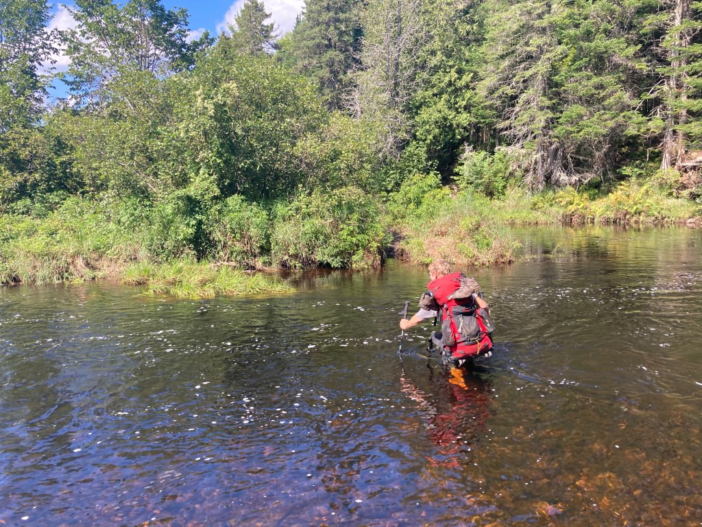
There was one final challenge before heading into my final(!) town stop. Northern Maine is infamous for rugged, remote terrain, a total lack of bridges, and difficult river fords – no hand-holding! Two of the most major fords (as well as several others that day) stood in between me and Monson, ME: the West and East branches of the Piscataquis River. These fords in particular I had heard horrifying things about: a friend hiking in June had nearly drowned fording the river, and even just a few weeks earlier some more friends had to road walk around the river after encountering dangerously high water levels. I was apprehensive as to what I would find, but to my relief, the West Branch appeared calm, beautiful, and not too high. I forded it with Peace Pipe, and found it waist-high – my deepest ford yet, but not too bad. Later, the East Branch of the Piscataquis was even easier, and only knee-deep.
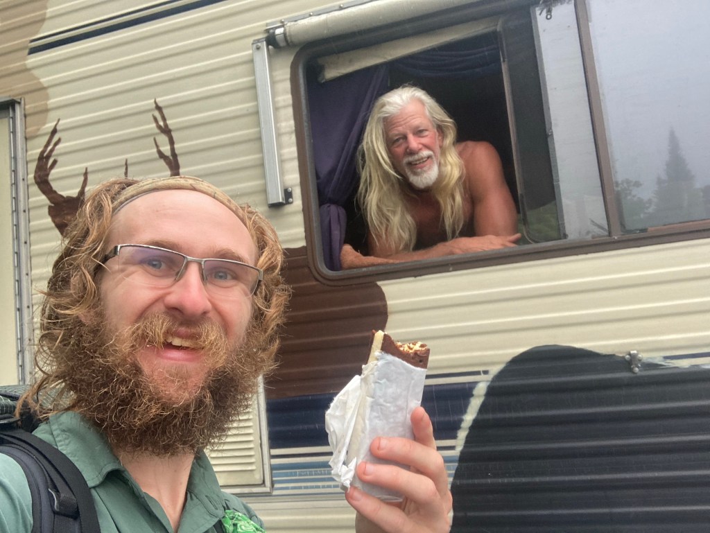
That night, I camped a few miles before the road, in what had become my favorite strategy for town stops. I love my nero days. It was a rainy night, and I left early in the morning in the dark gloom. I was hoping to catch the morning shuttle from Shaw’s Hiker Hostel, where I was staying, so that I wouldn’t have to hitch into town. As it turned out, I beat the shuttle by quite a bit, so I had time to meet a rather fascinating trail angel, Onesimus. Onesimus travels up and down the AT and is well-known for handing out ice cream sandwiches. I enjoyed a sandwich and listened to him talk about his interesting thoughts on religion for quite a while.
Happily, before the shuttle arrived, Meadow and Victory arrived with Victory’s husband to head into the Hundred Mile Wilderness! I was glad to see them once again and catch up on the last section of the trail. I wished them well on the final leg and we said our goodbyes – this time, in fact, for the last time.
When the Shaw’s shuttle arrived, I was also thrilled to reunite with Gravity and Charmer! I was glad to reconnect with some trail friends as they were heading into the final chapter. I would be heading out there too, after a couple days to settle myself in my final town stop.
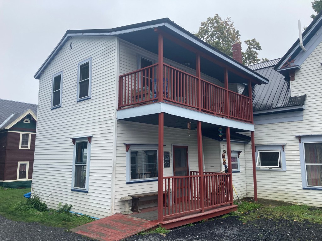
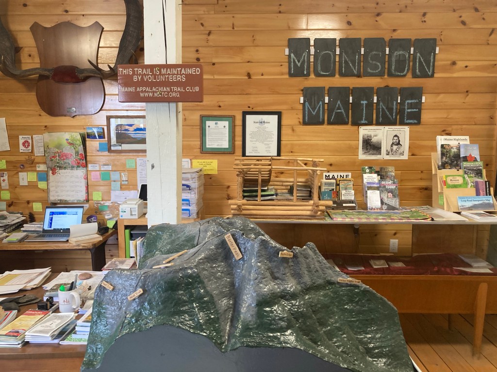
Shaw’s Hiker Hostel is arguably the most famous hostel on the AT, and serves as the gateway to the Hundred Mile Wilderness for NOBOs in Monson, ME. Poet, one of the cool owners, was happy to give me a ride into town, and gave me a quick tour of Monson while we were at it. “Don’t blink or you’ll miss it,” he said. It was really cool to arrive at Shaw’s and finally be at such an iconic place. Practically everyone stays at Shaw’s, and it was neat to be at such a large gathering place for hiker trash. I was with everyone I’d been hiking around for the past week, and saw several friends that I hadn’t seen for a long time, including OG Baggins, Zip, and even Learning Curve, from way back at Around the Bend in GA! Learning Curve had jumped up to help out at several hostels along the trail and was finishing his season at Shaw’s. I was so glad to reunite with him! There were also many, many new faces. To be honest, I didn’t feel much of a desire to meet new people at that point, since we were so close to the end, and it felt like I had met enough people. (More fool me…) I had several nice chats with new folks nonetheless.
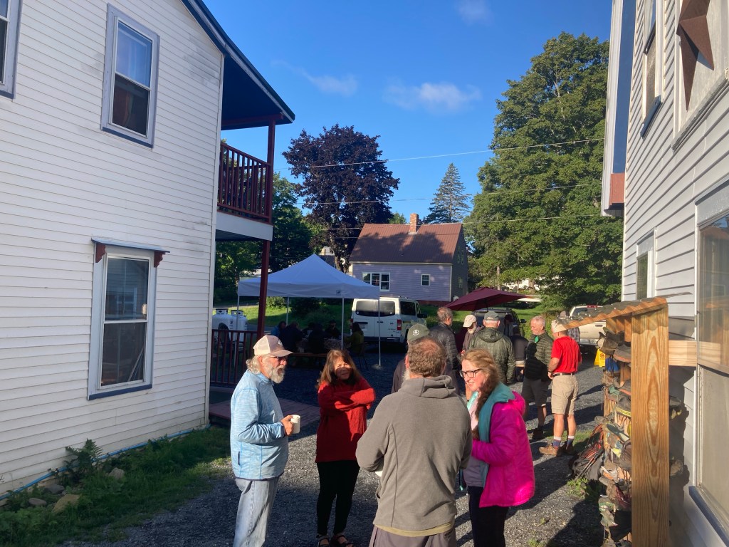
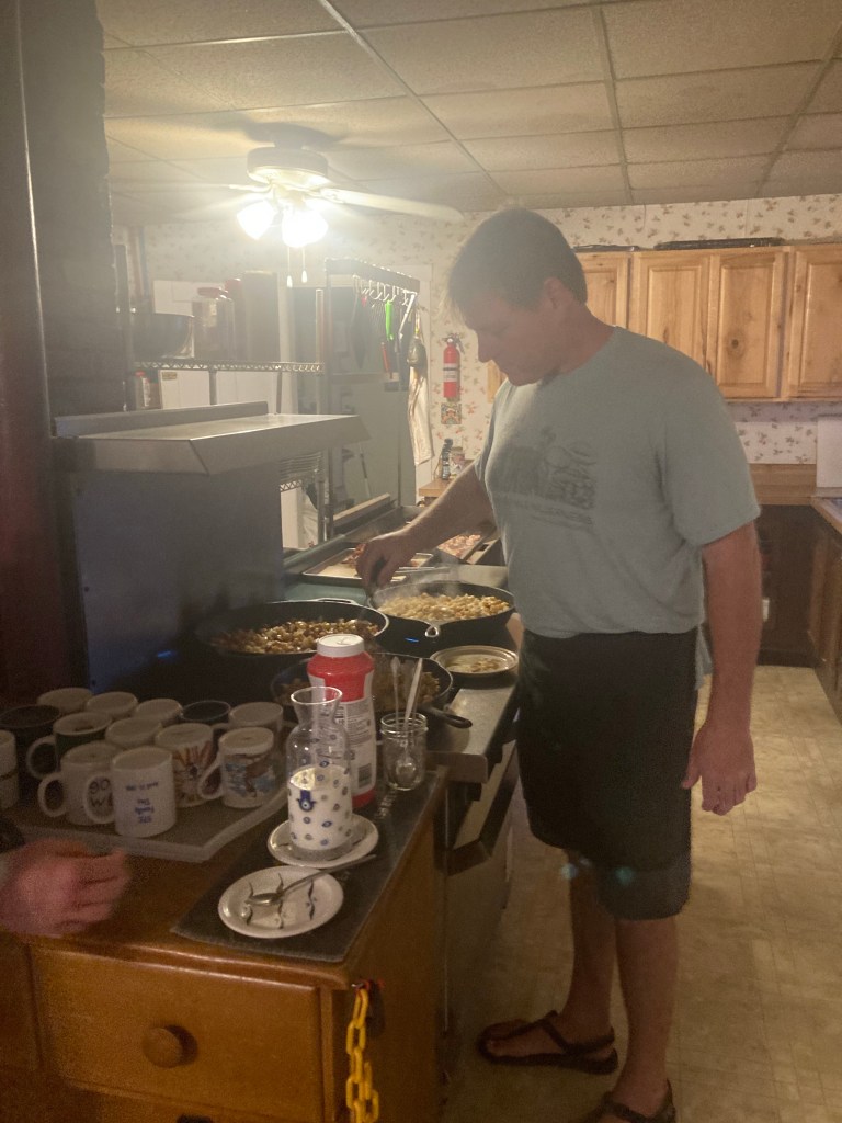
I spent two days at Shaw’s as I prepared to enter the home stretch of my thru-hike. I did all the usual town chores: laundry, shower(s), a large resupply (including setting up a food drop for halfway through the Hundred Mile Wilderness). I made my last calls to Macy and my family; the next time we talked, I would have finished my thru-hike. It hadn’t really sunk in yet. It felt like any other hostel stay, not the final one. That said, I did start to tear up at one point as I played Rocky Mountain High on the piano, so I guess that’s where my emotions were at. The staff at Shaw’s were all awesome, and made the place a super welcoming, positive environment. I had delicious breakfasts both mornings I was there, with Poet and company cooking up a truly massive amount of pancakes, potatoes, eggs, and bacon for the many guests. It was a great place to spend my final town days.
I was ready to get back out there, tackle the Hundred Mile Wilderness, and reach Katahdin. I couldn’t believe it would all be over so soon. Let’s do this thing!

Leave a comment