
8/2-8/6: Franconia Notch -> Pinkham Notch
I had almost forgotten how beautiful the Whites are. It kept getting better and better as I traversed over spectacular peaks and ridgelines. The Whites ended up being a rich social experience, too. I’ll come right out and say that this was easily my favorite section of the whole trail!
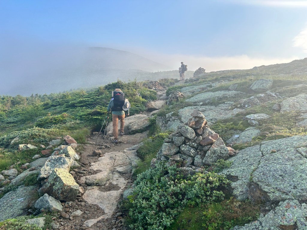
I left the Notch Hostel with my pack full of food and my heart full of excitement. For the first and only time, every mile of the trail I’d hike that day was something I had done before. Instead of small summit sections on Greylock and Moosilauke, here was an entire day of familiar territory. I knew I was in for an exciting section with Franconia Ridge. It also seemed to be a gorgeous day, so I was crossing my fingers for good conditions as I would traverse this long, exposed section.
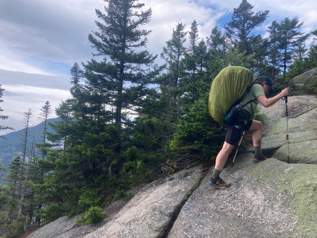
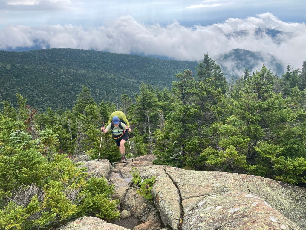
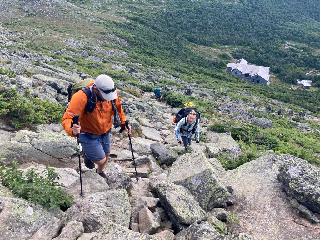
The day started with a steep climb up the Liberty Spring Trail. Not gonna lie, I was sorta dreading this climb, probably more than anything else in the coming leg of the trail. It was tough enough when I had done it in the winter, and I knew it would feel even harder with the rocky terrain of summer rather than snow on the ground and a full resupply on my back. It was certainly tough, but as it turned out, I was pleasantly surprised by how not awful it felt. I felt strong!!

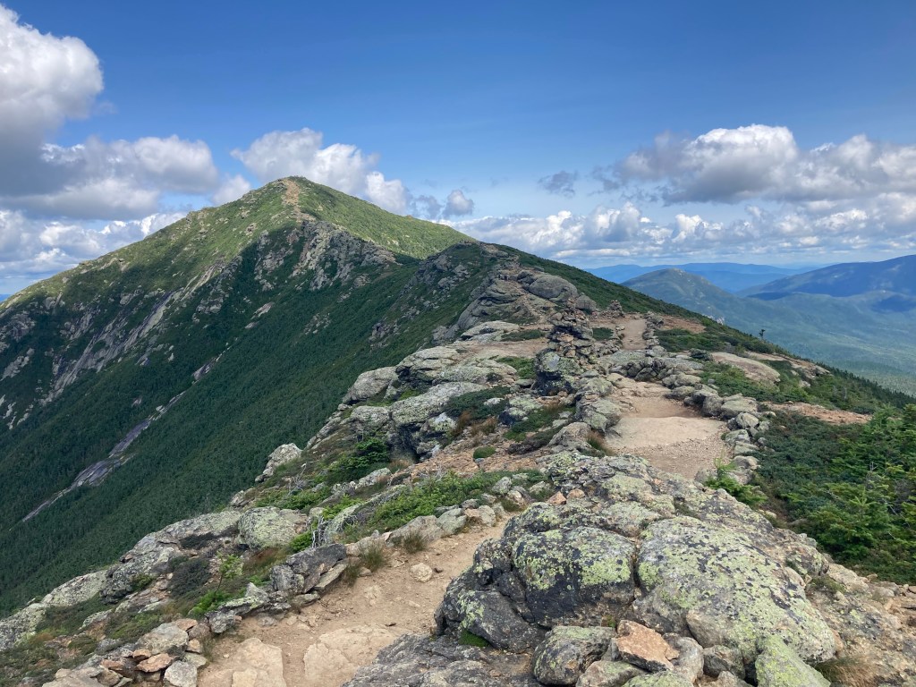
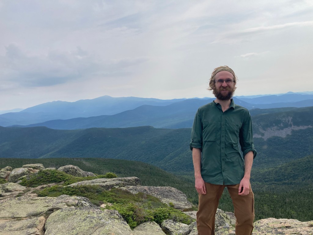
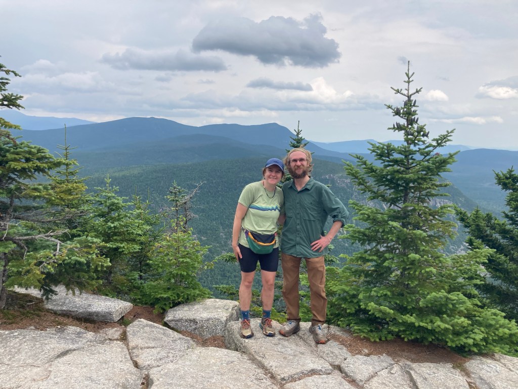
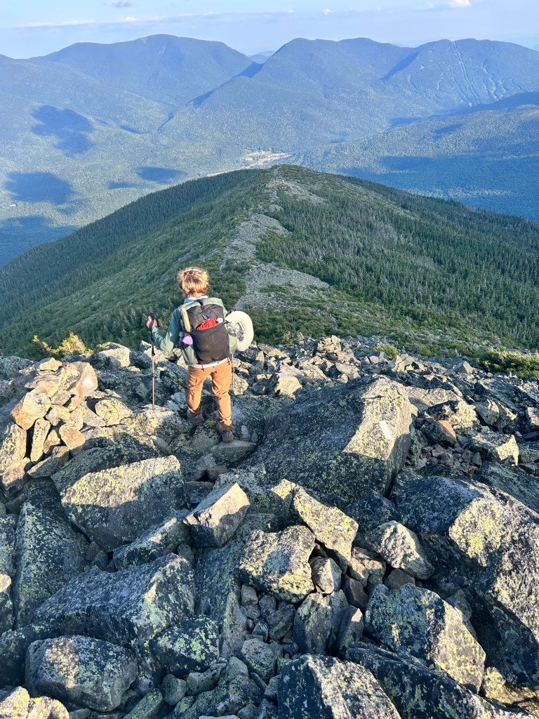
When I reached the top and the Franconia Ridge trail, I took the brief side trail to bag the summit of Mt. Liberty for the third time. Mt. Liberty will always have a special place in my heart: it was my first of the NH 48, my first 4000 footer, my first serious winter hike, and Macy and I climbed it on our 6-month anniversary 🙂 And after this time, I can confidently say it’s my favorite summit in the Whites.
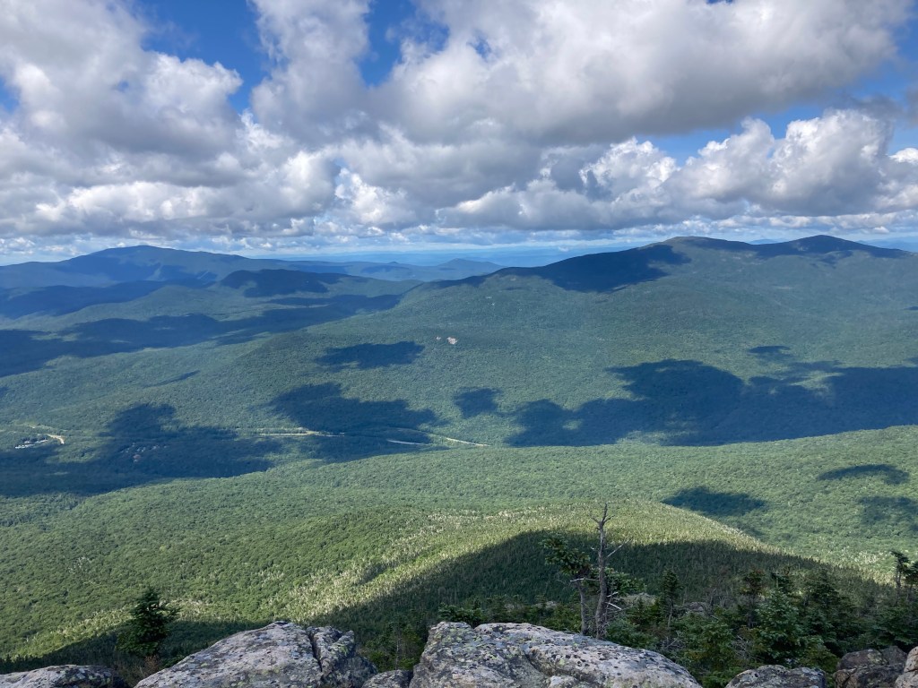
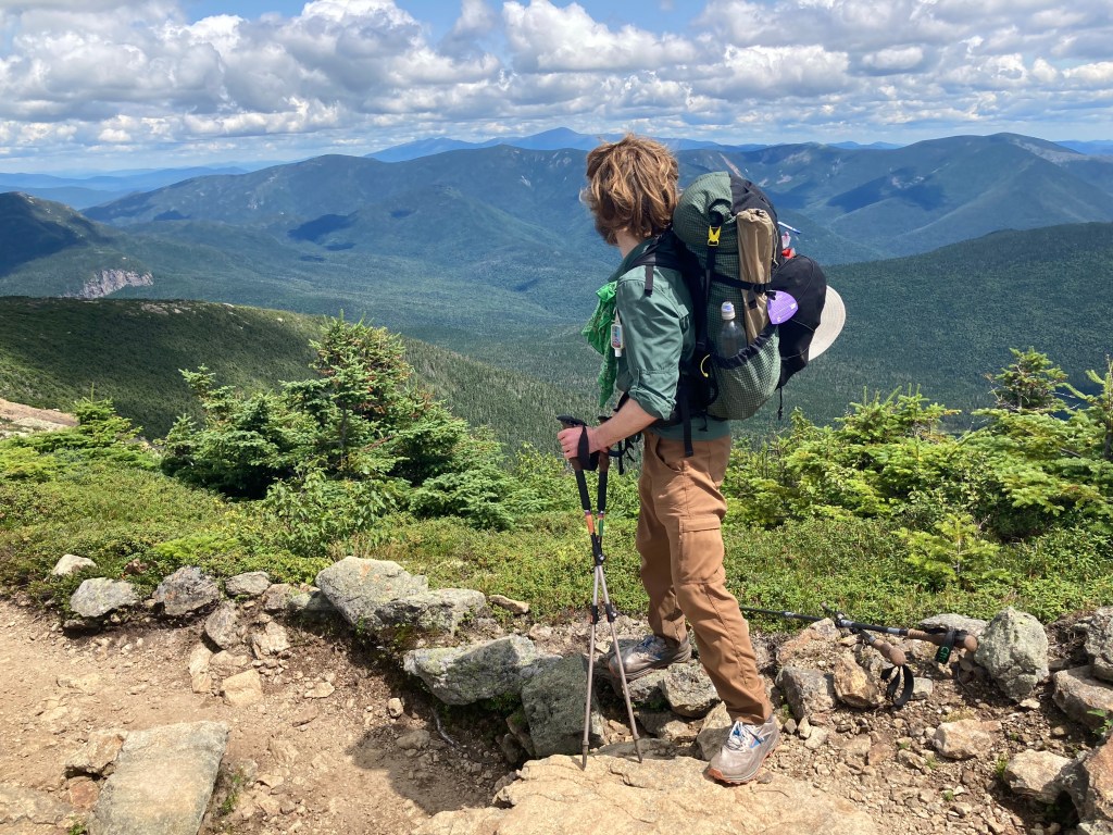
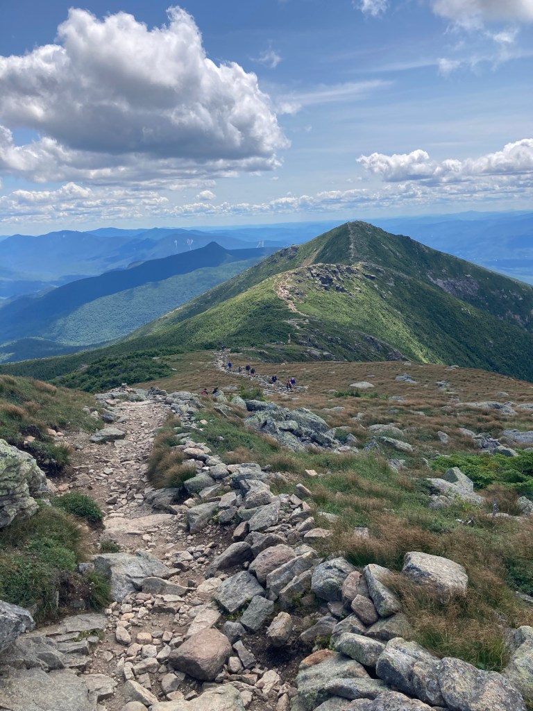
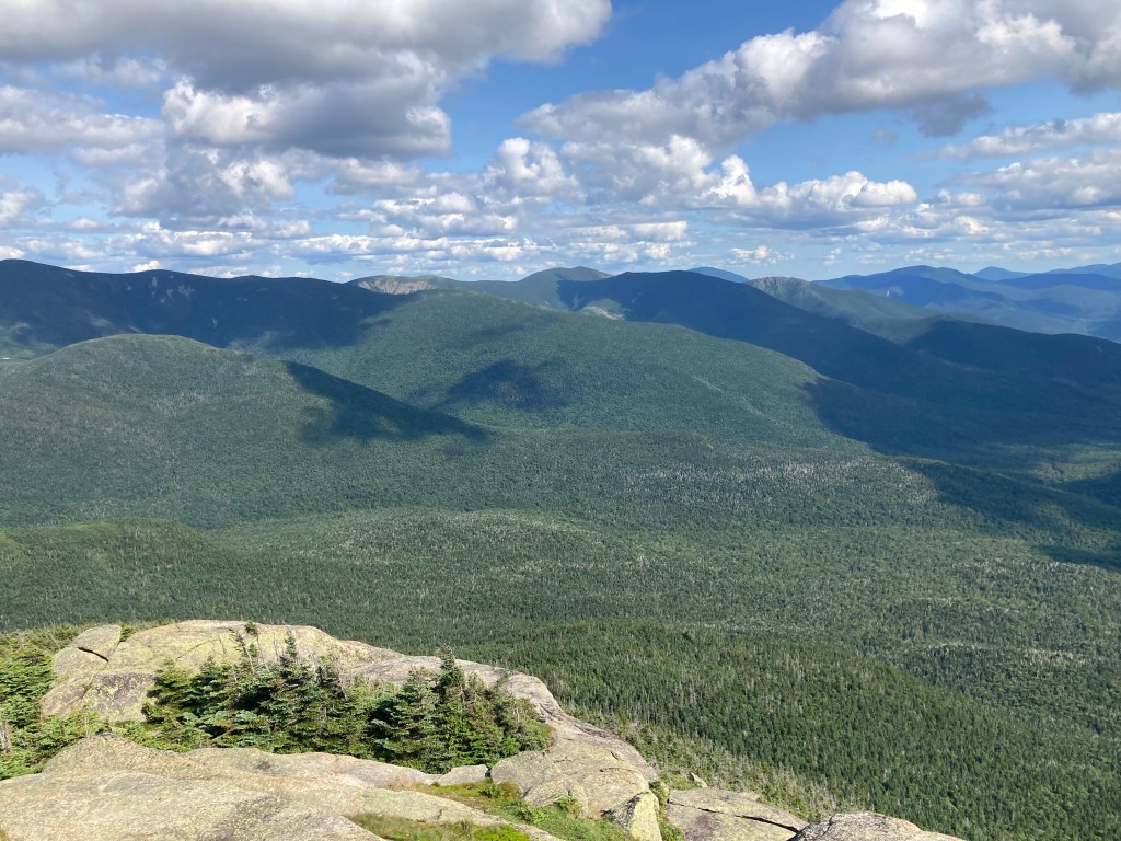
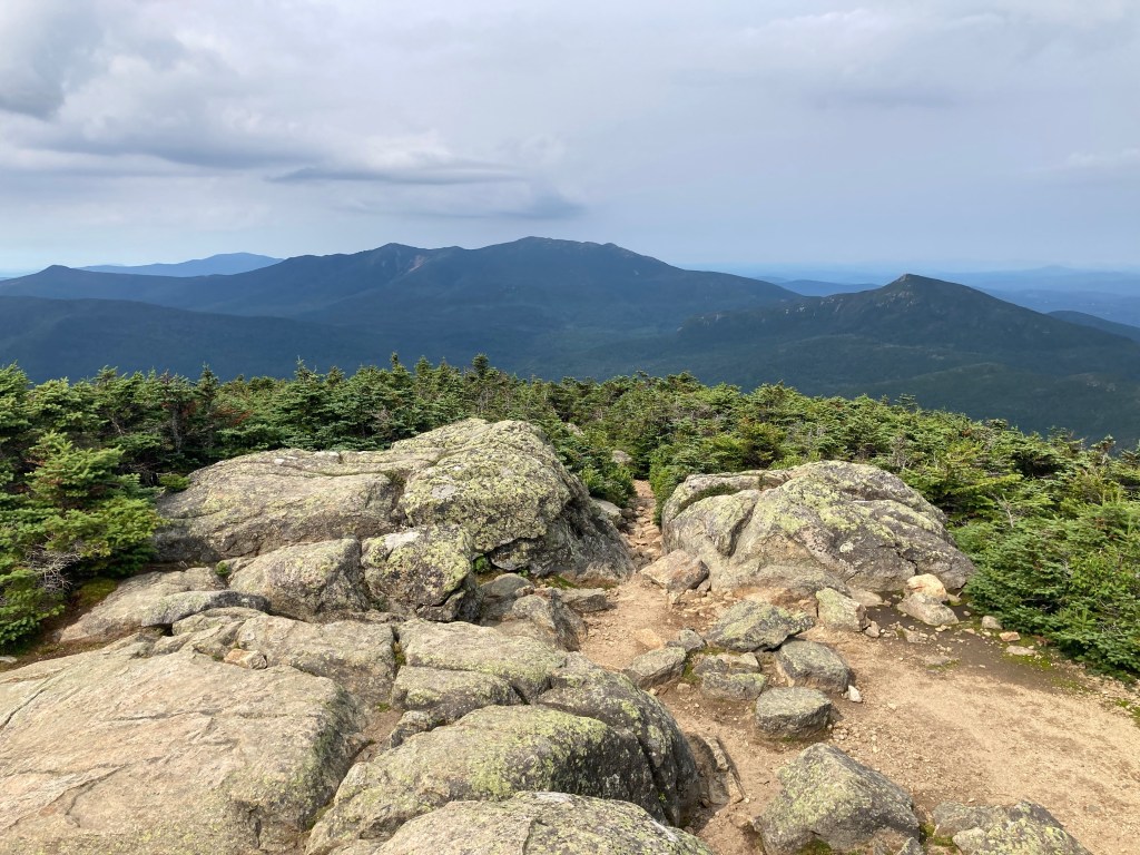
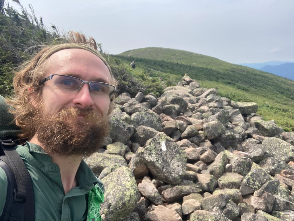
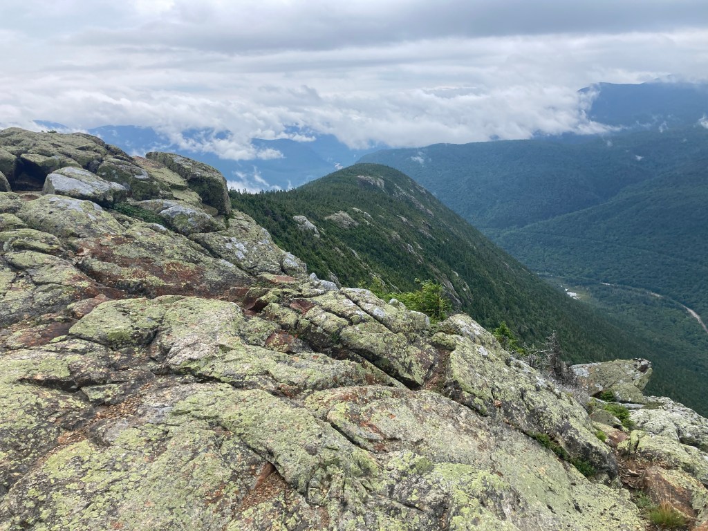
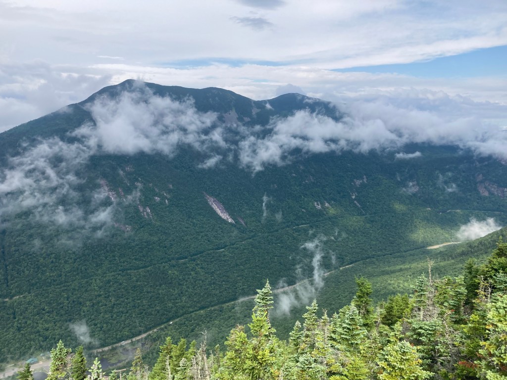
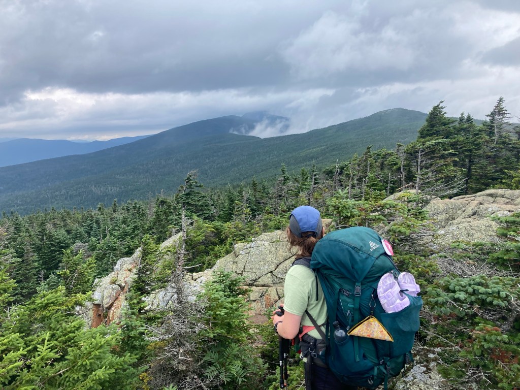
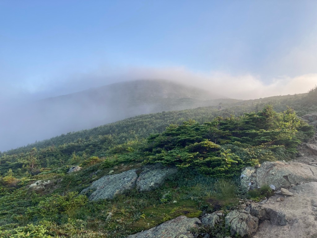
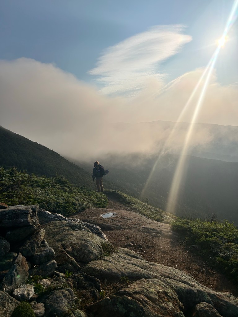
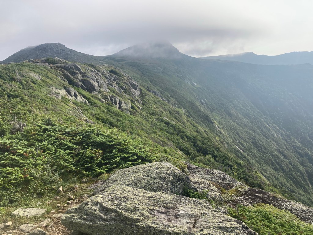
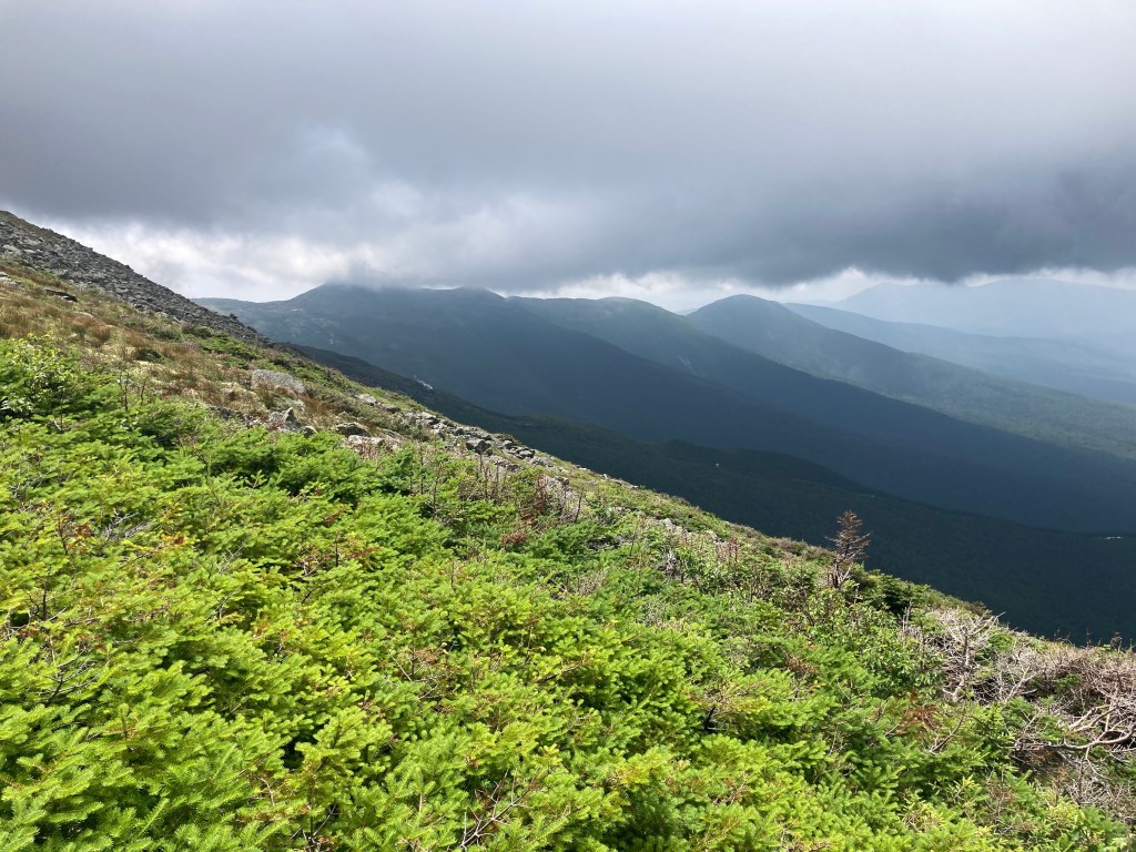
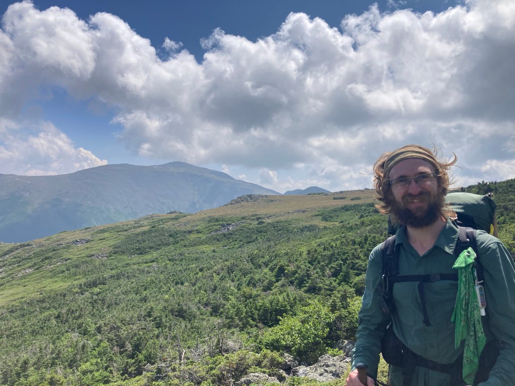
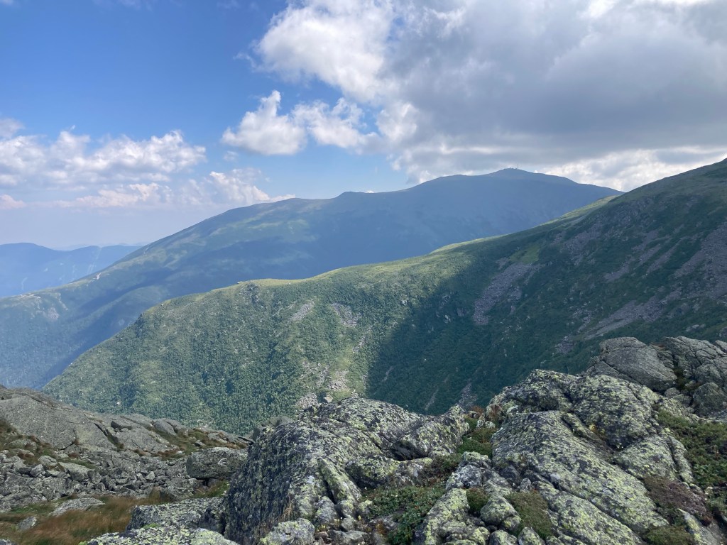
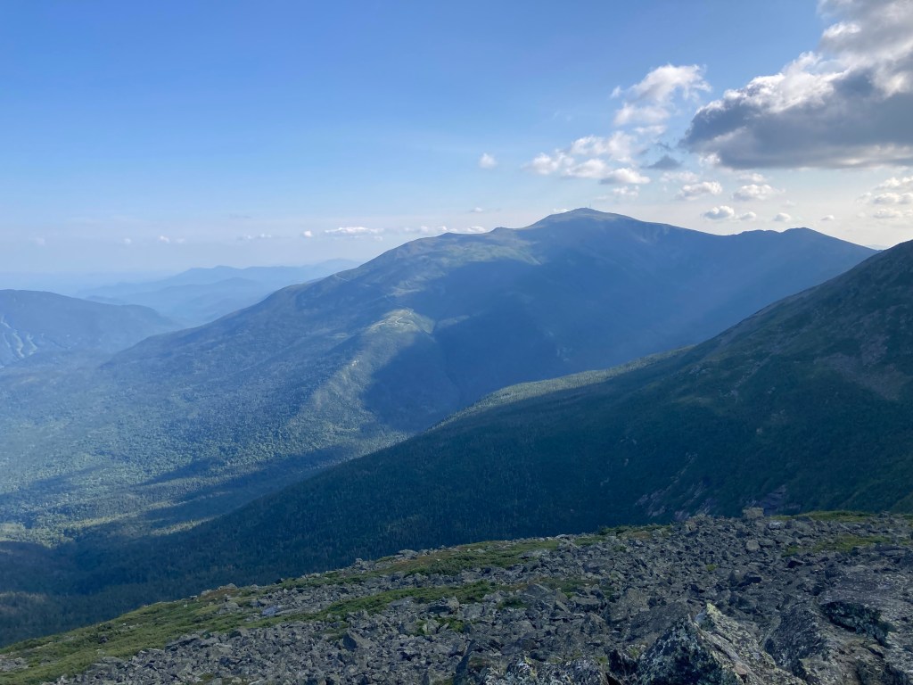
What greeted my eyes when I got above treeline blew me away. I had spectacular, 360 degree views of everything from the summit! It was totally clear in all directions. To the west, I could see where I had come from with Moosilauke and the Kinsmans standing tall, as well as the striking façade of Cannon Mt. down below. My immediate future lay to the north, where even Lafayette was miraculously clear. To the east, the wonderful mountains of the Pemi Loop were all around me, from Mt. Flume nearby all the way to Bondcliff’s awesome exposed summit. In the far distance, I could see Mt. Washington and the Presidential Range, and even those were unshrouded by clouds. It was the best views I had seen on the trail, by far – perhaps the best views I had seen, EVER. I had never seen the Whites so beautiful! The conditions were absolutely perfect; it wasn’t even very windy on the ridge.
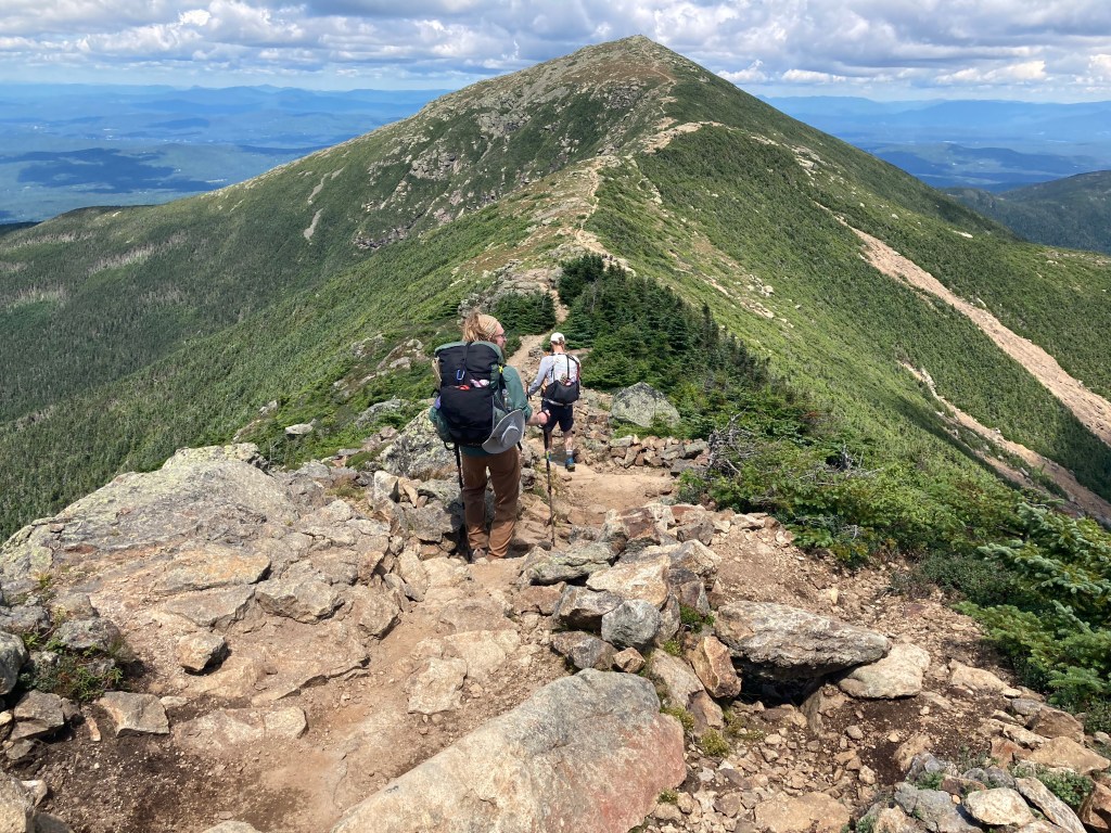
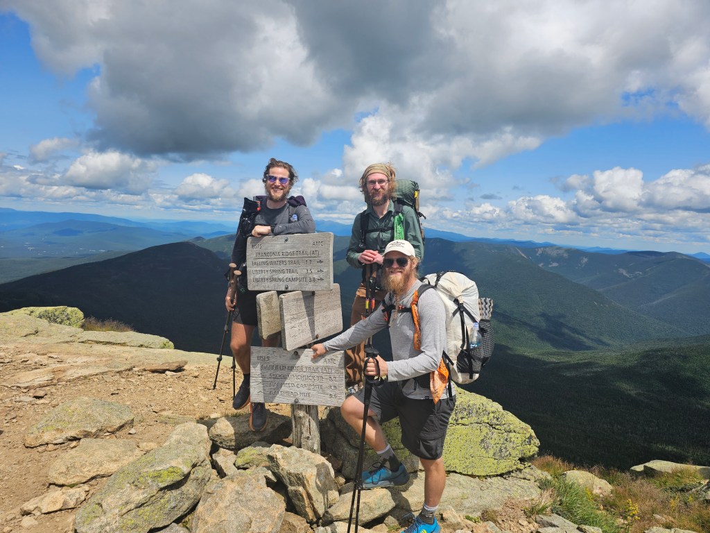
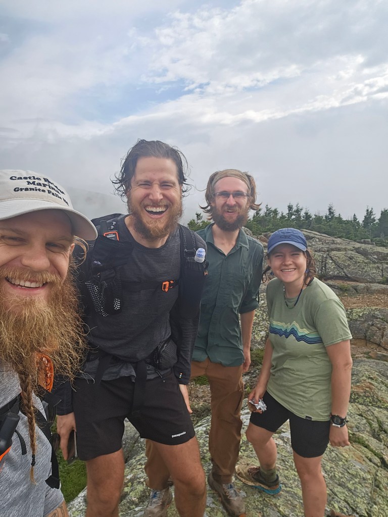
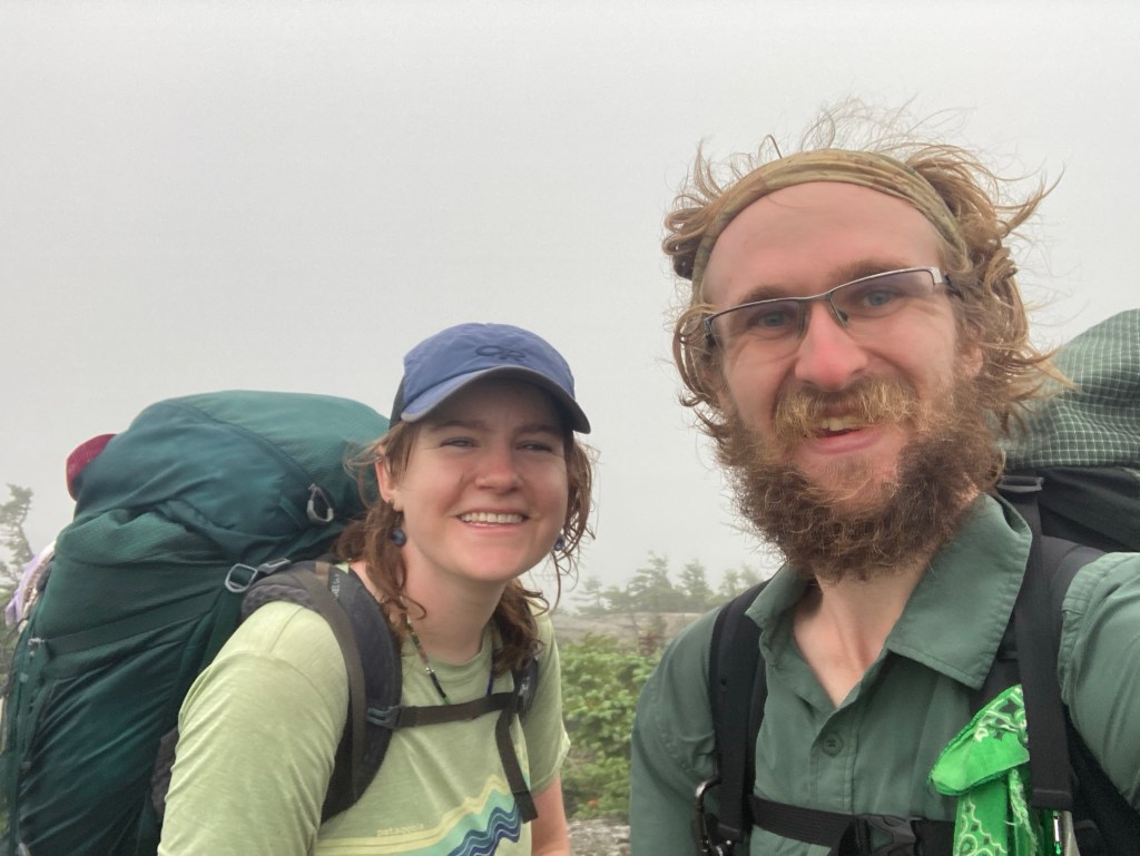
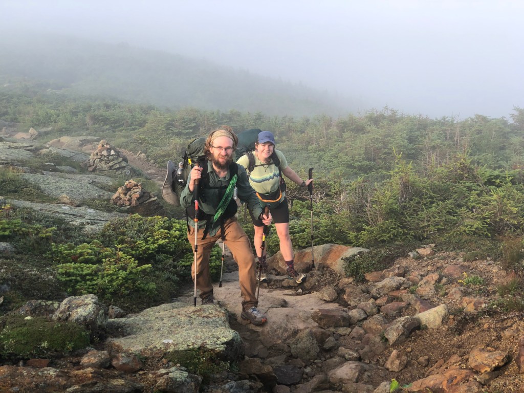
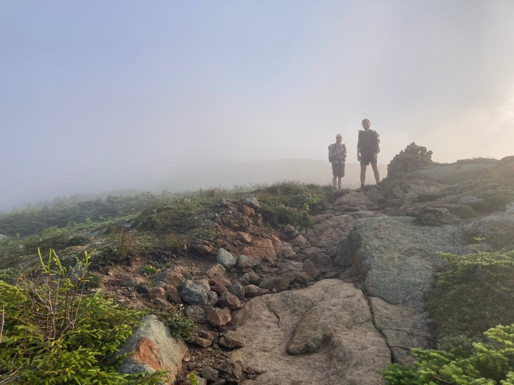
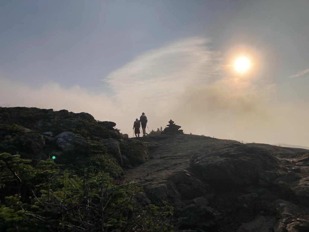
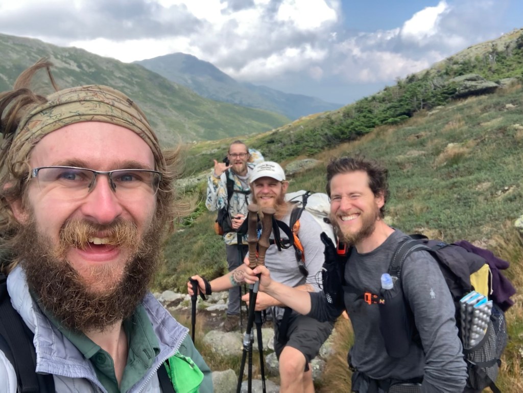
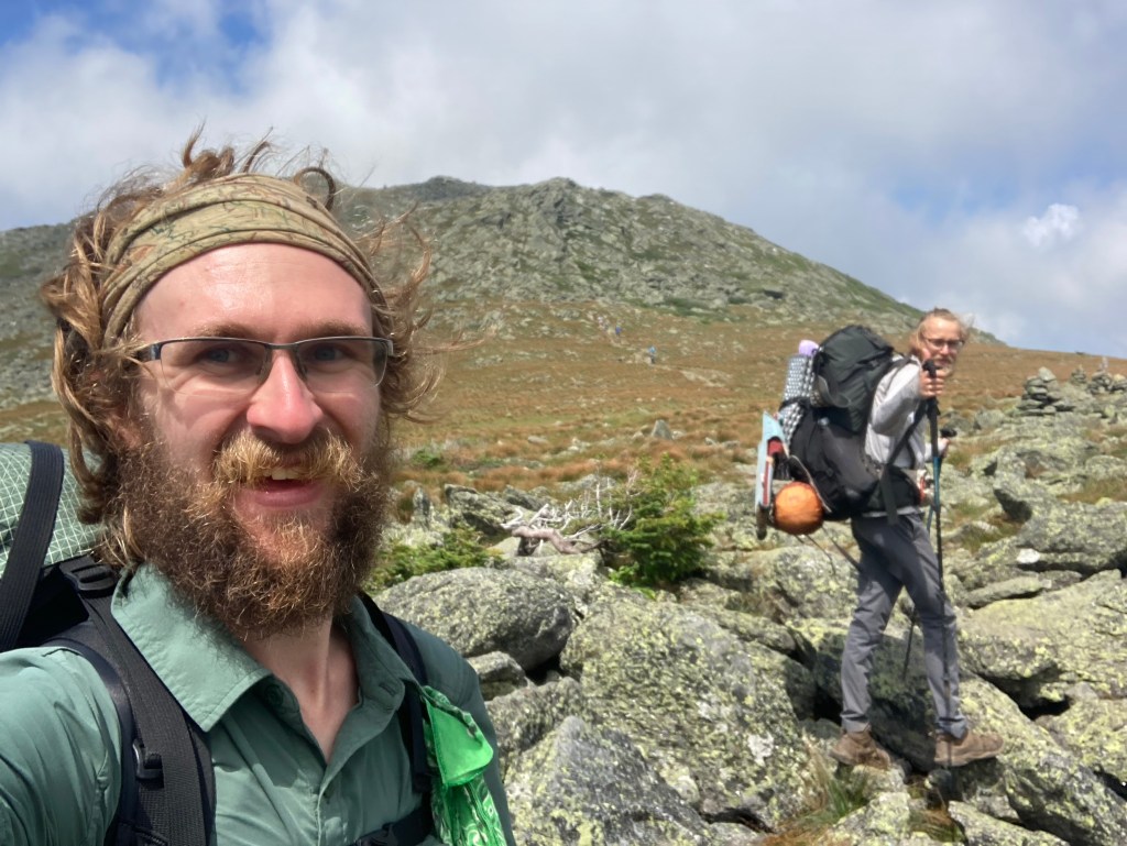
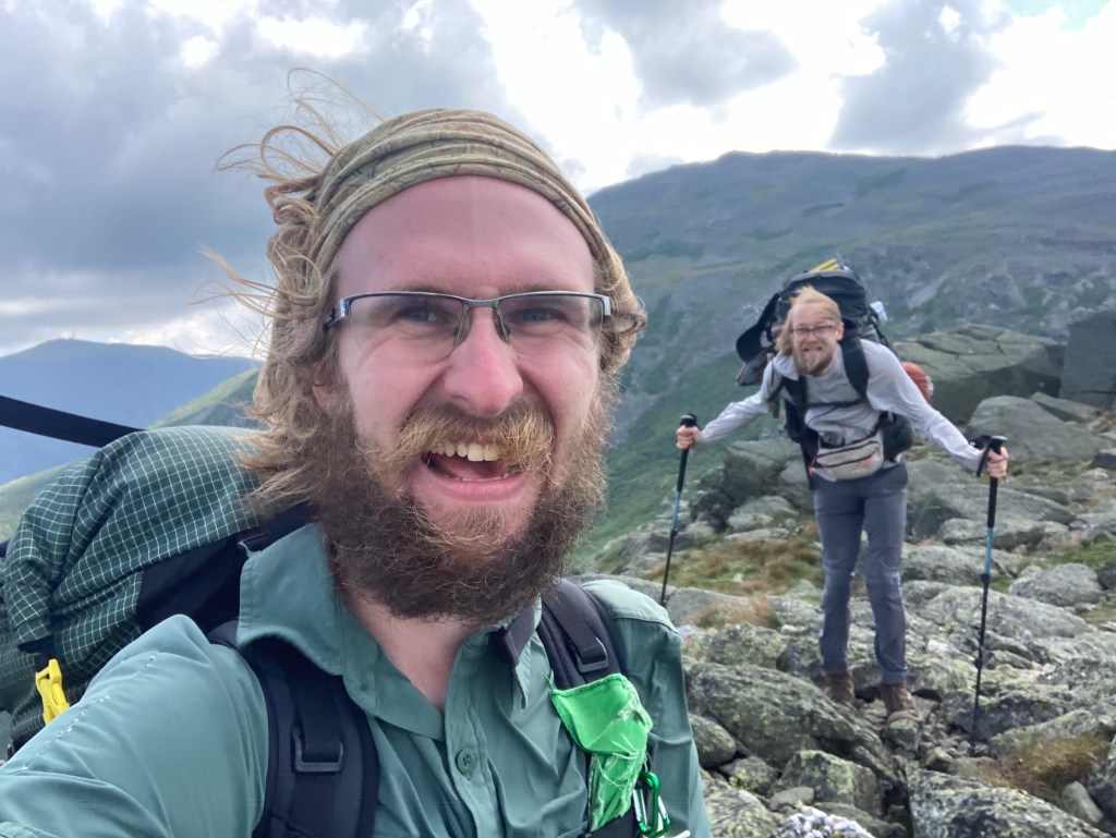
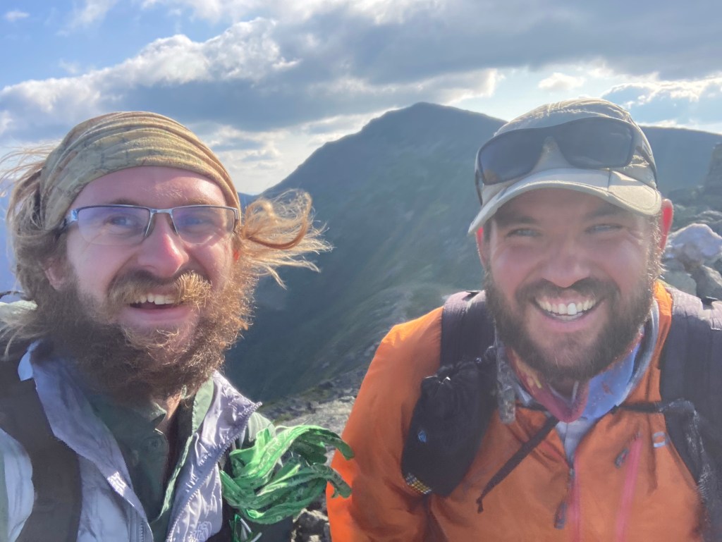
Thankfully, I got to share this transcendent summit experience with new friends! I met Stealth and Pigeon en route to Liberty, and we ended up hiking most of the rest of the day together. It was great to swap trail stories and get to know each other while revelling in our glorious surroundings.
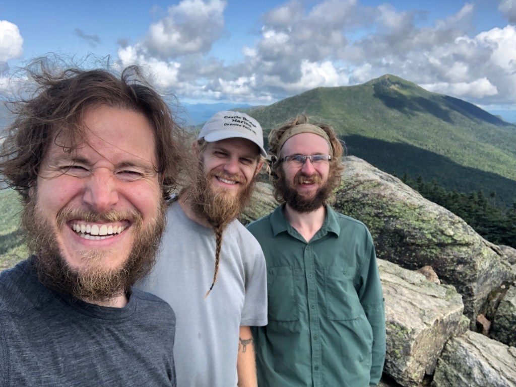
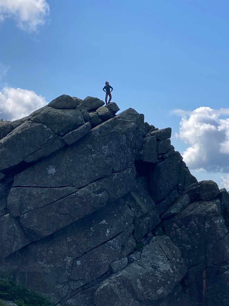

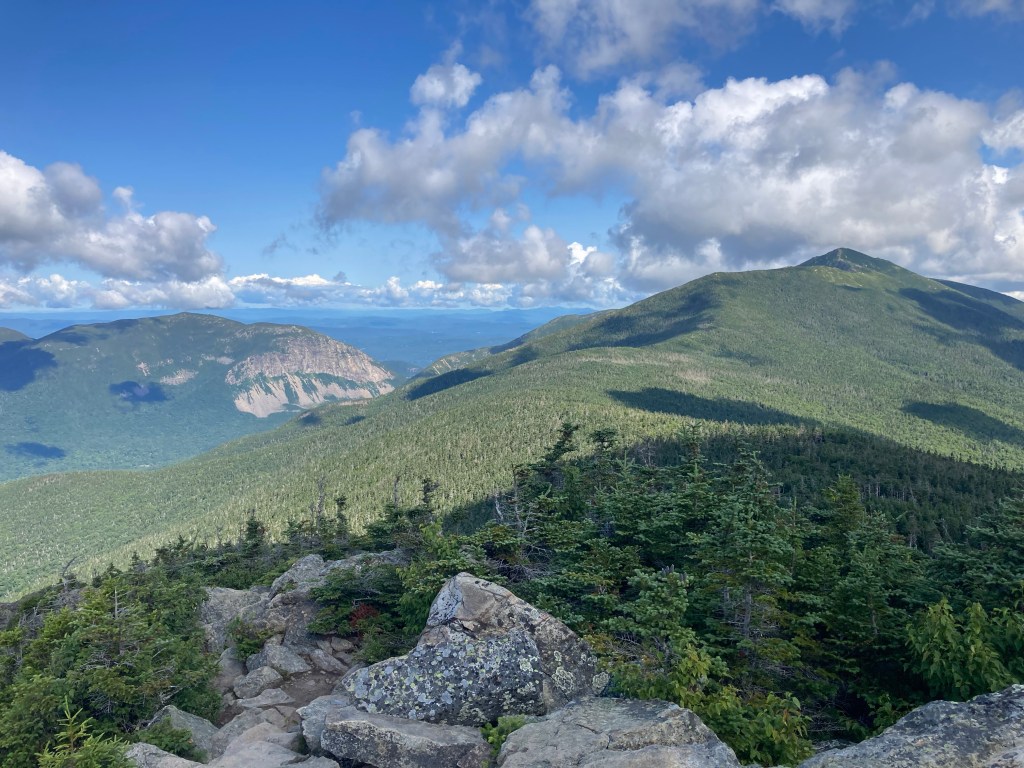
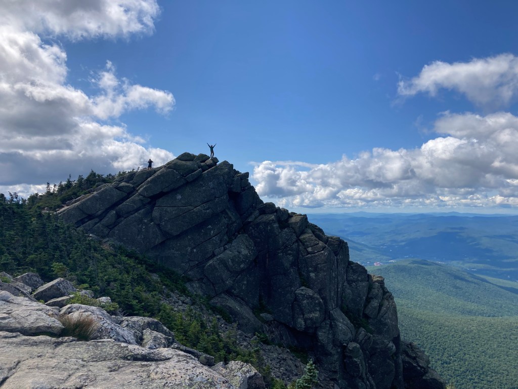
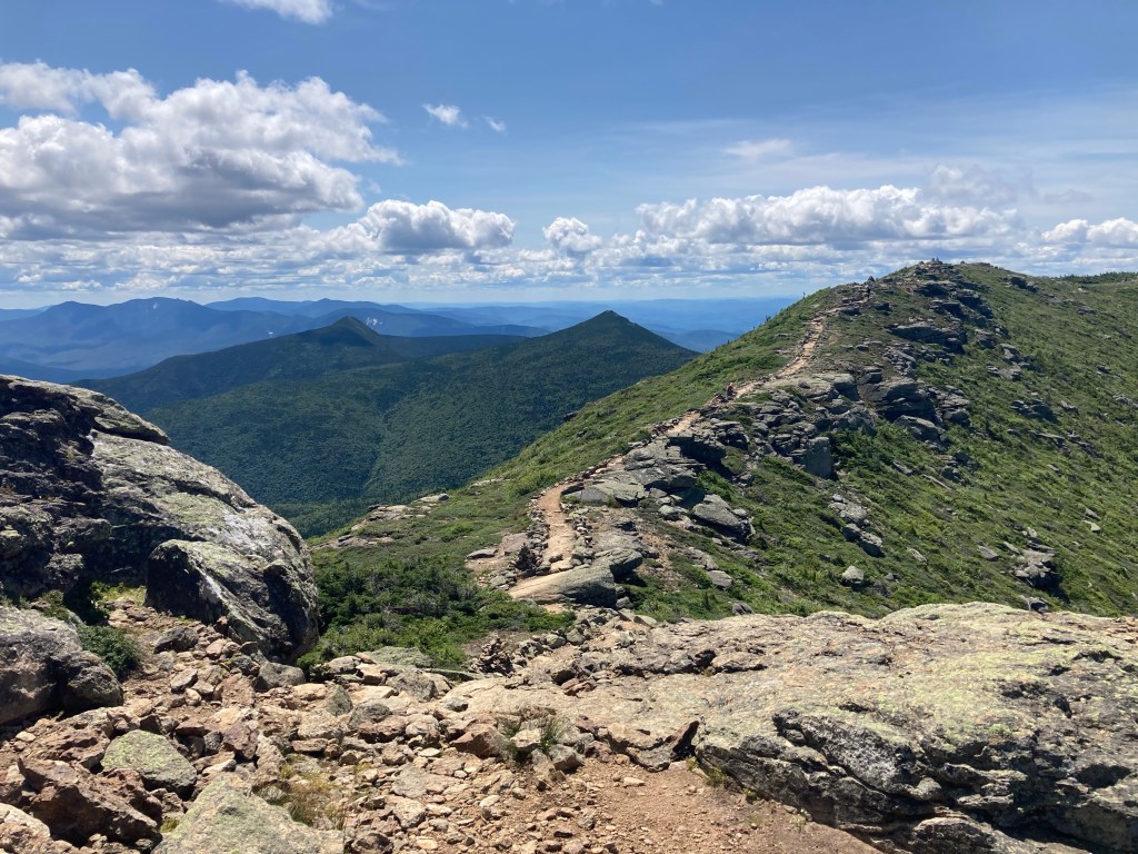
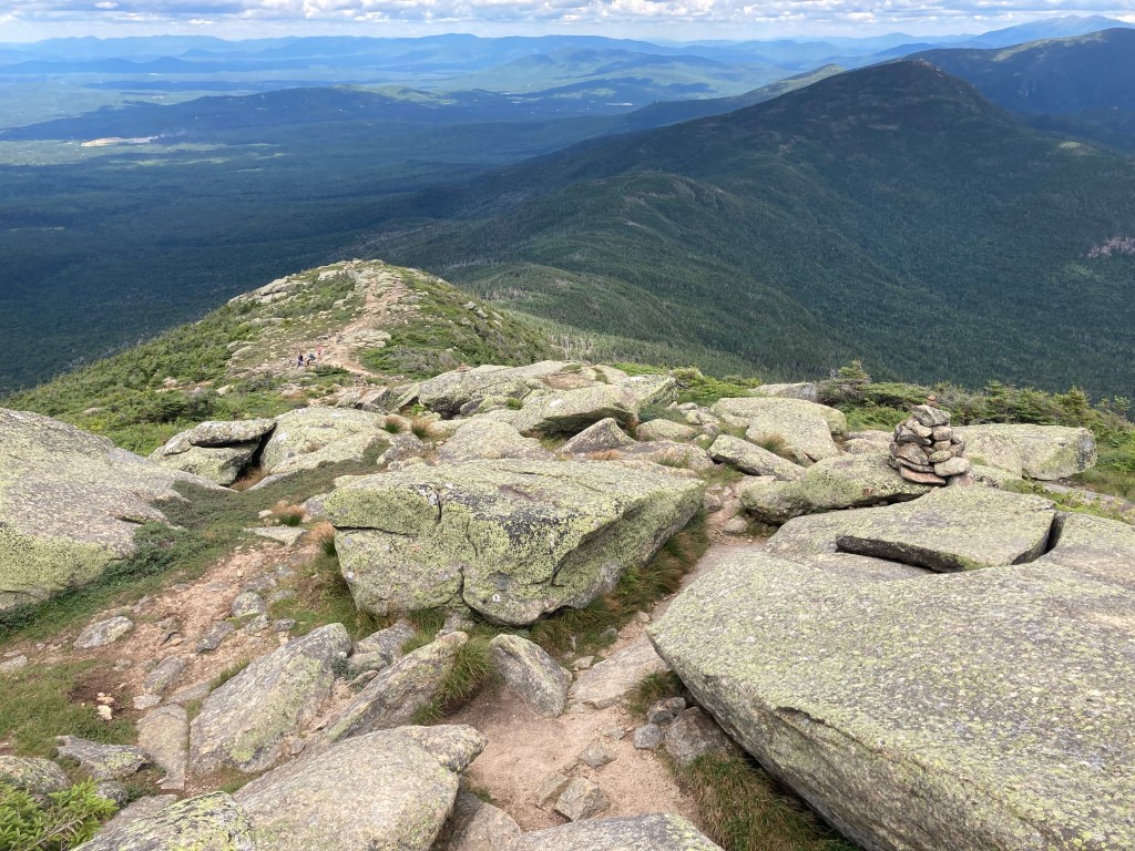
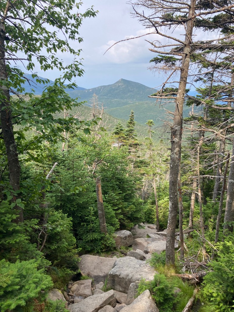
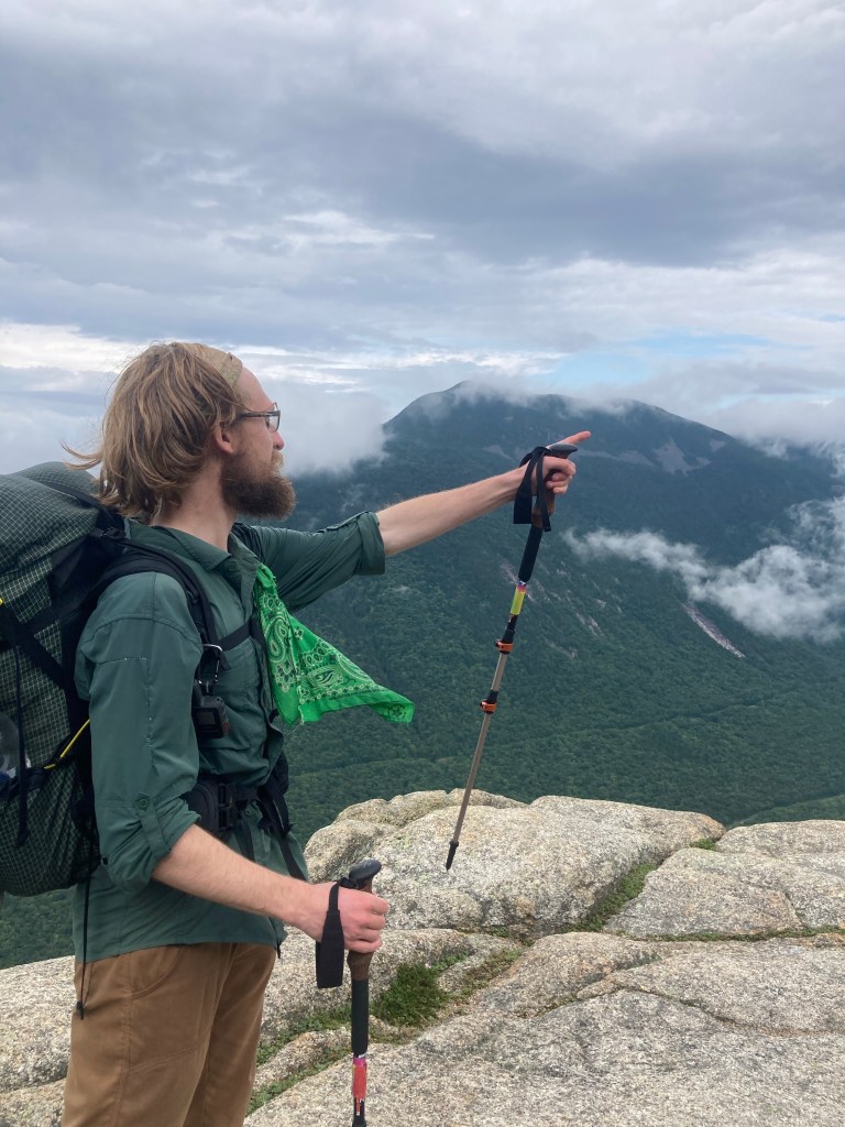
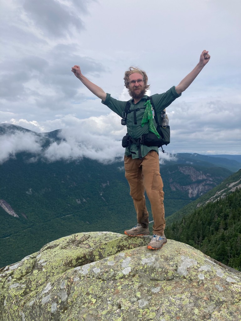
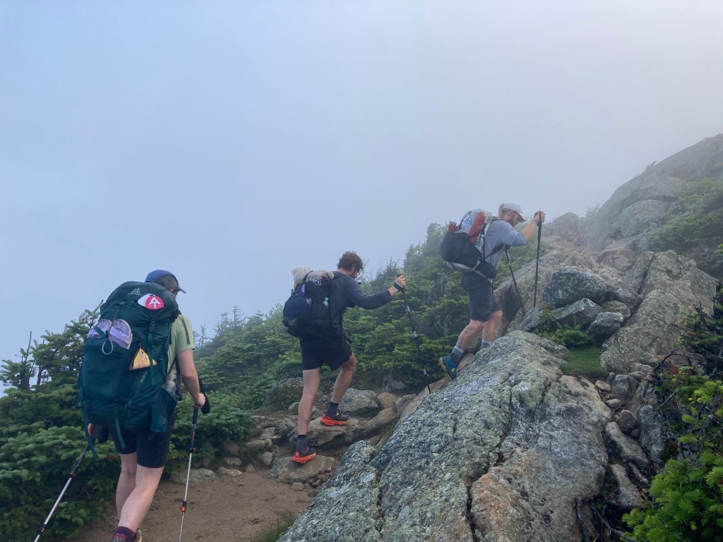
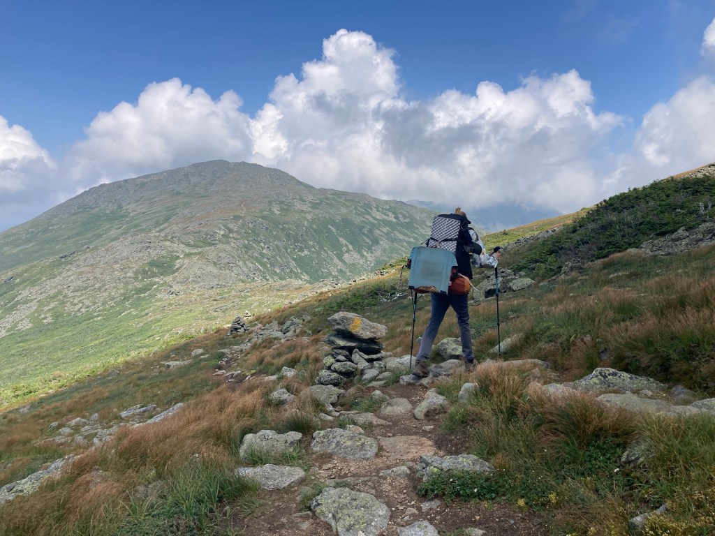
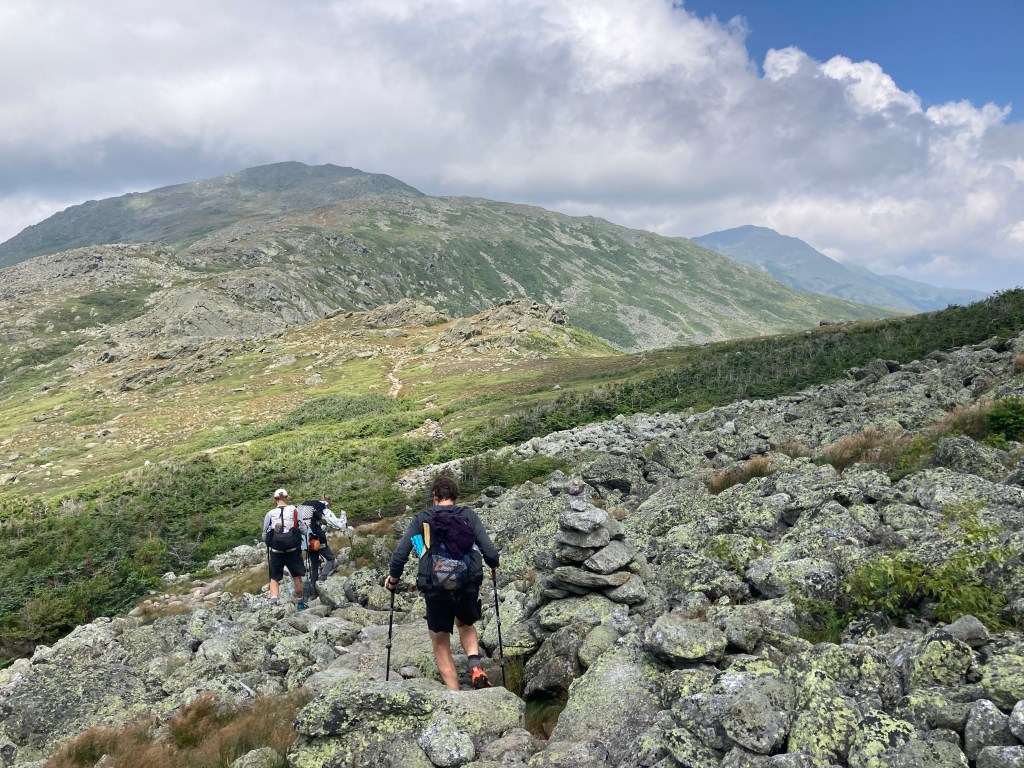
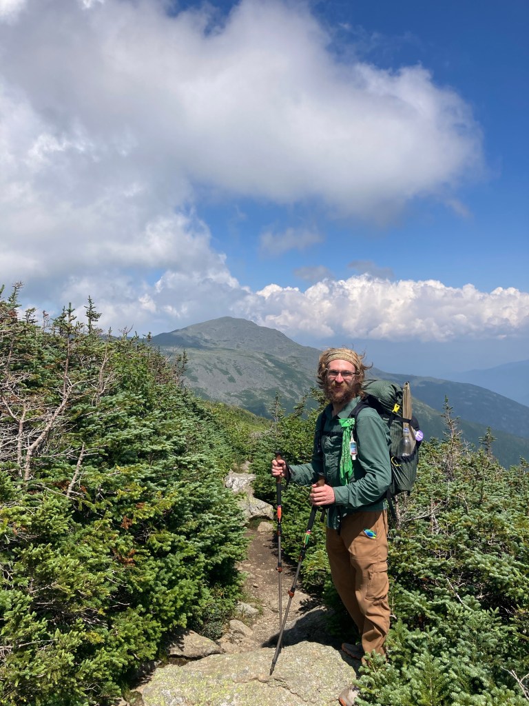
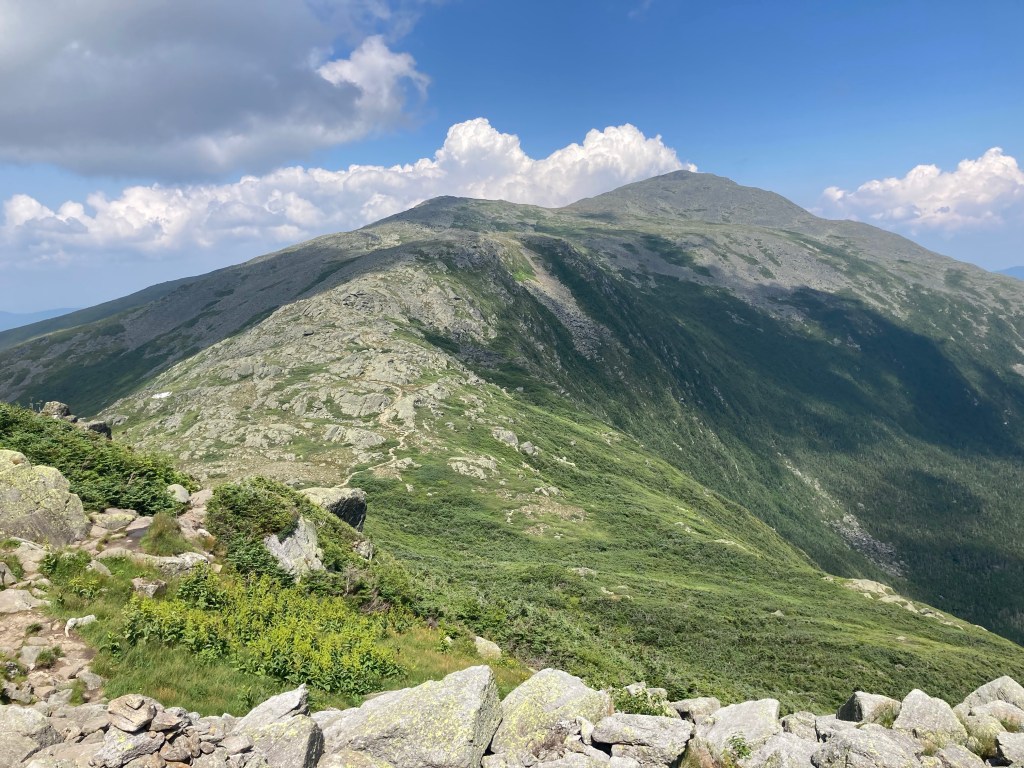
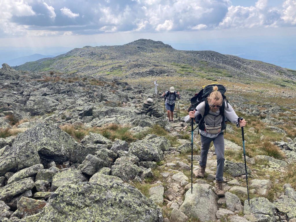
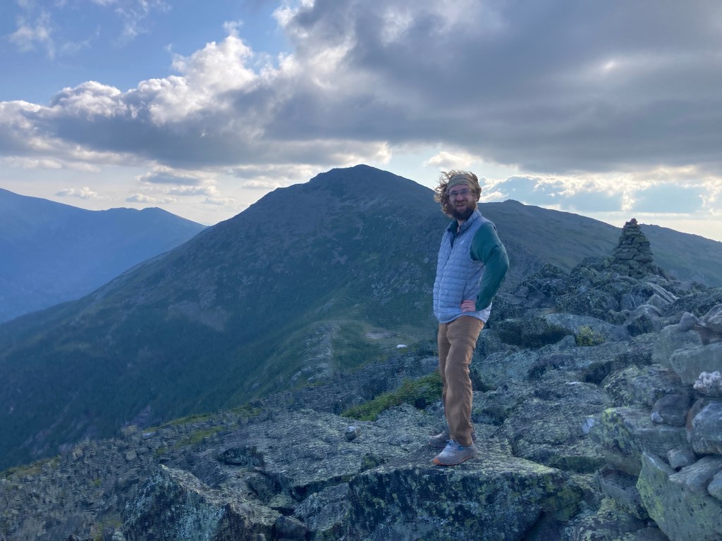
From Mt. Liberty, we hiked a few miles under tree cover along the ridge before getting to the iconic, exposed part starting with Little Haystack. It felt like there were a lot of people there for a Wednesday, but it wasn’t too much of a pain or too surprising considering how nice of a day it was. This was my third time doing Franconia Ridge, having previously done it as a day hike and as part of the Pemi. But it was only this time that I thought, “Oh…THAT’S why this is SO famous and iconic.” It was incredible. Every summit was clear and gorgeous. From Little Haystack, we walked over to Mt. Lafayette, the tallest mountain in the Whites outside of the Presidentials – but not before reaching Lincoln first. As you approach Lincoln, you can’t see Lafayette behind it, so once again I found myself thinking, “oh, this is Lafayette already,” right up until you actually reach the summit of Mt. Lincoln and realize, “oh, THERE’S Lafayette.” I’ve been up there three times now and I’ve been fooled every time.
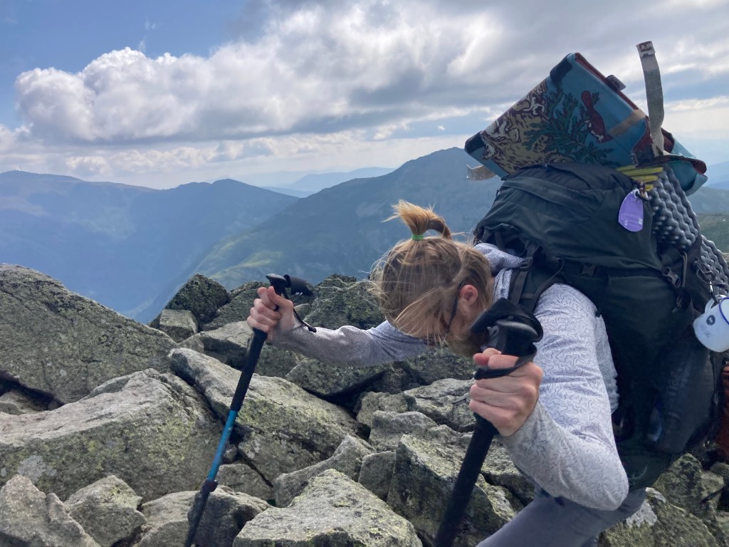
The ridgewalk was a lot harder than I expected slash remembered, though. I guess having four days of thru-hiker food in your pack does make a big difference there.
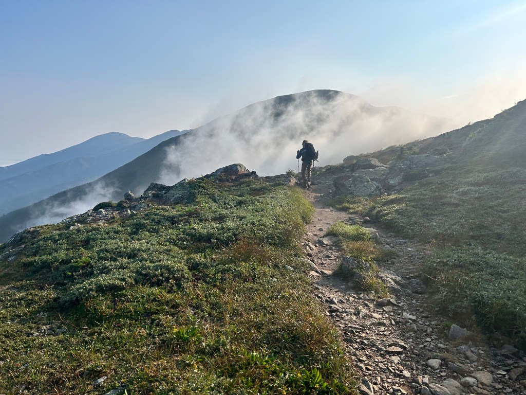
In the midst of all this, we were treated to a unique show. Fighter jets from a nearby Air FNational Guard base (?) were doing practice runs all around us! They swooped through Franconia Notch and did flyovers very close over the ridge! It was super cool to witness. It added a whole different kind of spectacle to the already amazing day.
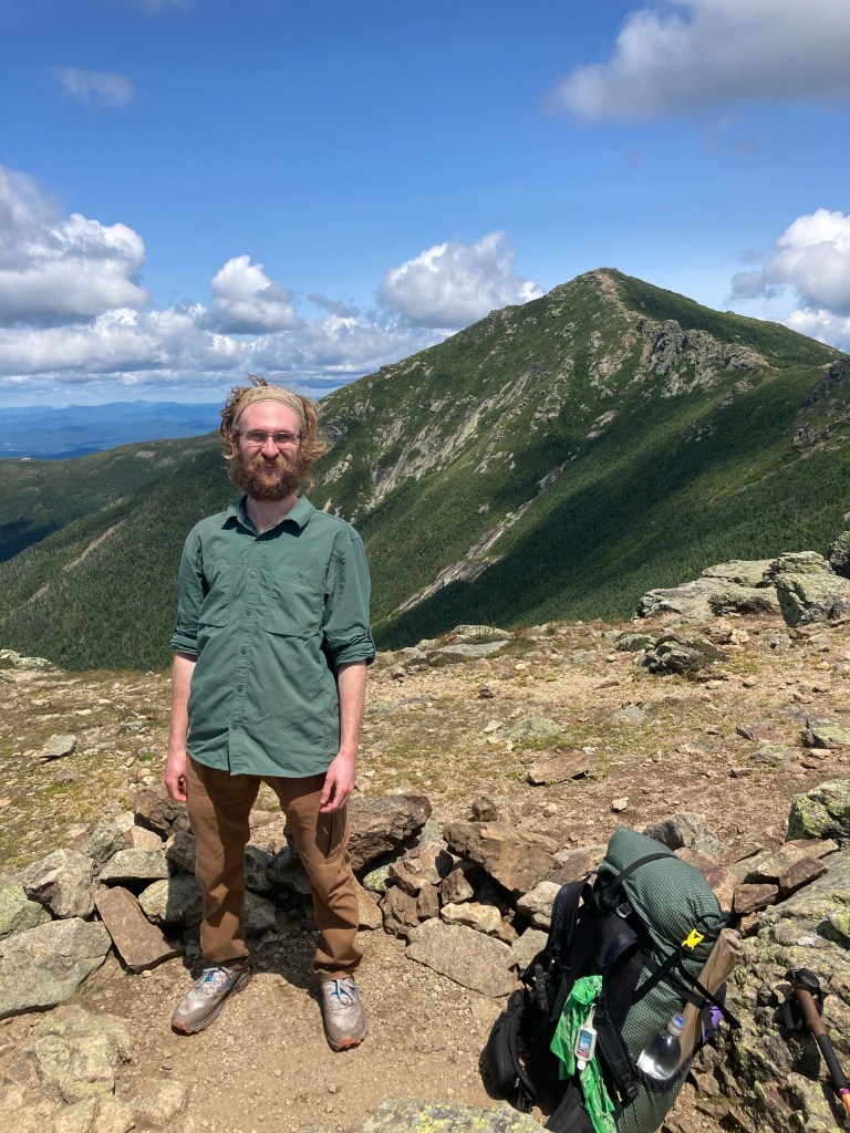
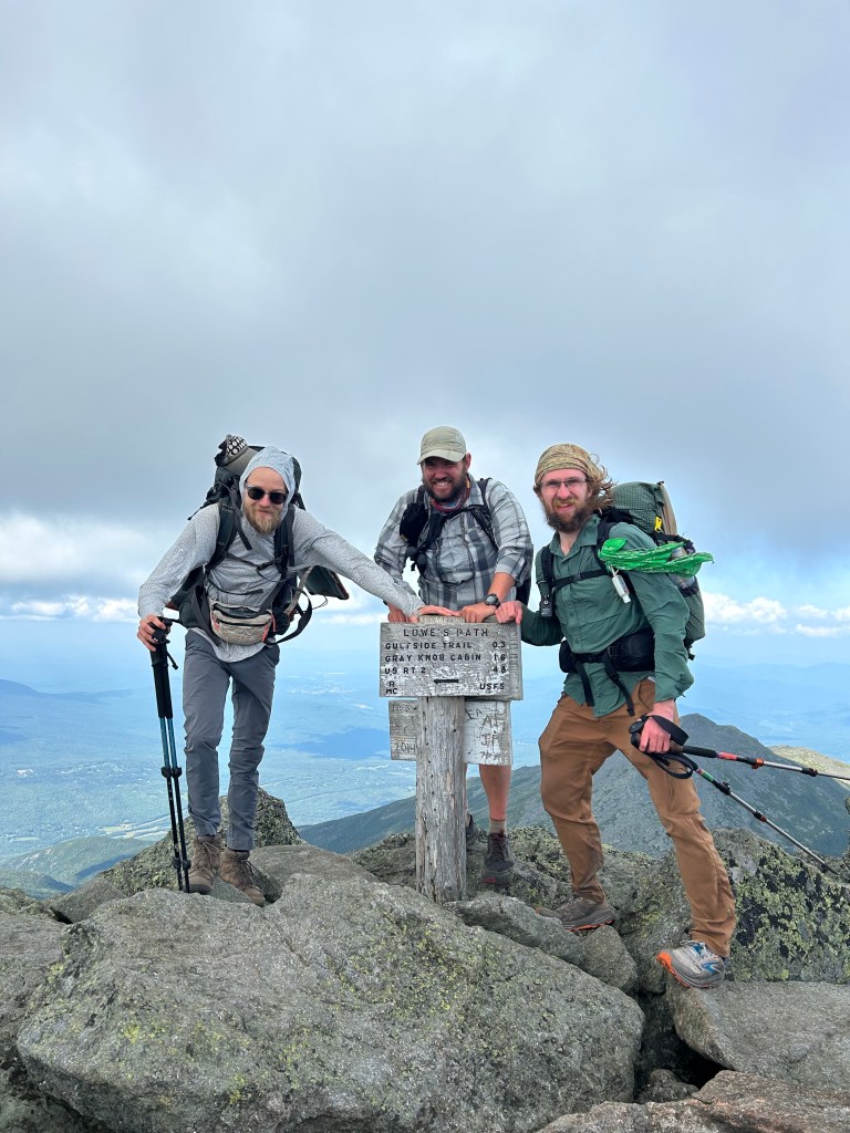
Turns out, the summit of Mt. Lafayette is pretty darn cool when it isn’t covered in clouds. From there, Stealth, Pigeon, and I descended the equally tough and cool Garfield Ridge Trail (and left all the crowds behind in the process).

Once we had gone down quite a long ways, naturally, we had to go back up the steep ascent to Mt. Garfield. I was excited to see this one in the clear, since it was completely socked in the only other time I had been there. The views were still awesome, even if they were no more impressive than everything else we had seen that day.
The final descent down to Garfield Ridge Campsite was tough and steep, too. Both sides of Mt. Garfield are pretty infamous. The campsite was crowded with thru-hikers and non-AT hikers alike. I enjoyed talking to some people doing the Pemi Loop; it brought back fond memories of that hike last summer. In fact, I had stayed at that same campsite! That makes Garfield Ridge the only place I stayed on the AT that I had stayed before. Sadly, the caretakers were off for their midsummer holiday, so I did not reunite with Peter, the legendary caretaker at Garfield. I will always remember his calming presence when I needed it most on the Pemi.
I had a very nice, chill evening at camp. I hung out with thru-hikers Smoke and OG Baggins, Pigeon and Stealth, as well as my new friend Nom Nom, who I had met at Hikers Welcome, and Smokey! I also enjoyed getting to know a LASHer, Cajun. He had just thru-hiked the Long Trail earlier this summer, and then hopped back to Maine Junction and was doing a section of the AT north through the Whites to Gorham, NH – quite the double whammy!
That was maybe the toughest day on trail yet, physically, but it was easily one of my favorites. It was possibly my favorite day of hiking in my entire LIFE!
The good times continued the next day. The descent from Garfield Ridge Campsite over to Galehead Hut was tougher than I remembered, but having leftovers for second breakfast at the hut was a great reward. I liked chatting with a 2022 thru-hiker, Tin Man, there, and he had good advice about the rest of the Whites and the AT.
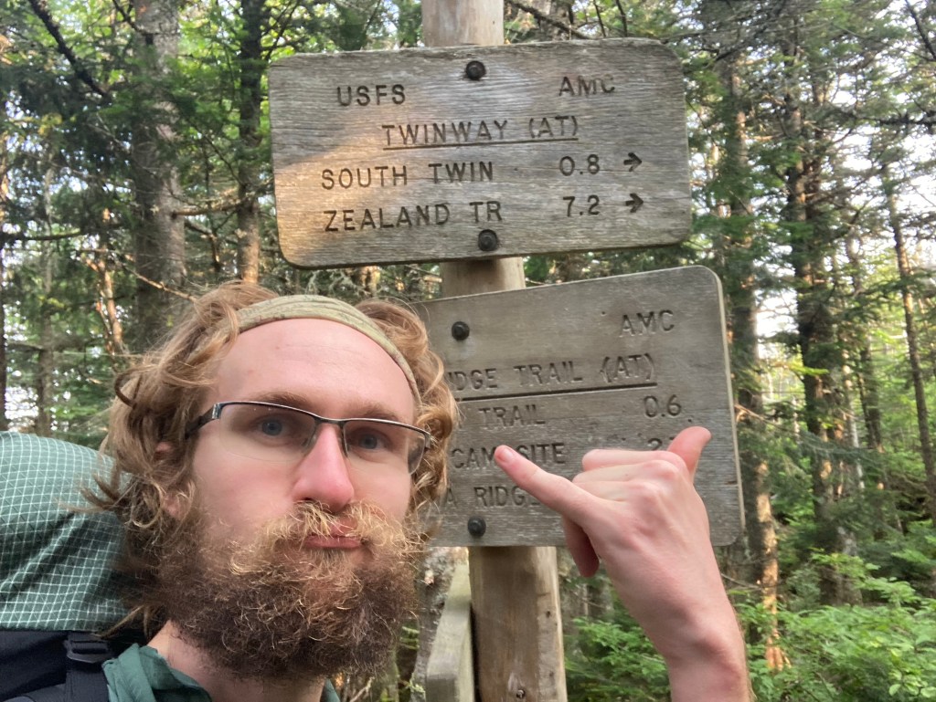
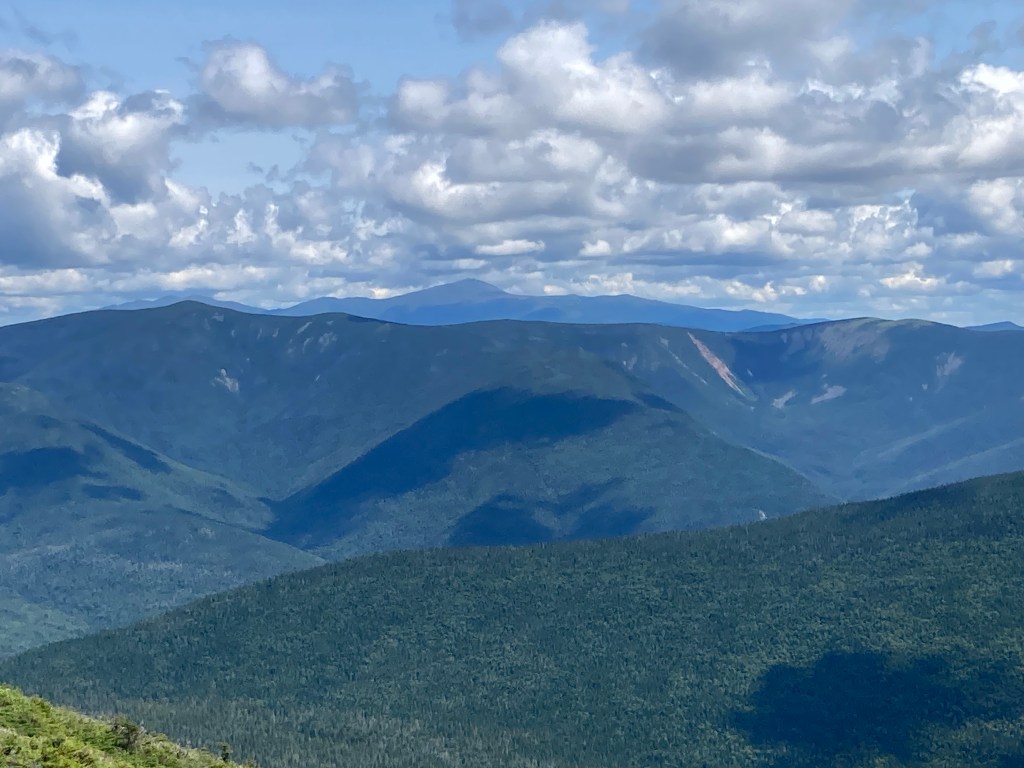
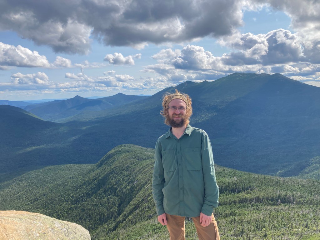
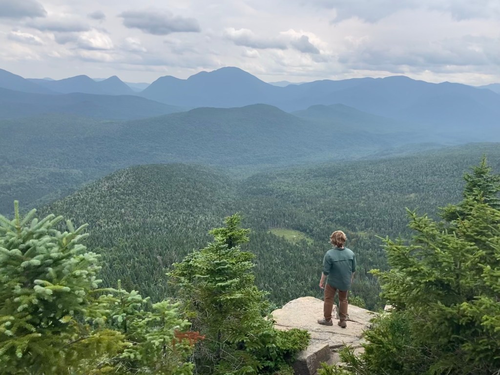
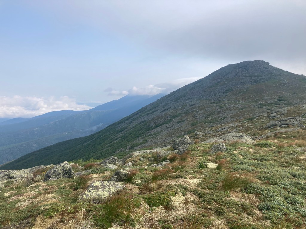
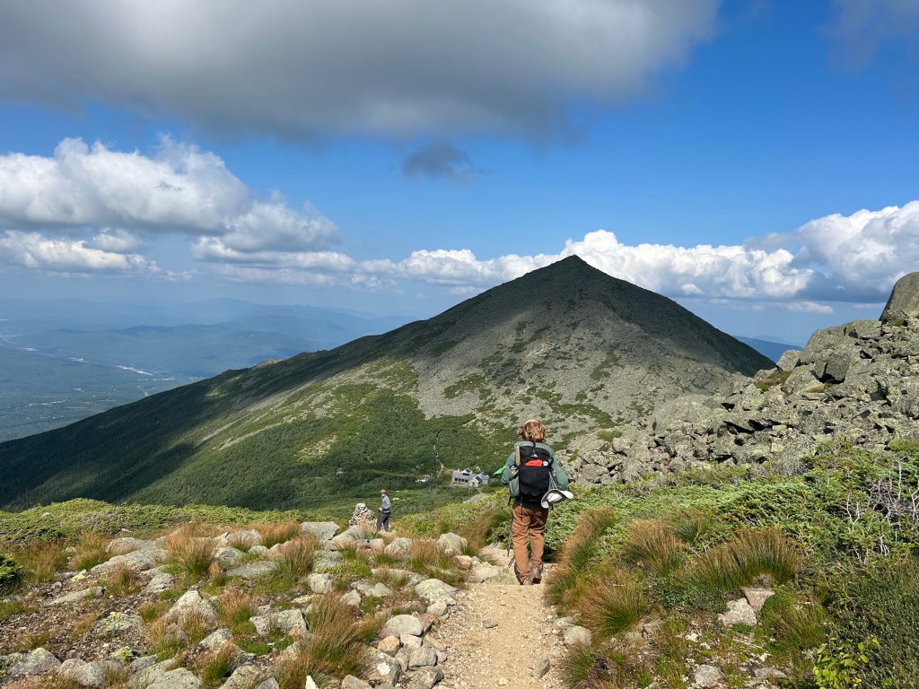
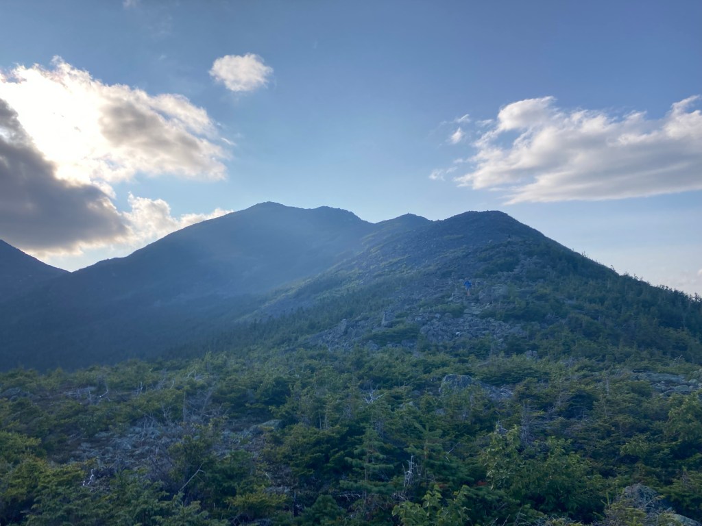
From the hut, the trail ascended a steep, tough mile to the summit of South Twin Mtn. I particularly love that summit, too. It’s wide open and rocky, and you can see in all directions. It was another beautiful day, although a bit hazier than the day before. We still had great views of Franconia Ridge behind us and the Presidentials to the east.
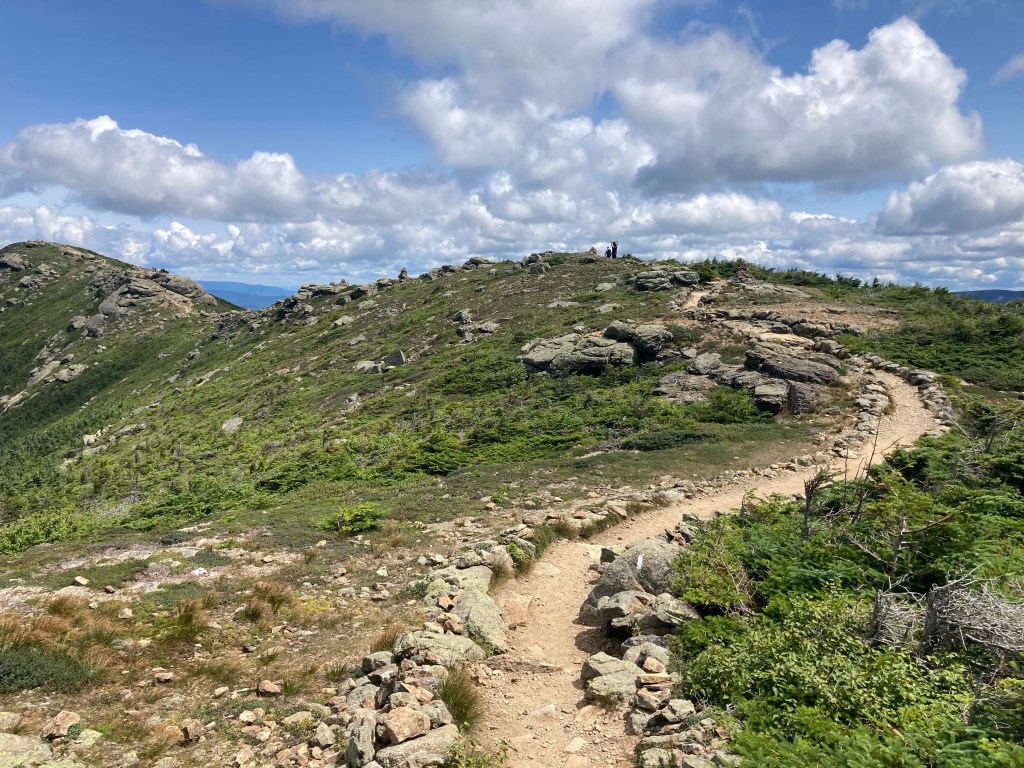
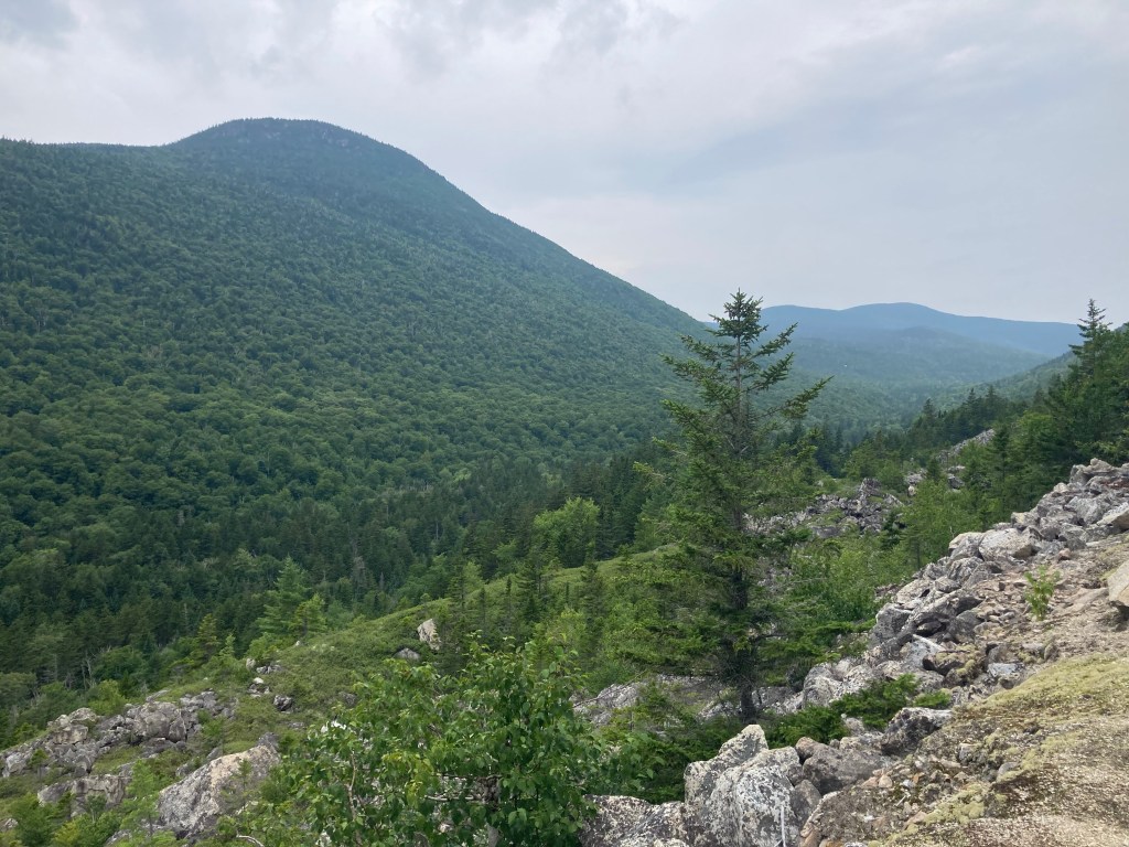
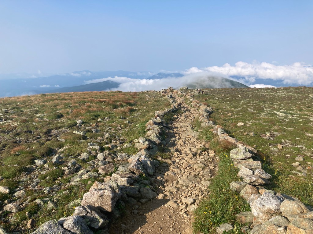
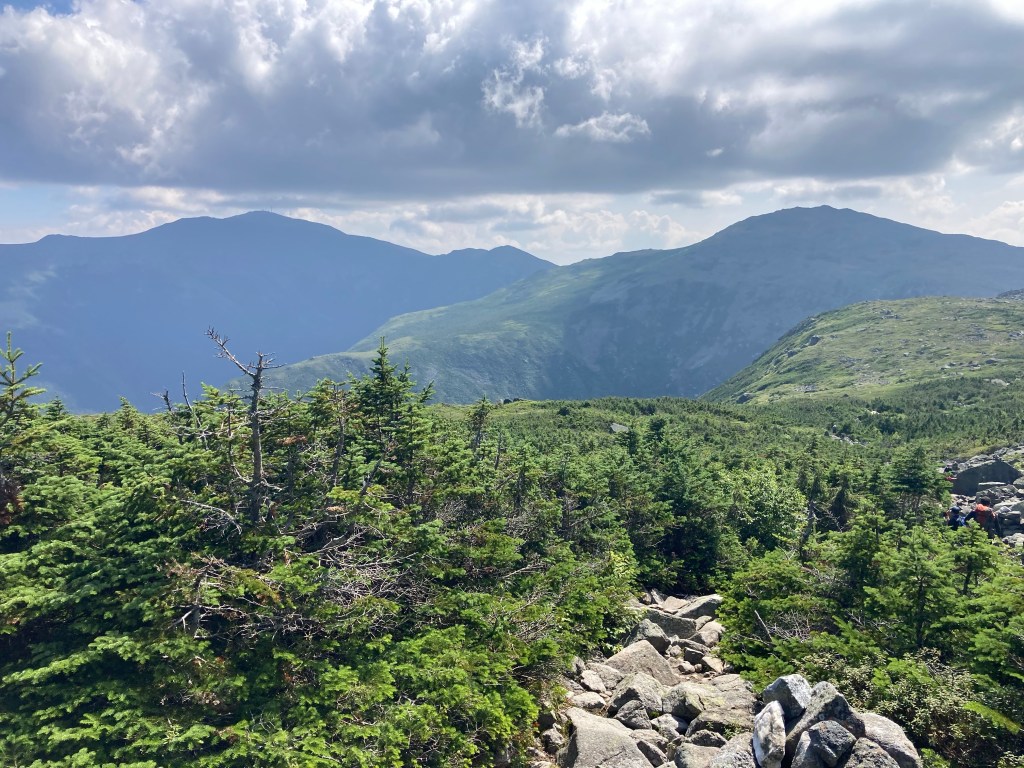
All this was still familiar territory for me, and was for a few more miles until the summit of Mt. Guyot. Past that, though, I was back into completely new terrain – and loving it! I had a great time exploring new areas of the Whites for the rest of the day. Not only were the mountains and trails we were on totally unfamiliar, but it felt like the views and the mountains we were looking at were totally new to me, too. It made me really excited to continue to explore these amazing mountains after the trail. There’s so much to see out there!
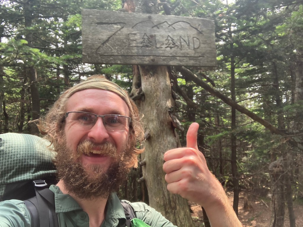
I bagged Zealand Mt., another new 4000 footer for me. There weren’t any views there, but at nearby Zeacliff, it was a different story. As a rule of thumb, if it has “cliff” in the name, it’s going to be freakin’ awesome. This was no exception!
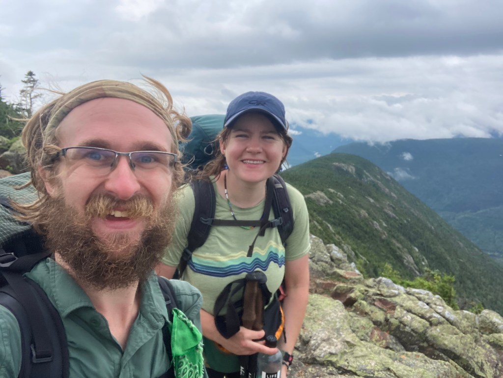
I was glad to share the spectacular views with Nom Nom. We ended up hiking together all afternoon, and I had a really good time getting to know her better. Later, Smokey joined us as well, and it was great to hike with him, too.

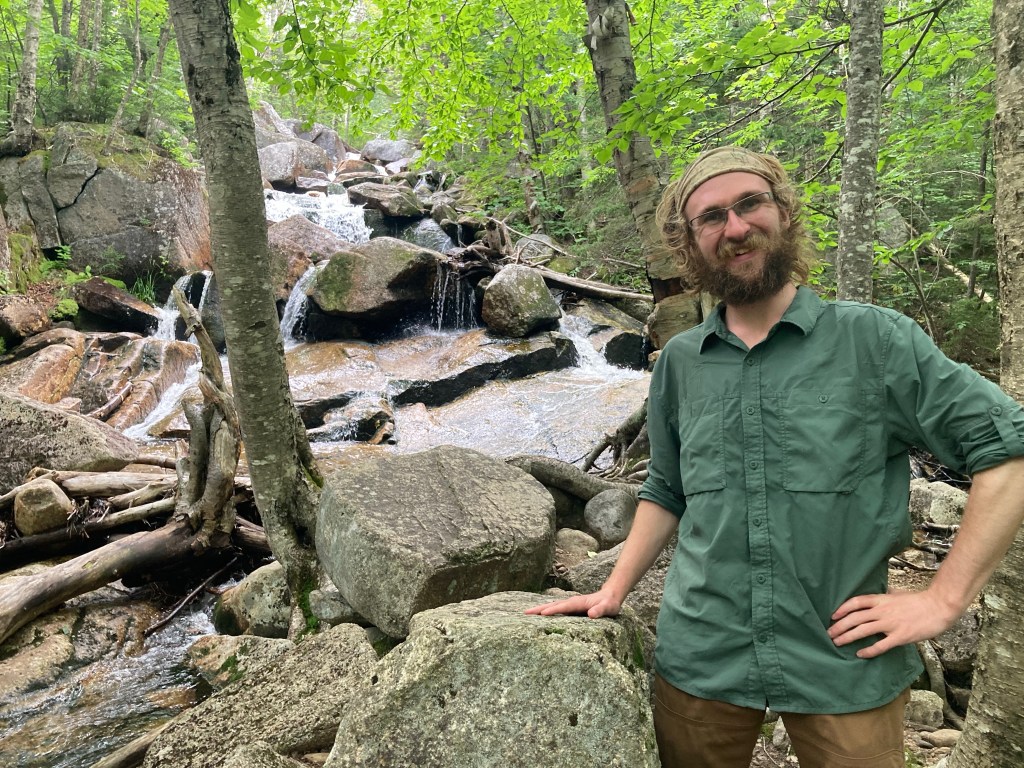
We all stopped at Zealand Falls Hut for a second lunch. I got delicious free black bean soup using my thru-hiker card. I enjoyed the namesake falls nearby, as well as Thoreau Falls later on.
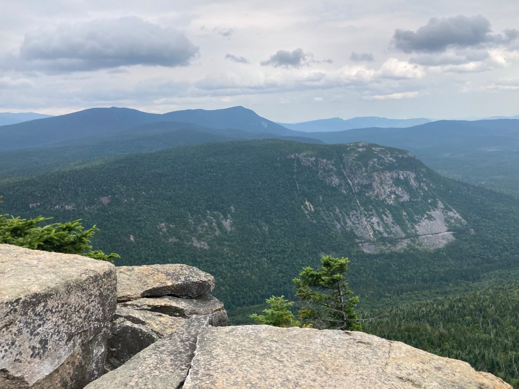
For the rest of the day, the trail was remarkably, mercifully flat and easy – quite un-Whitesy! It was still beautiful, though, especially as we passed the intimidating Whitewall Slide, which we had seen from Zeacliff far above.
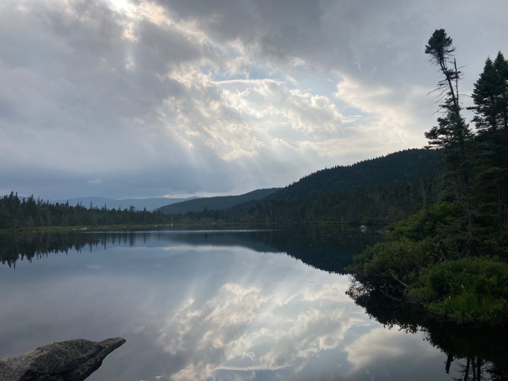
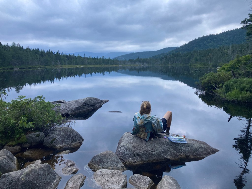
It was my longest day in the Whites ever by mileage, but it felt a lot easier than the day before. I stayed in Ethan Pond Shelter that night. In contrast to the previous night, there were only thru-hikers there: the same crew as last night, plus Victory & Meadow! It was great to see them again. That evening, I had a lovely time hanging out with Smokey and Cajun by peaceful Ethan Pond itself.
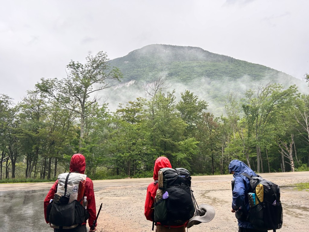
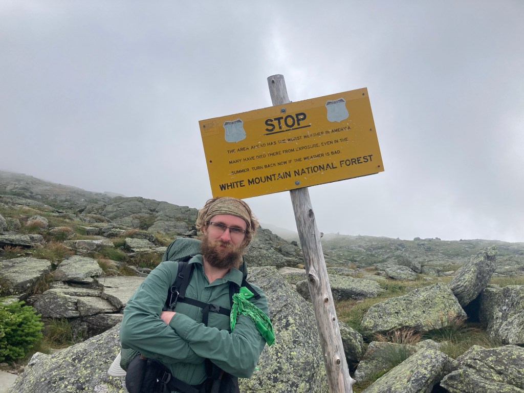
As we prepared to enter the Presidentials, the weather forecast for the next day looked pretty grim. It called for rain, severe afternoon thunderstorms and wind gusts as high as 60+ mph on the high peaks of the Presi. In other words, it was a nonstarter to go over any part of the 12-mile, exposed, above-treeline traverse of the dangerous Presidential Range. My original plan was to go to Nauman Tentsite at Mizpah Spring Hut, just at the southern end of the Presi, and before the trail goes above treeline. Even that plan, though, worried me a bit. I was specifically worried about the climb up Webster Cliffs, which was supposed to be very challenging and exposed. Several people were going to bail and go into town tomorrow to get out of the weather. One hiker was trying very hard to talk me out of hiking, in a way that felt rather condescending and annoyed me. I knew these mountains, though, and strongly suspected that the scary weather forecasted for Mt. Washington and the other high peaks would be a lot more manageable and less dangerous down in the valley of Crawford Notch and on the southern edge of the range that we’d be climbing. With Stealth and Pigeon, I resolved to tentatively proceed with our original plan for the day. If we woke up and got out early, we could hopefully beat the afternoon thunderstorms entirely. We’d stick together for safety, and we were prepared to bail at Crawford Notch if the weather was worse than we thought, or turn back at the exposed Webster Cliffs if it seemed unsafe to go on. Thus we planned to forge ahead. It did not seem like an unsafe decision.
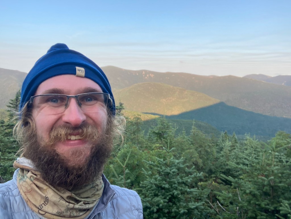
We set out before 6am the next morning, my earliest start ever. The first few miles were a dark but pretty easy descent down to Crawford Notch in a light rain. Nom Nom had joined Pigeon, Stealth, and me, and the four of us started the climb up the Webster Cliffs Trail.

The rain really wasn’t bad, and in fact, we all soon took our raincoats off as we climbed. The weather didn’t pose a problem at all. The rain actually stopped just in time for us to do the tough, scrambly part! It was definitely a hard climb, but it was super cool and fun too. Meanwhile, to my delight, we got views from the cliffs as we went! The interspersed clouds among the mountaintops made for an amazing sight. I couldn’t believe our luck. It was probably the most fun climb I’d had on the whole trail. Nom Nom called me one of the most positive people she’d met :’)
I was glad Nom Nom was there. Stealth and Pigeon are much faster than I am, and I was very appreciative they were willing to stick with me for safety reasons, but this way they were able to eventually go ahead at their own pace while Nom Nom and I hiked together.
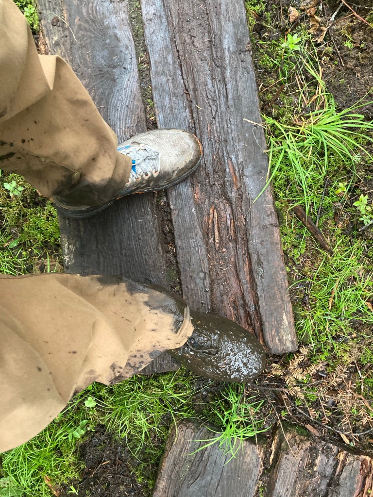
By the time we got over to Mt. Jackson from Mt. Webster, it was socked in again, and the rain and wind were coming back. We were eager to get to Mizpah Spring Hut and get inside. Perhaps I was a little too eager. I slipped and sunk my foot into the mud – just a few feet before the deepest mud pit I had ever seen. Eek! It was sorta nerve-wracking realizing how much worse that could’ve been.


Smokey joined Nom Nom and me towards the end of our hiking for the day, after getting a later start from the shelter that morning. I was glad he had been able to do the climb in good weather and take in those magical views. The three of us arrived at Mizpah Spring Hut by 12:30pm. It was an easier day than I had expected. It felt weird to be stopping so early, but I knew it was the right call. I felt vindicated by the weather, and I was very happy with how we had played it and how it had all turned out!
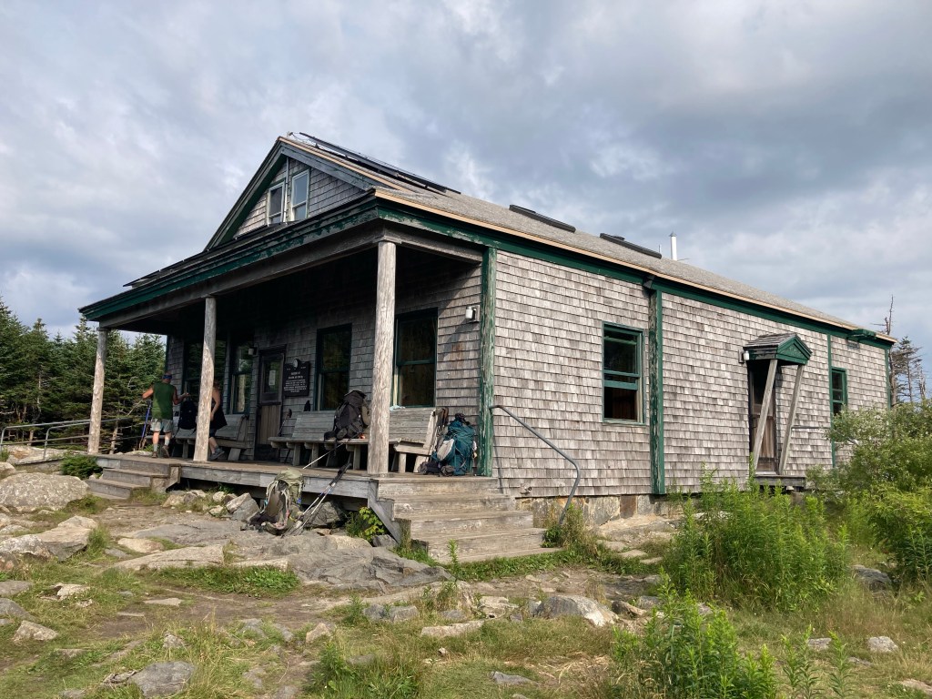
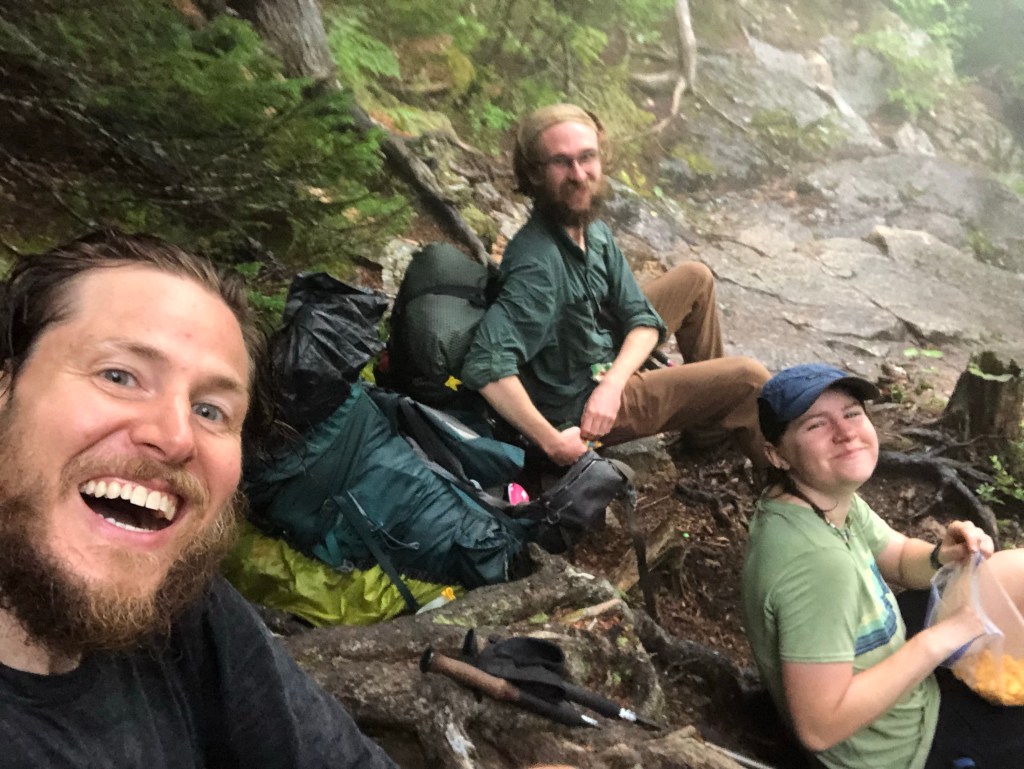
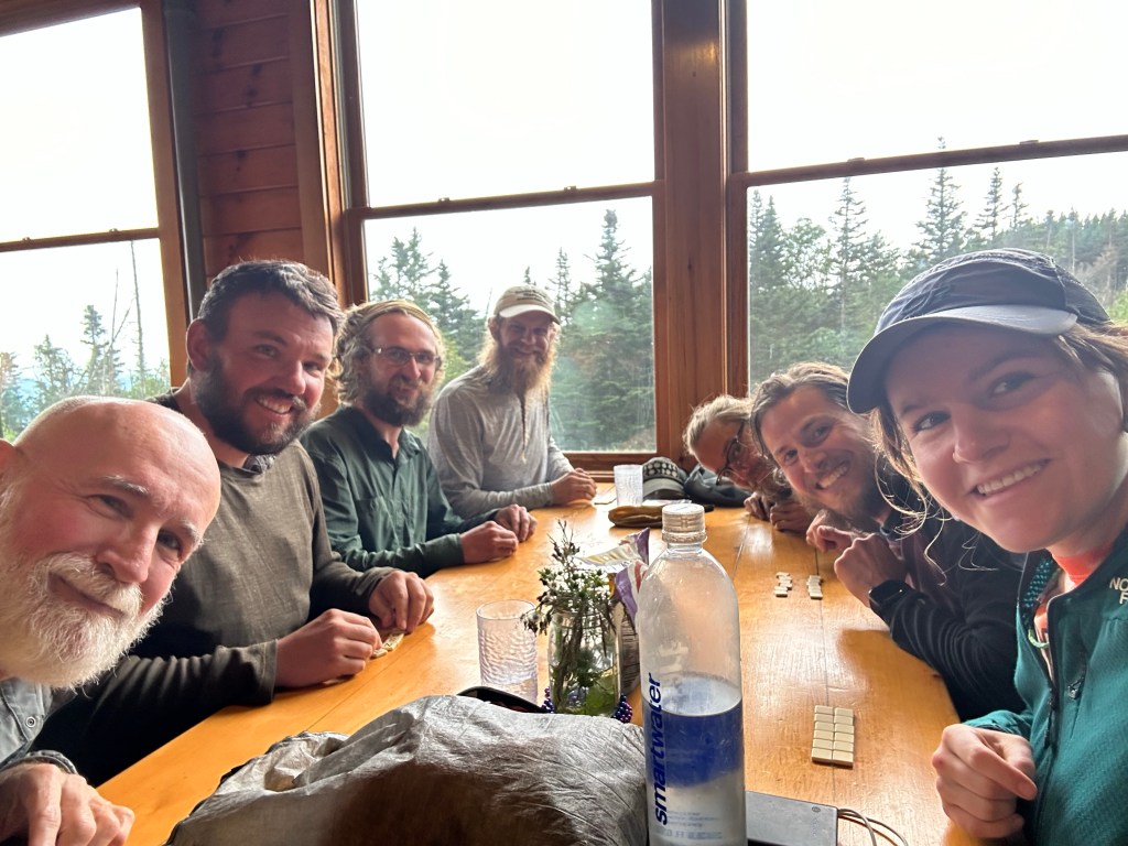
We had all afternoon to hang out at the hut, with our tentsite right next door. It made for a unique, relaxing, and thoroughly fun experience. Just as Smokey and I reminisced about our “lake day,” I would fondly remember our “hut day.” I got lentil soup and carrot cake for lunch. Later, the hut croo gave us some leftover nachos, which we were happy to help them get rid of. We played Bananagrams, and I even read Calvin and Hobbes in the hut’s library. It was great to spend the whole afternoon with awesome trail friends: Smokey, Nom Nom, Stealth, Pigeon, Cajun, and new friends Grizz and Peroni. I loved how social the Whites were! That day also happened to be my 5 month trailiversary 🙂

Unfortunately, the arrival of a large tramily of 8 or 9 people, past 7pm, put a damper on the end of an otherwise excellent day. It included several people I knew from way back, including a few from the Before Times, so it was neat to run into them again, but as a group, they rubbed me the wrong way in a number of ways. It felt like they just arrived at the campsite to complain. Complaining about the campsite, complaining about the hut croos, complaining about the trail itself, even complaining about missing views because *they* chose to blue-blaze and skip some miles! I felt like I noticed a sense of thru-hiker entitlement for the first time that night. I was also annoyed by their loud talking right next to our tents while some of us were trying to sleep. I wasn’t the only one that was bothered, either. Finally, I began to worry about overcrowding in the next few days, with this sudden influx of people that seemed to be heading for the same spots as I was. Sigh.
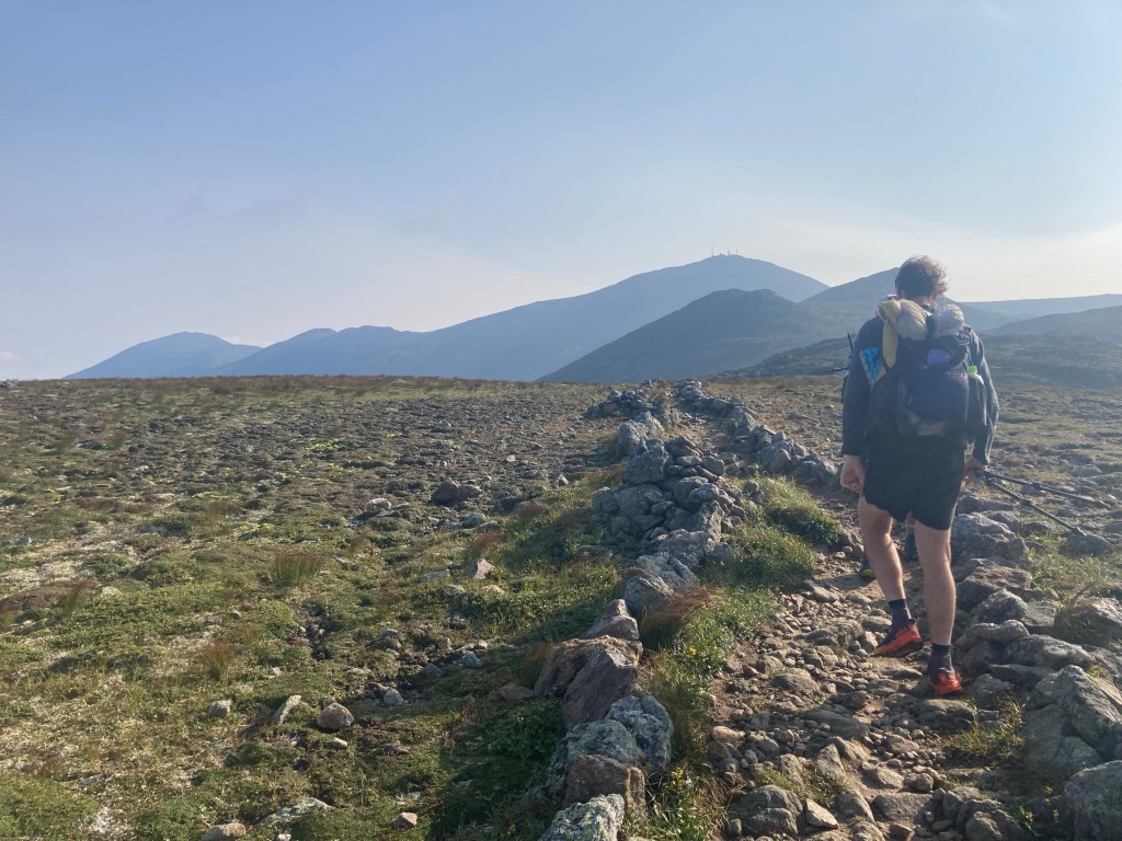
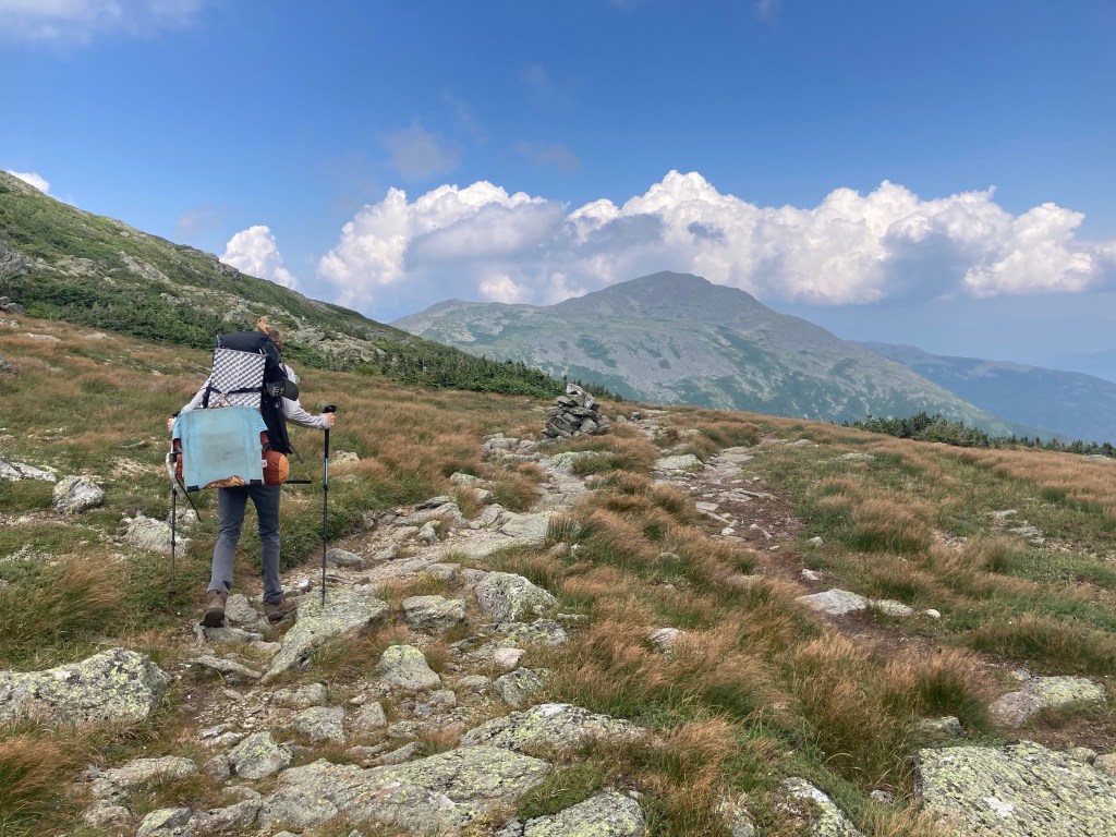
Nevertheless, I was really excited to do a Presi traverse the next day and try to get over the whole range in one day. The weather was looking good, and I crossed my fingers that we’d get beautiful clear views, as unlikely as they are up there! I hiked out very early again with Nom Nom, and ended up spending the morning hiking with her, Stealth, and Pigeon. Sadly but unsurprisingly, we started in the clouds. It was still really beautiful in the morning fog, though.
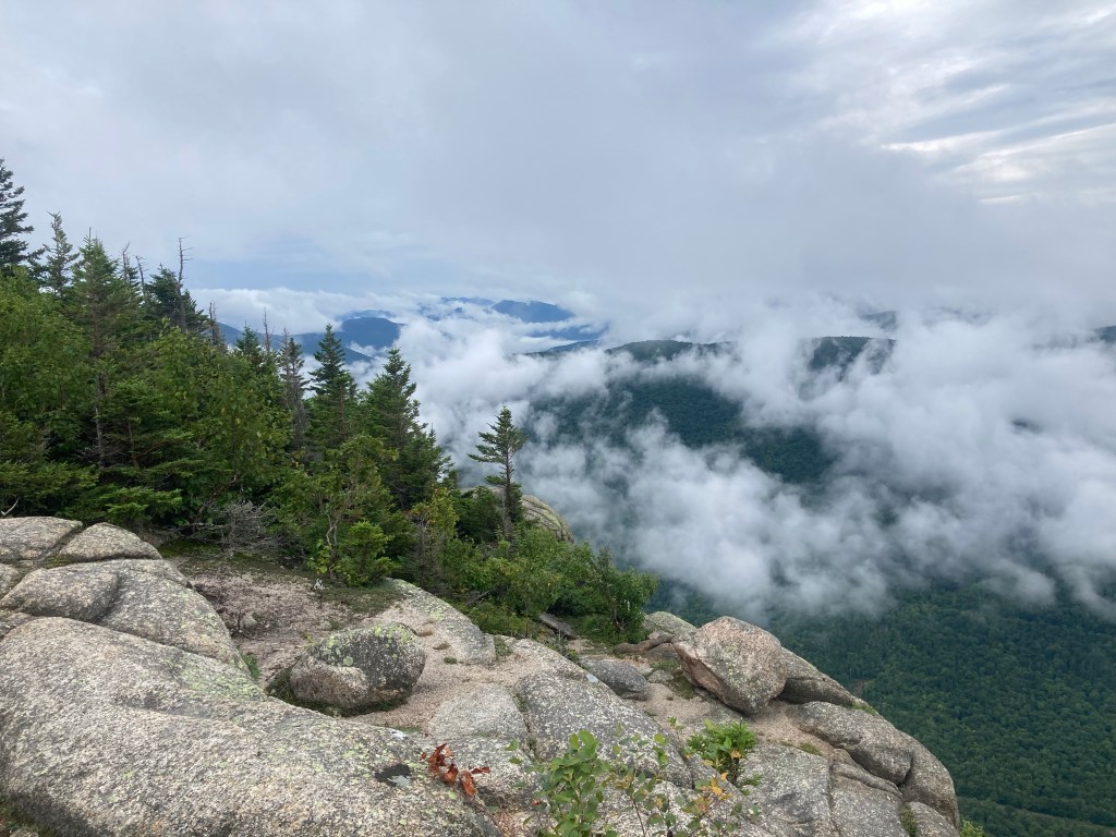
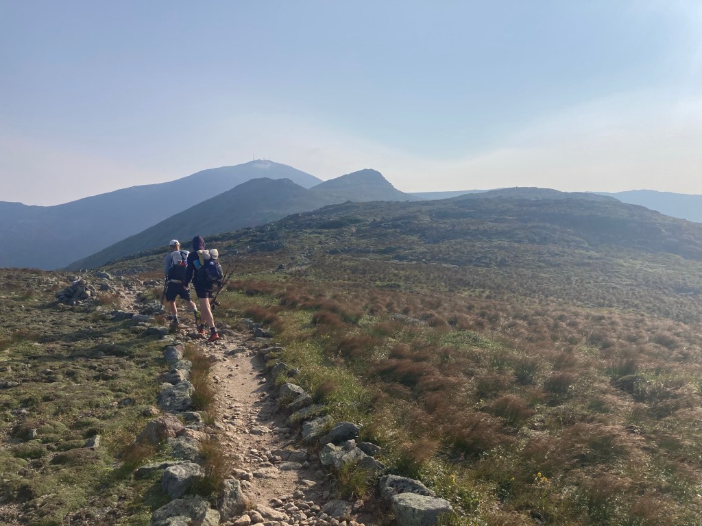
The official route of the AT bypasses four summits along the Presi: Eisenhower, Monroe, Jefferson, and Adams. There are optional side trails you can take to the summits, of course. I did not feel obligated to take these, since I had already bagged all of those peaks, but I was hoping to be able to hit up Eisenhower and Monroe again, since they were completely socked in when I had done the Presi the first time. It was still foggy by the time we reached Eisenhower, so I passed it by. Oh well. It cleared up beautifully by the time we got to the other side, though! The views of the southern Presi in the morning light were stunning. The trail also felt surprisingly chill, although it was very windy. I knew the northern half of the traverse would be much harder, though, so I didn’t let it lull me into a false sense of security.
Things were looking good by the time we reached Mt. Monroe, so I split off to take the blue blaze to the summit. Doing that trail added a lot of difficulty! There were the boulders I remembered. It seems that the Presi is the one time in the whole trail that the AT does NOT take the most difficult route. By the time I got to Monroe’s summit, whatdya know, it was fogged over again 😦 I guess I’m not allowed to have summit views in the southern Presidentials. (The northern Presis love me, though.)
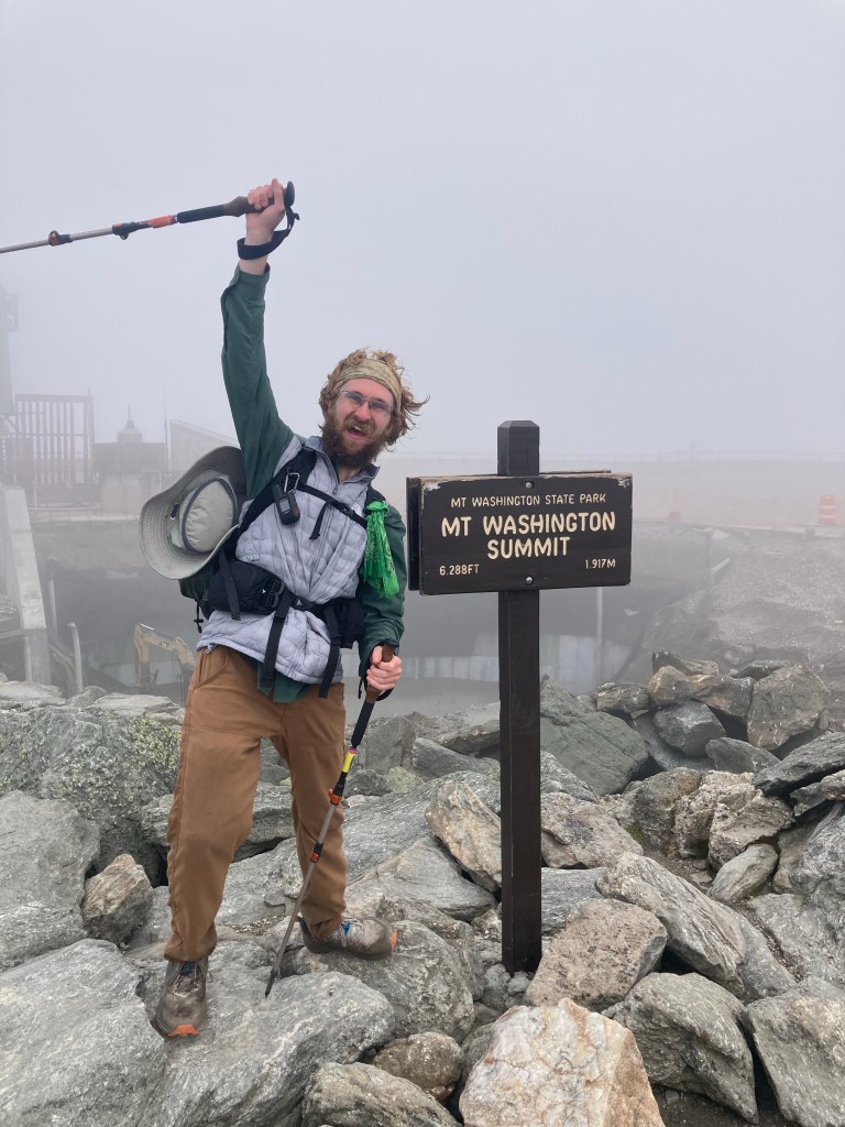
I reconnected with Nom Nom and the rest at Lakes of the Clouds Hut on the other side of Mt. Monroe. We had breakfast leftovers again and celebrated a very successful morning so far! Then it was up to Mt. Washington with Nom Nom and Smokey. That climb brought back some harrowing memories from the last time I was on that section, in much less ideal circumstances. I’ve learned a lot since then 😅
The fog persisted, and Washington’s summit was totally socked in. Oh well. Luckily, there was not much of a line to take my picture with the iconic summit sign, so I waited my turn like a good thru-hiker.
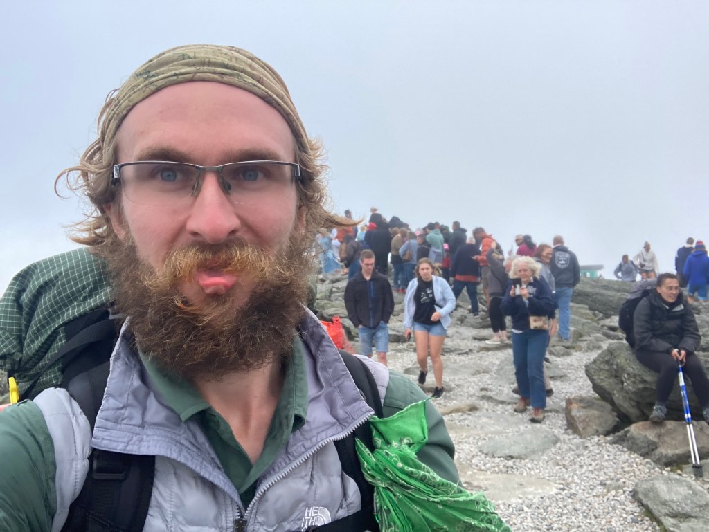
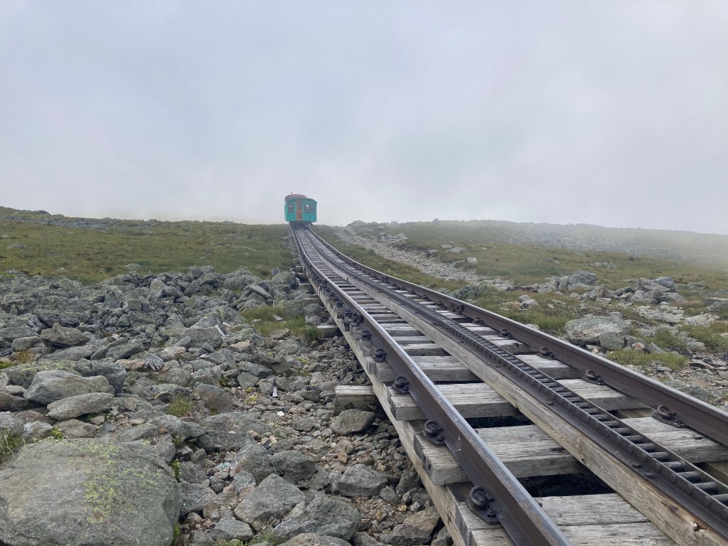
I got chili dogs at the cafeteria at the summit for a filling lunch with several trail friends. There were a TON of people around; it had ski lodge vibes, and not in a good way. The cog railway was in full swing, which was cool to see running as we hiked, but did make it crowded, especially since it was Saturday. To be honest, the Mt. Washington summit was easily the lowlight of the day for this reason. Plus, with all the structures and construction going on up there, it probably wouldn’t have been the best summit even if it was empty and we had clear skies.
I was glad to get off the summit with Smokey. We crossed the cog railway tracks and saw several trains go by. It’s apparently a tradition for thru-hikers to moon the cog railway; neither Smokey and I chose to partake. For one thing, I think the bouldery terrain would make a speedy getaway difficult after the fact.
I hiked with Smokey, Stealth, and Pigeon for a while, and then just Smokey for the rest of the afternoon. It was still foggy as we approached the side trail to the summit of Mt. Clay, a subpeak of Washington and the only peak along the ridge that I had not been up before. I decided not to climb it; I told the others, either it’ll stay foggy and I won’t regret missing views, or it’ll clear up by the time we get to the other side just to spite me, and then, well, it’ll be clear! Win-win. Sure enough, half an hour later, the fog cleared away, and we had amazing views for the rest of the afternoon. You’re welcome, guys. Even Mt. Washington’s summit remained clear for the rest of the day, as far as we could tell, which was slightly annoying since we had hit it at just the wrong time. Oh well. There wasn’t much else to complain about in the northern half of the traverse – at least when it came to views.
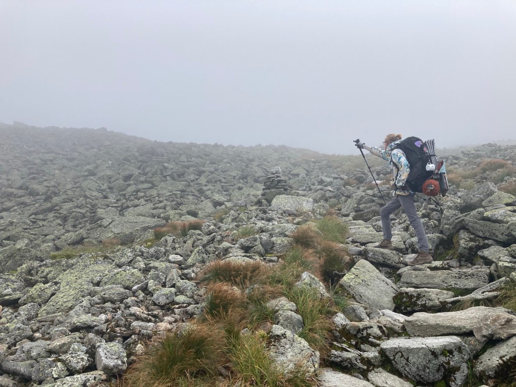
The northern Presis are TOUGH. I was expecting it, and warning others of it, but it was still even harder than I remembered. It’s all boulder fields, for miles and miles.
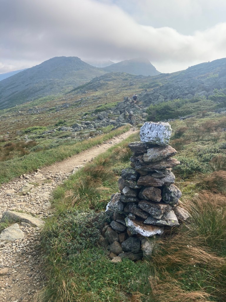
Pigeon, Stealth, and I ended up taking a wrong turn and hiking down the wrong trail for about 500 feet of elevation. Really made things even harder for ourselves accidentally…it turned out that two other separate groups had made the exact same mistake! Above the treeline there, the trails are all marked with cairns, and the white blazes of the AT are nonexistent. It was easy to follow the wrong cairn and miss where we were supposed to go. One thing I do agree with the AMC haters about is that they need to be clearer with their signage or at least blazing the different trails above treeline, especially the AT route.
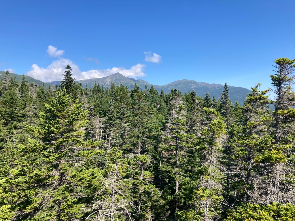
As we approached Mt. Jefferson, the skies were perfectly clear. I was really tempted to go up to the summit, but I resisted that succubus. Sorry, Jeff (or should I say, Thomas?). I just knew that as soon as I got up there it would cloud over again. I probably still have some lingering resentment towards that mountain after my first Presi experience.
In any case, I continued on the AT around the base of Jefferson with Smokey. Mt. Adams dominated our field of view in all its majesty. When we eventually got to the side trail to its summit, I convinced Smokey to come to the top with me. I wanted to get one more extra summit, and Mt. Adams, being the second tallest mountain in the Northeast, would feel awesome. The summit looked soo close from that junction. More fool us.
Cajun came up behind us and joined us to summit Mt. Adams. He had done all the summit side trails that day, a truly impressive feat! He’s a peakbagger like me. Smokey, Cajun, and I set out for the summit. However, we soon realized we weren’t on an official trail. In our defense, we were following some cairns, and on a mountain like that, the cairns are just suggestions anyway. We christened our new route the “SCS Cutoff.” Sorry, redliners, you’ll have to come back for one more trail.
Bagging that peak among all those boulders was very hard. It was certainly impressive up there, but it was super windy, and crowded, since Mt. Adams is very pointy and there isn’t much space to go around at the summit. We got out of there quickly.

The way back down to the AT was legitimately even longer than the way up, which had looked so deceptively short. I don’t think I had ever been more glad to be back on the AT again.
Soon, we arrived at Madison Spring Hut. My original plan was to push up and over Mt. Madison, too, but at this point, I was certainly interested in the work-for-stay option. The timing seemed good – they only open the 2 work-for-stay slots at 4pm, and it was 4:15 when we arrived. No luck. The spots had been taken already by some SOBOs, of course. Sigh. Our day was much harder than theirs probably was, just saying. Oh well. I contented myself with soup and bread before the final climb of the day.
I climbed to the summit of Mt. Madison with Cajun, Smokey, and Nom Nom. I like to joke that Mt. Madison is just a cairn that got out of control. It was a tough, bouldery climb – probably the toughest part of the AT that day. As Smokey observed, if we hadn’t just done Mt. Adams, this would’ve felt a lot worse. But soon enough, there we were atop Mt. Madison, our last peak of the day! It felt like a big accomplishment to have tackled so many big, brutal, beautiful mountains in one stretch.
But our day wasn’t over yet, and we were running out of sunlight. Smokey and Cajun went on, and I stayed behind to buddy up with Nom Nom for the final descent. It was very helpful for both of us to have a hiking partner for the harrowing ridge. The descent off Mt. Madison is the stuff of infamy on the AT. It is a huge boulder field, with only the slightest suggestion of a well-defined trail, that you descend for several miles before finally making it below treeline. It was a long, slow, but cool trip down the ridgeline. Meanwhile, that big tramily blew past us, and it was an additional stressor wondering if there’d even be space for us at camp when we eventually got there. When we finally got below treeline, we still had a steeper descent down to Osgood Tentsite, although thankfully the boulder field was done with.
Nom Nom and I arrived at camp at 7:45pm – it was a late night! To that tramily’s credit, they had pushed beyond the tentsite rather than taking up all the available space there and more. Our trail friends had saved spots for us :’) It was a fun evening decompressing at camp with Nom Nom, Cajun, Smokey, and Grizz. I felt very proud of myself and all my trail friends for what we had done that day! It was my longest day in the Whites ever and my longest day timewise on the whole AT. My knees were very unhappy with me, but it was worth it. It was easily my hardest day on trail, but definitely one of my absolute favorites.
I love these mountains so much. The Presis in particular have so much character, with their unique shapes, unique terrain, and unique vegetation.
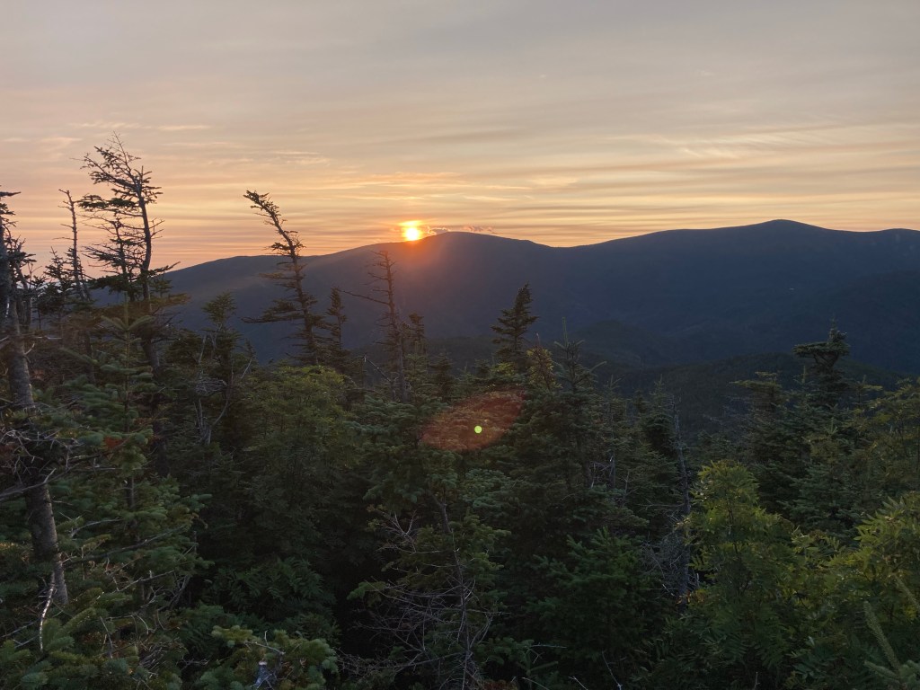
As we were coming down Madison below treeline, I had been struck by a neatly framed view of the Wildcats in the evening glow. These mountains were our next – and last – big challenge in the Whites. I stood there and found it hard to believe that in just a few short days, I’d be through the Whites, this huge section of trail that I had been looking forward to since the beginning. Not only that, but before I knew it, my thru-hike, this whole adventure, would be over, too. I had already been cognizant of this fact, but for whatever reason, it hit me particularly hard at this view at the end of the day.
I slept in in the morning (can’t imagine why) and had a lovely, relaxing morning. The trail into Pinkham Notch was relatively easy, and I hiked much of it with Smokey. The imposing views of the northern Presi from Low’s Bald Spot were the highlight of the day. Then I had made it to Pinkham Notch, and I was done with this most difficult, amazing leg of the trail!
I was so glad to share this phenomenal section with awesome new friends. This great social aspect on top of the fantastic hiking made this easily my favorite section of trail (finally overtaking the similarly social Smokies). I couldn’t believe our luck with the weather! I couldn’t have asked for a better week in the wild, wonderful Whites.

Leave a reply to Valerie Rushanan Cancel reply